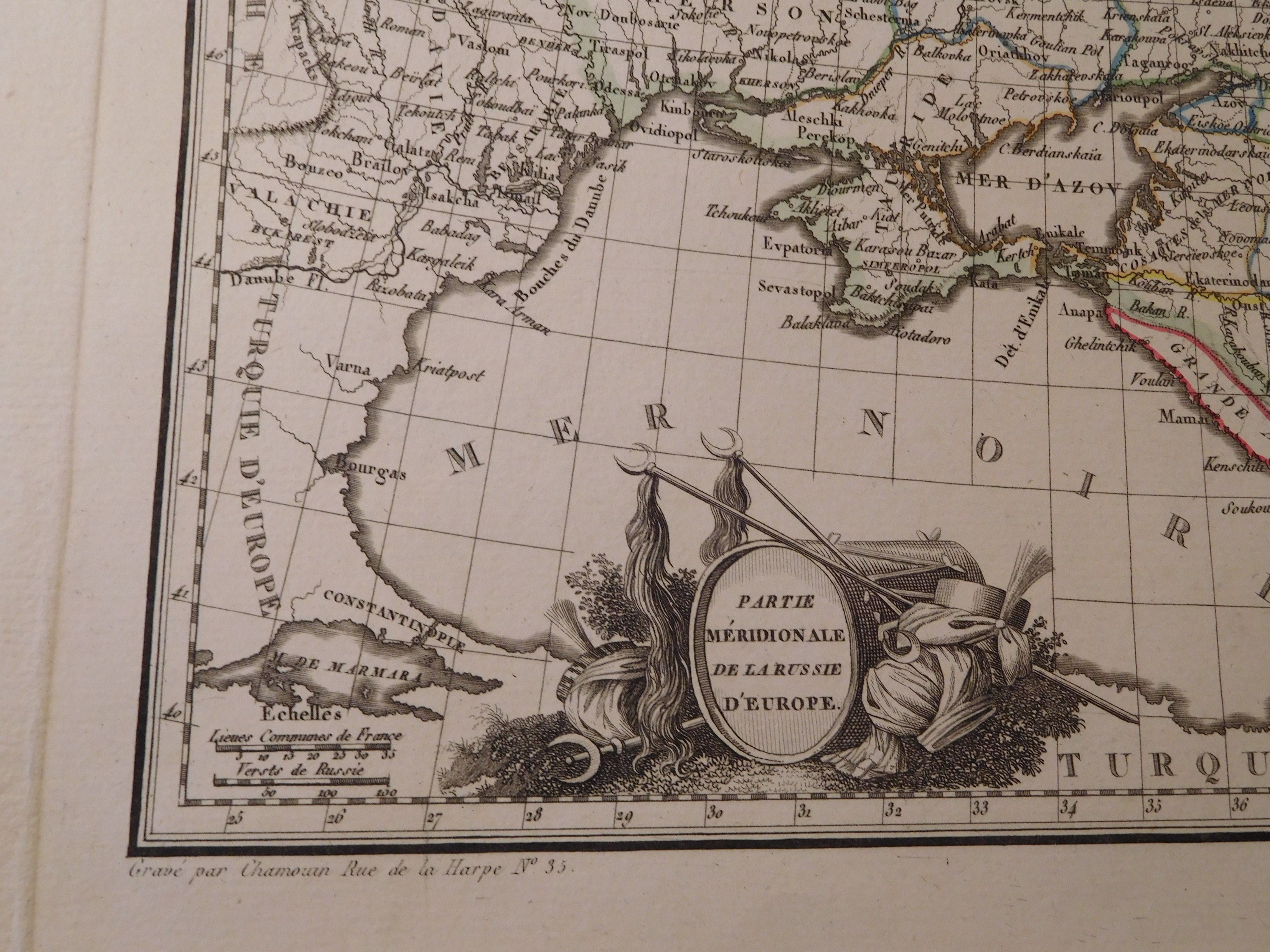
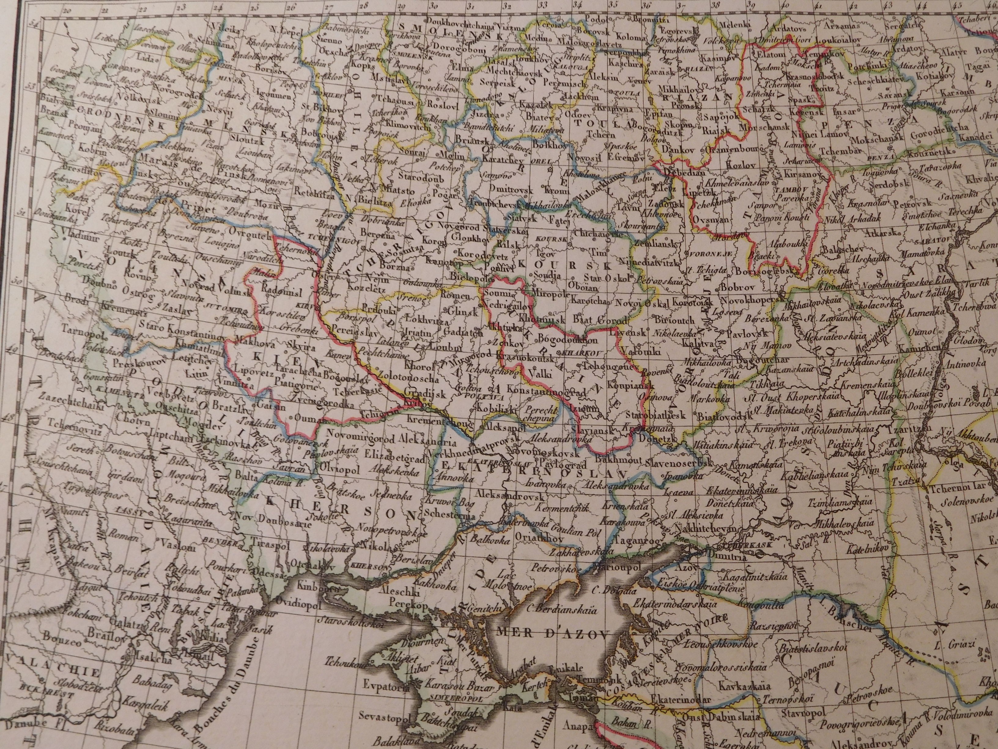
48. MALTE-BRUN CONRAD, PARTIE MERIDIONALE DE LA RUSSIE D'EUROPE.
Paris 1812, François Buisson, drawing by Giraldon, eng .Chamoun, 30 x 22 cm; (card: 41.5 x 29 cm), passe-partout 50 x 32.5 cm.
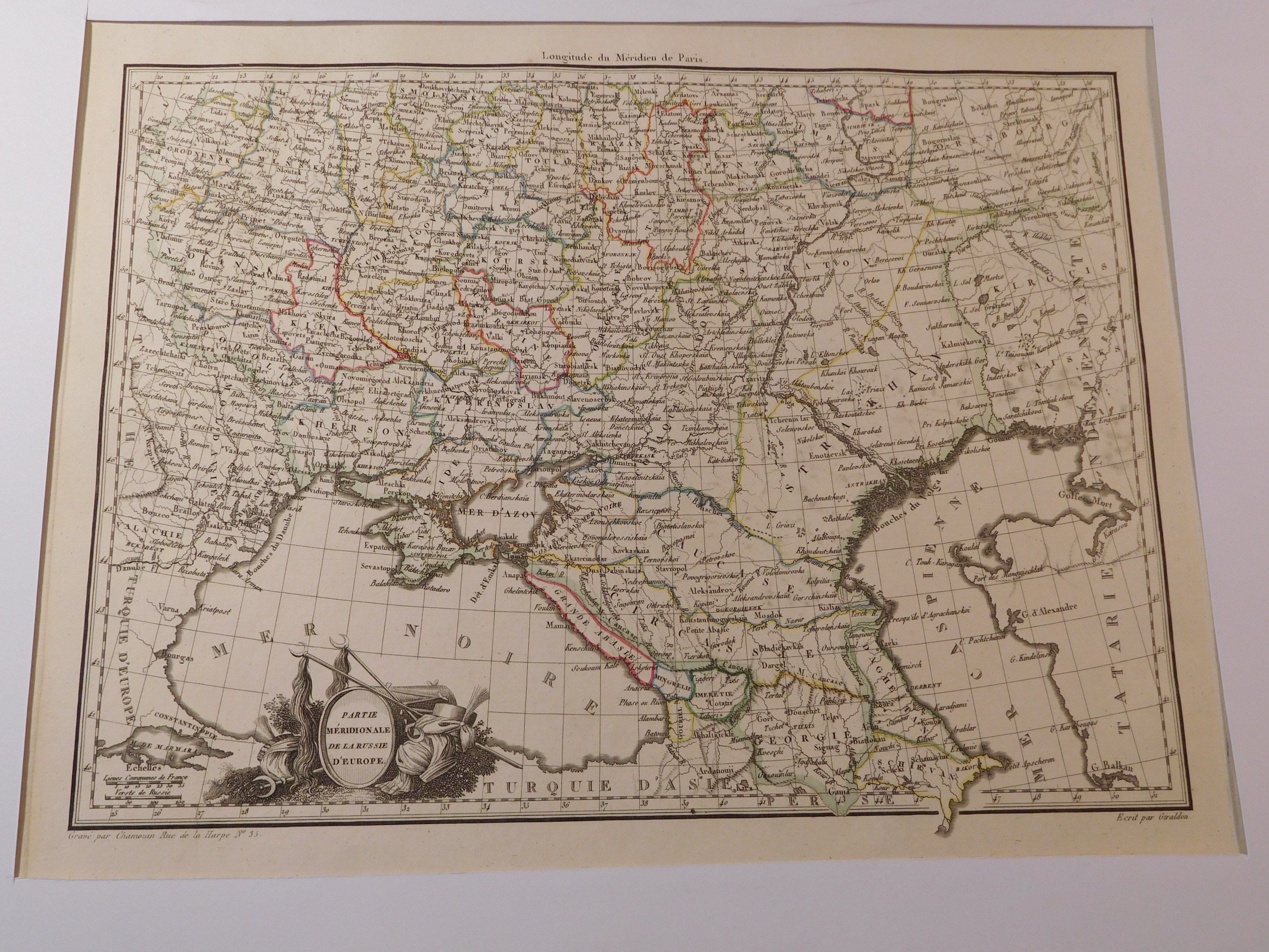
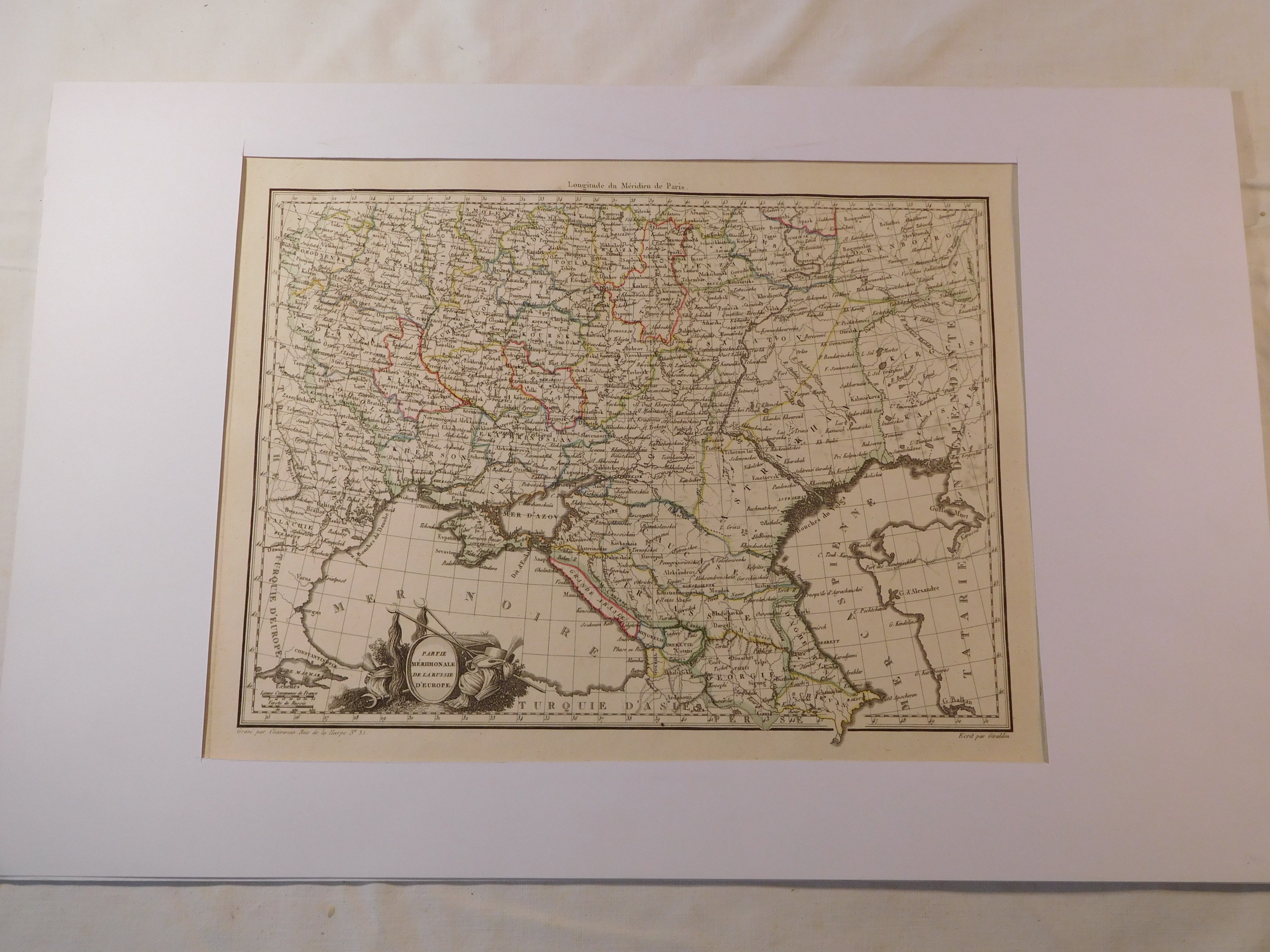
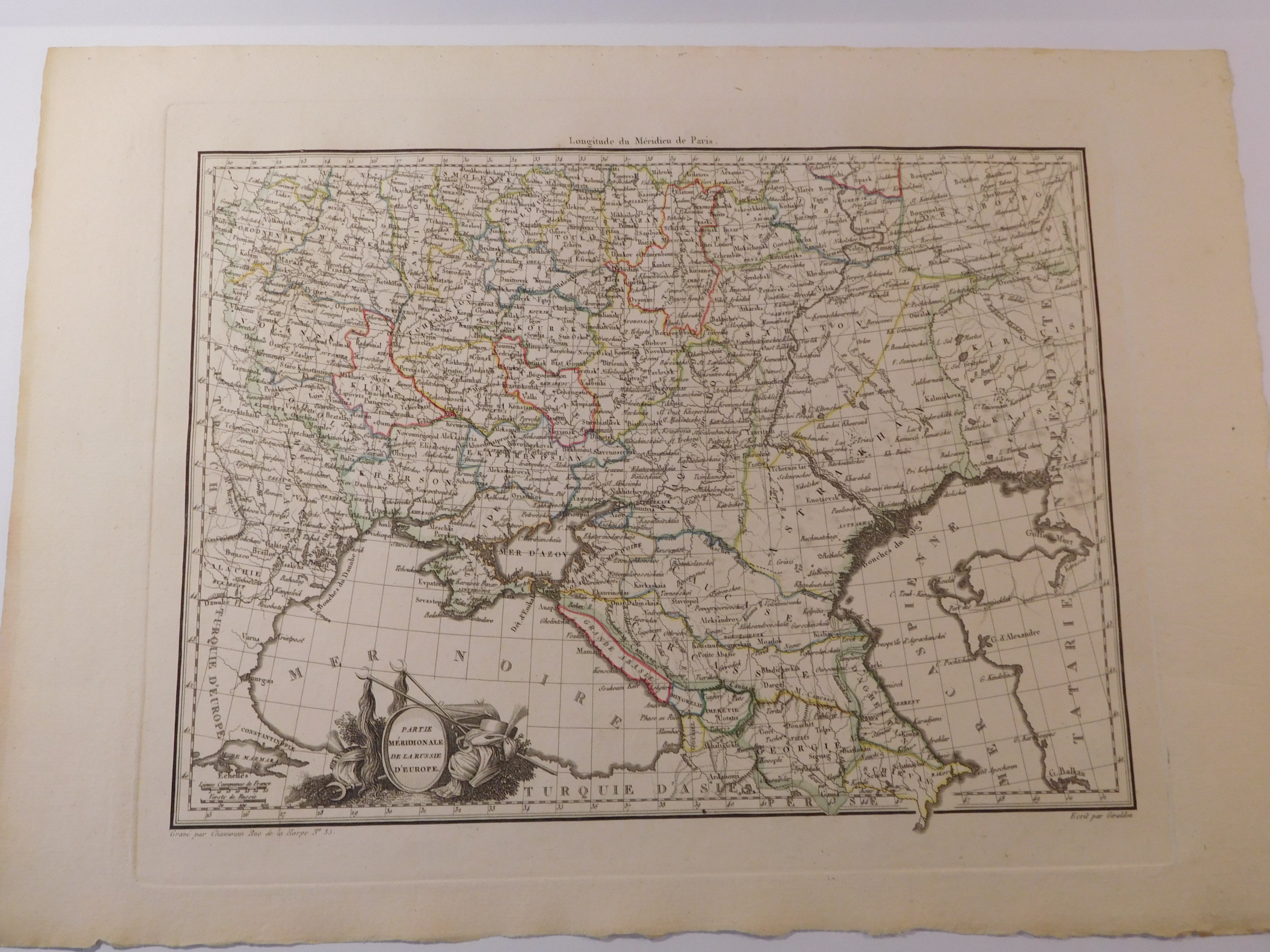
Age-colored copperplate map of part of southern European Russia from the atlas of the famous geographer Conrad Malte-Brun (1775-1826), "Atlas Complet du précis de la géographie universelle". In the lower left corner a graphic with a cartouche and folded Turkish spades. The map shows a large part of the former Republic of Poland (Volhynia, Podolia, Grodno) and today's Ukraine (Kherson, Dnieper, Kyiv, Chernihiv). An interesting feature of the map is that the geographical name "Ukraine" is used for the governorates-areas from Sumy to Izium and Slavyansk. The map is framed in white passe-partout.
Piece bdb preserved, clear imprint of copperplate, clear colors, generally flawless.