Advanced search Advanced search
49

1825. TARDIEU PIERRE, CARTE DE LA RUSSIE D'EUROPE (...) LA POLOGNE (...).

add Your note 
Lot description Show orginal version
Estimations: 32 EUR

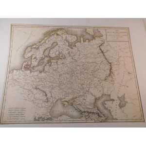
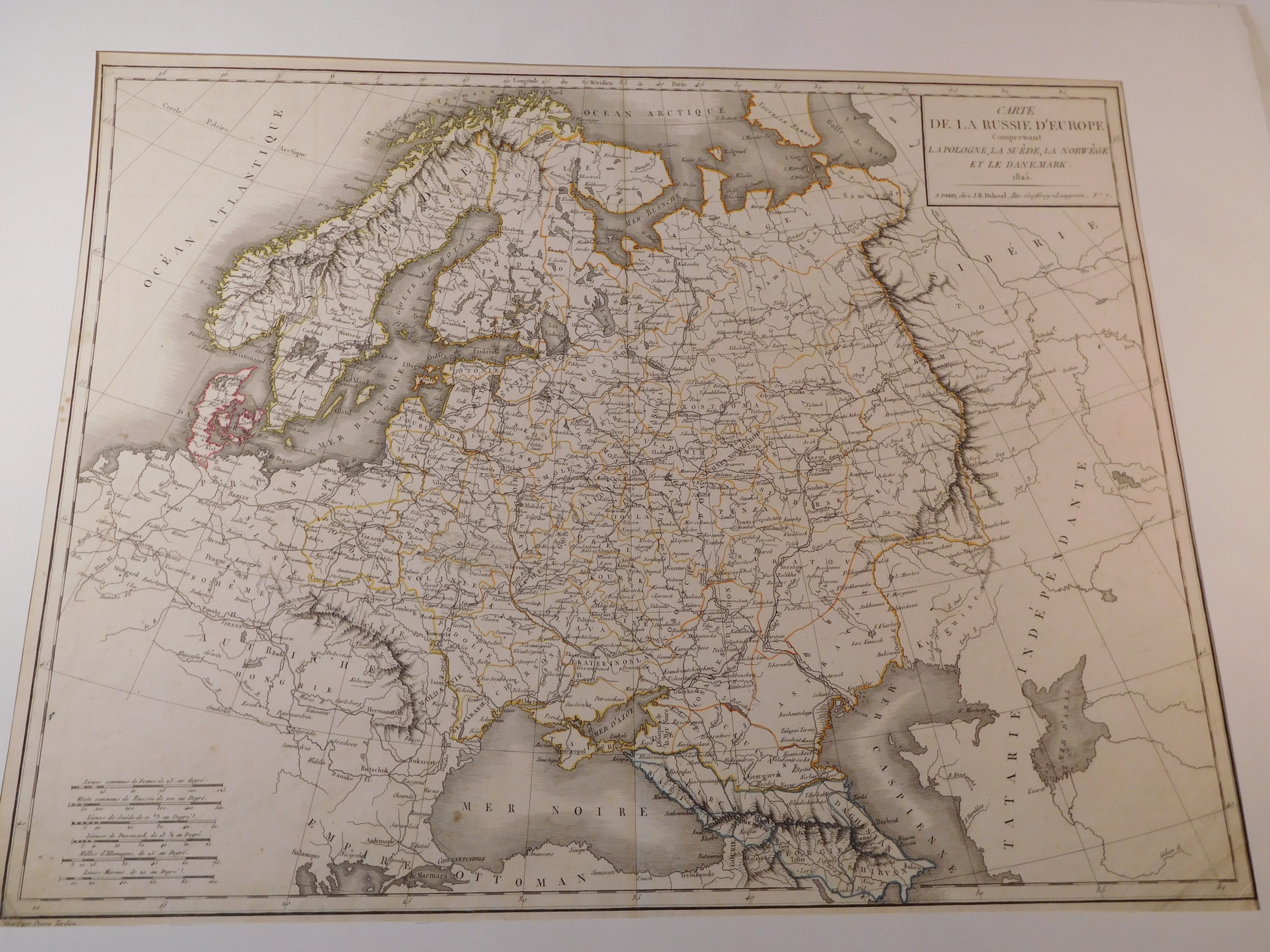
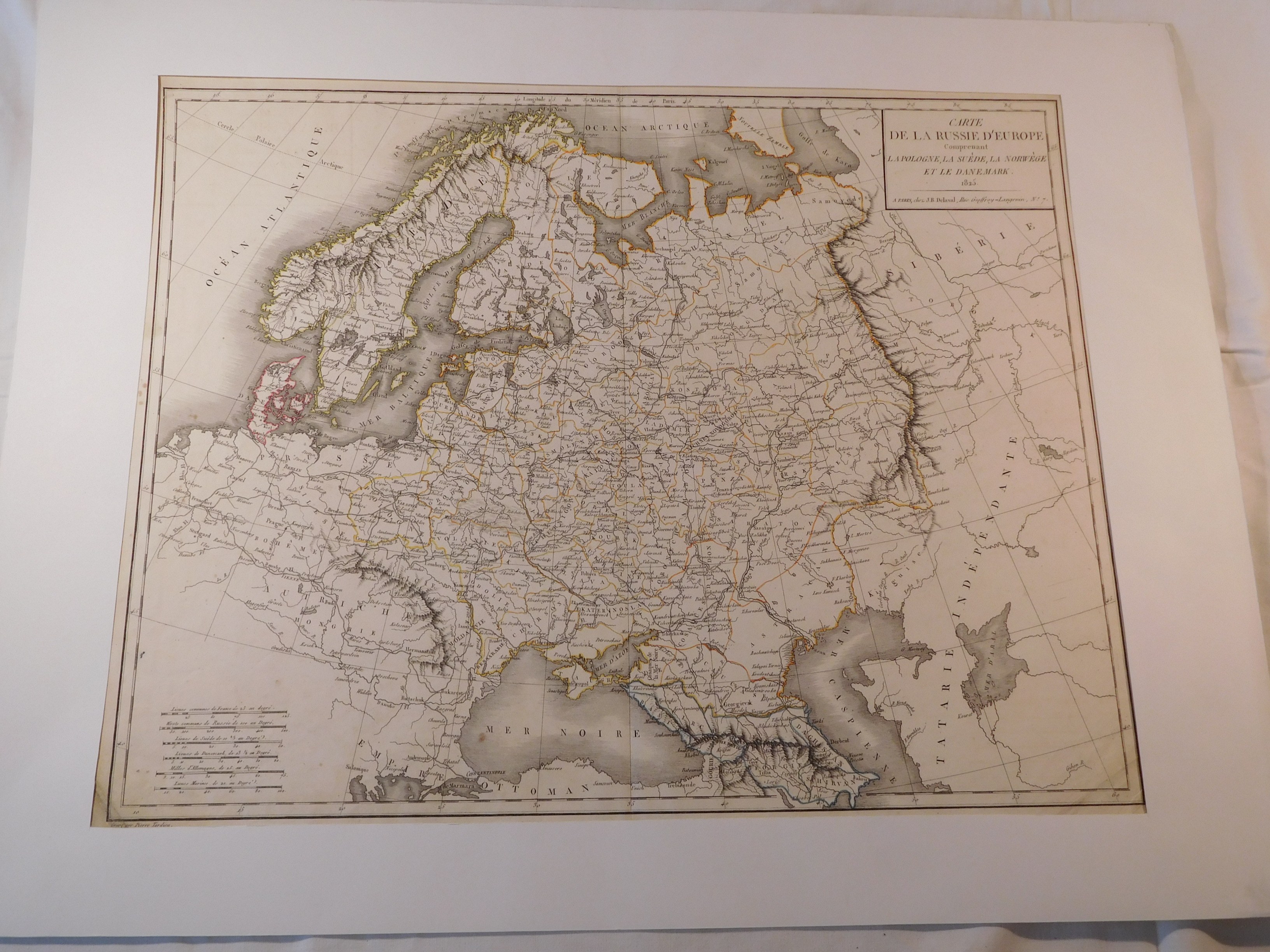
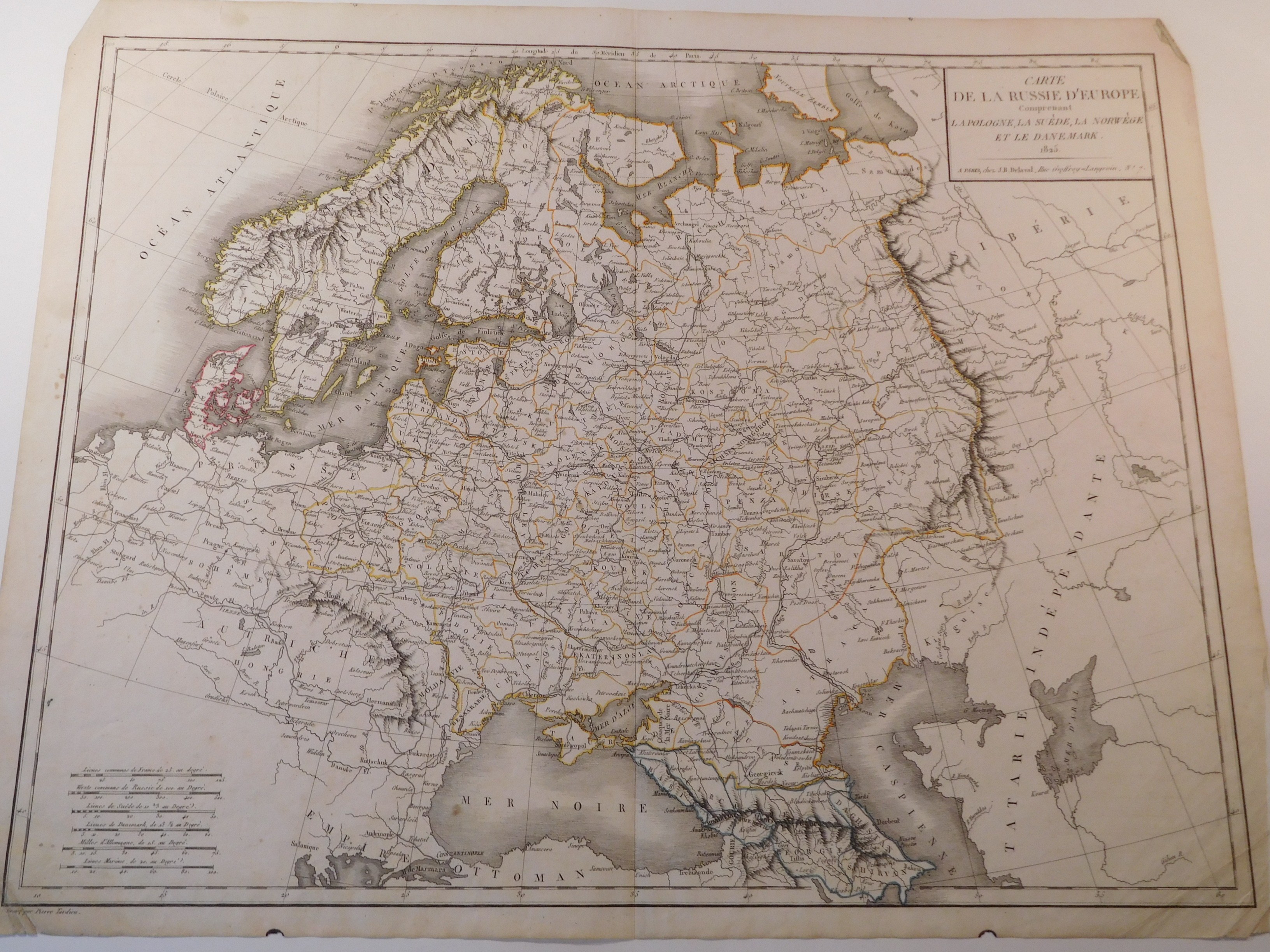
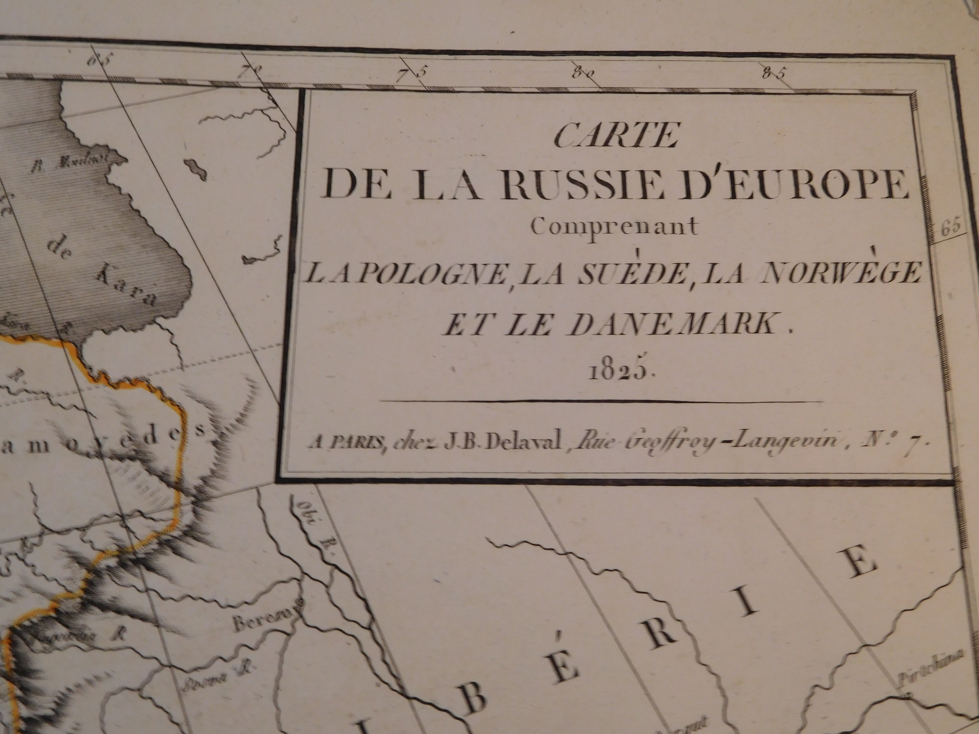
49. TARDIEU PIERRE, CARTE DE LA RUSSIE D'EUROPE (...) LA POLOGNE (...).

Paris 1825, J . B. Delaval, eng. Pierre Tardieu, 50.5 x 40 cm; (card: 54 x 43 cm), passe-partout 64.5 x 50 cm.

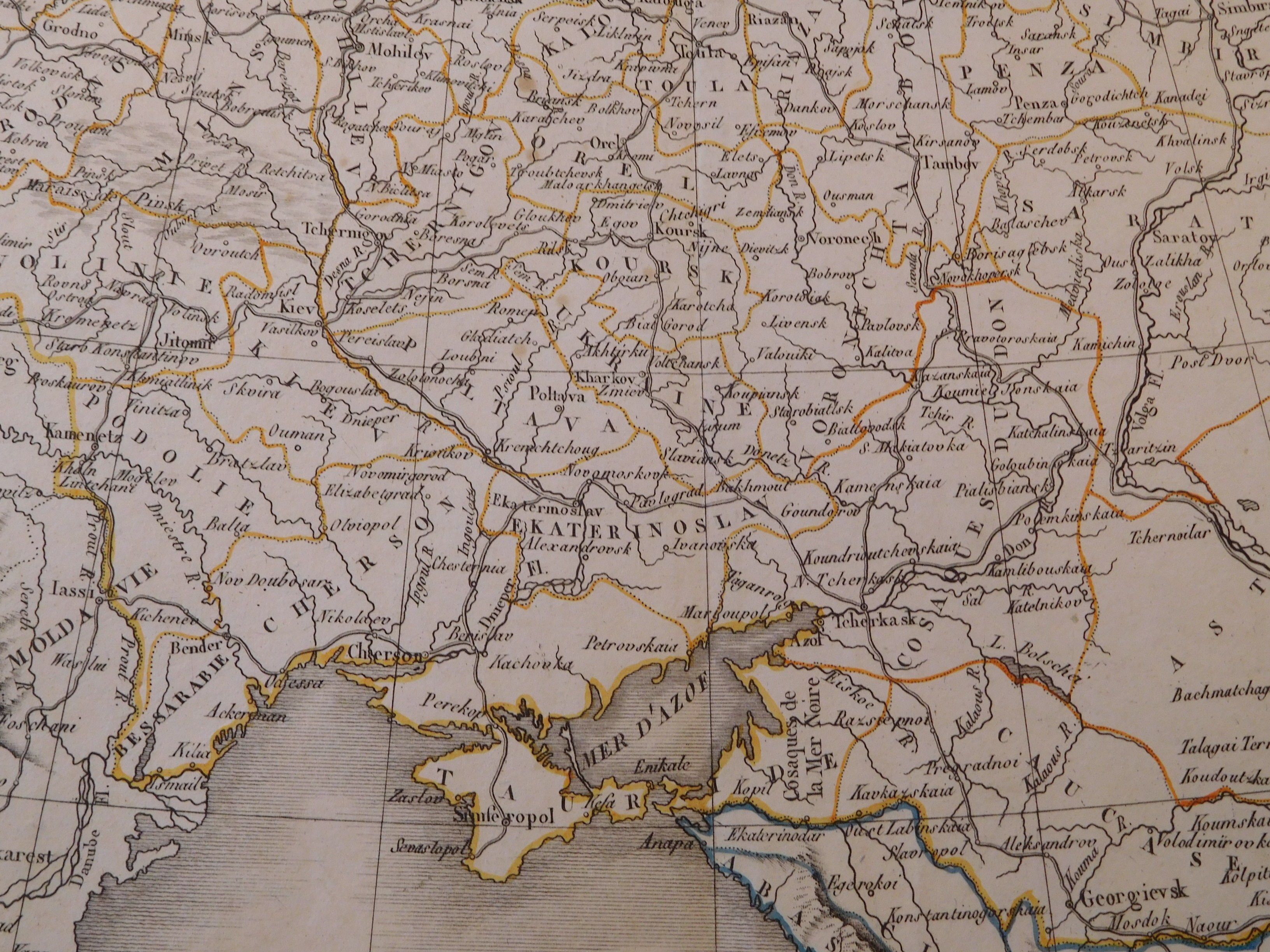
Colored map of European Russia and Poland, Sweden, Norway and Denmark in the period. In the case of Poland, this is the area of the constitutional Kingdom of Poland created by the Congress of Vienna. An interesting feature of the map is that the geographical name "Ukraine" is used for the governorate - the area from Kharkov to Slavyansk. The map is framed in white passe-partout.

Piece moderately preserved, clear colors, stains in margins and folds in margins; also a trace of a tear in the upper margin about 6 cm; otherwise flawless.


Auction
IV Polish-French Antiquarian Auction - Russia and Ukraine vs France
gavel
Date
08 October 2022 CEST/Warsaw
date_range
Start price
17 EUR
Estimations
32 EUR
Hammer price
no offers
Item is not available any more
Views: 25 | Favourites: 1
Auction

Antykwariat Derubeis

IV Polish-French Antiquarian Auction - Russia and Ukraine vs France
Date
08 October 2022 CEST/Warsaw
Lots bidding

All lots are listed to bid

Buyer's premium
10.00%
OneBid does not charge additional fees for the bidding.
Bid increments
  1
  > 10
  200
  > 20
  500
  > 50
  1 000
  > 100
  2 000
  > 200
  5 000
  > 500
  10 000
  > 1 000
  20 000
  > 2 000
  100 000
  > 5 000
 
Terms and Conditions
About the Auction
FAQ
About the Seller
Antykwariat Derubeis
Contact
Antykwariat Derubeis
room
ul. Wygoda 16
32-020 Wieliczka
phone
+48693550311
keyboard_arrow_up