


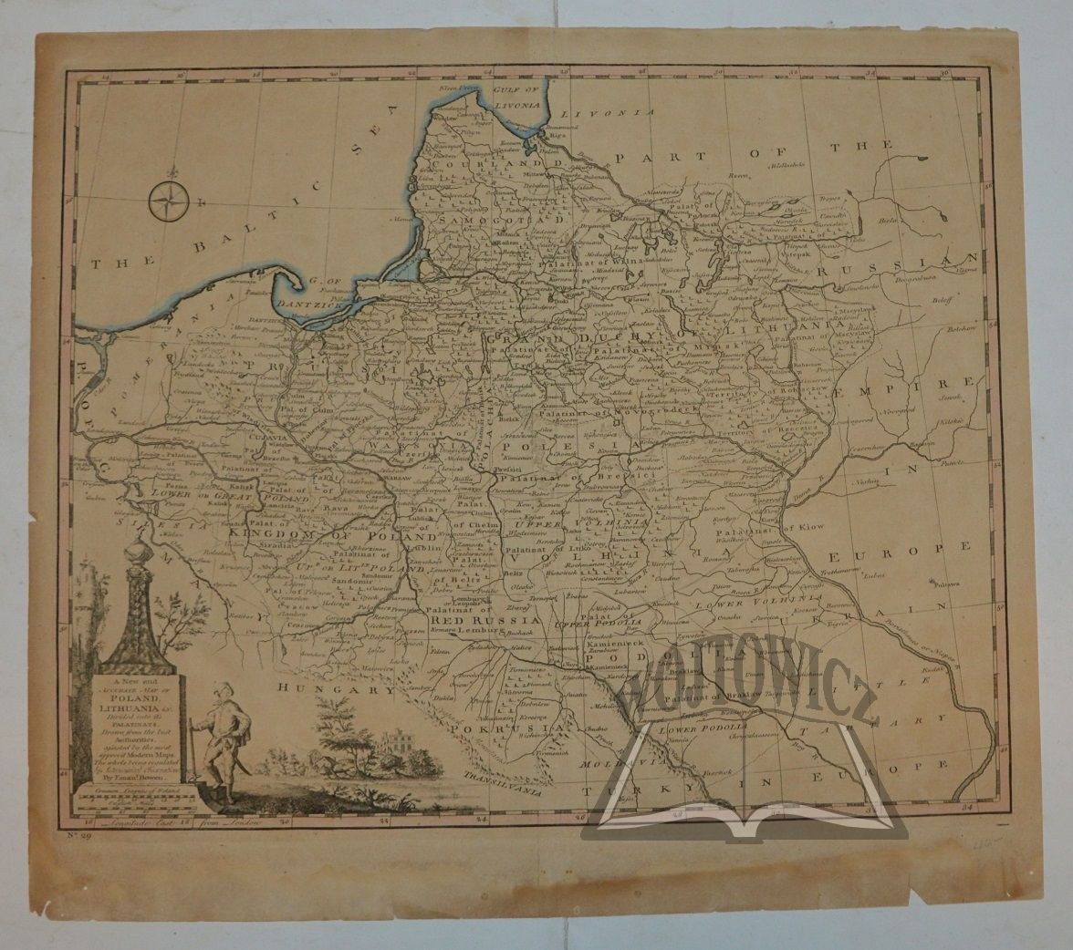
(POLAND & LITHUANIA). "A New and accurate map of Poland, Lithuania &c.".
Copperplate. The map is from Emanuel Bowen: "Universal History of the World", published by William Innys et al., London 1766. Dimensions: 34.5 x 42.8 cm (board: 40.5 x 45.5 cm).
Traces of dampstaining and browning, non-existent margin tears. Decorative information cartouche in lower left corner.


![[MAP]. MAP OF POLAND 1 : 500 000. OLSZTYN. [Sheet ] 3. w-wa 1947....](https://img1.one.bid/img/6363/1859794_1x.webp?1713045600)


Recently viewed
Please log in to see lots list
Favourites
Please log in to see lots list