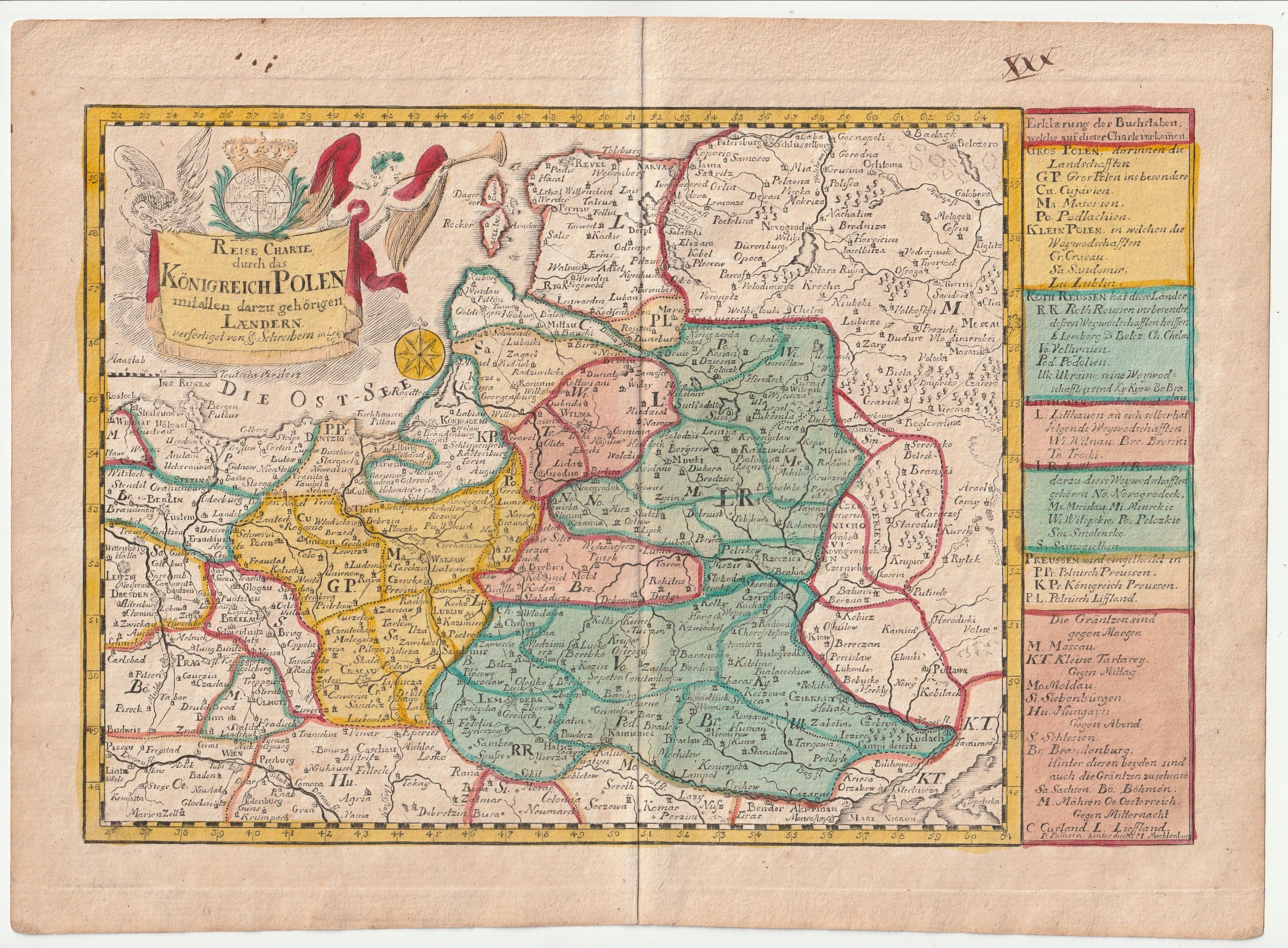
KRÓLESTWO POLSKIE. Mapa Królestwa Polskiego; Johann Georg Schreiber
addYour notecreate
Lot description
KRÓLESTWO POLSKIE. Mapa Królestwa Polskiego; pochodzi z: Atlas Selectus..., ryt. i wyd. Johann Georg Schreiber, Lipsk, ok. 1745; miedz. kolor., st. bdb.; wym.: 254x169 mm; REISE CHARTE durch das KÖNIGREICH POLEN mitallen darzu gehörigen LAENDERN verfertiget von JG Schreibern in Leipzig;
LabelsBETA
Labels are assigned by artificial intelligence based on the recognized context of the image. The algorithm is constantly learning and we make every effort to make the results more accurate over time.


![[MAP]. MAP OF POLAND 1 : 500 000. OLSZTYN. [Sheet ] 3. w-wa 1947....](https://img1.one.bid/img/6363/1859794_1x.webp?1713045600)