


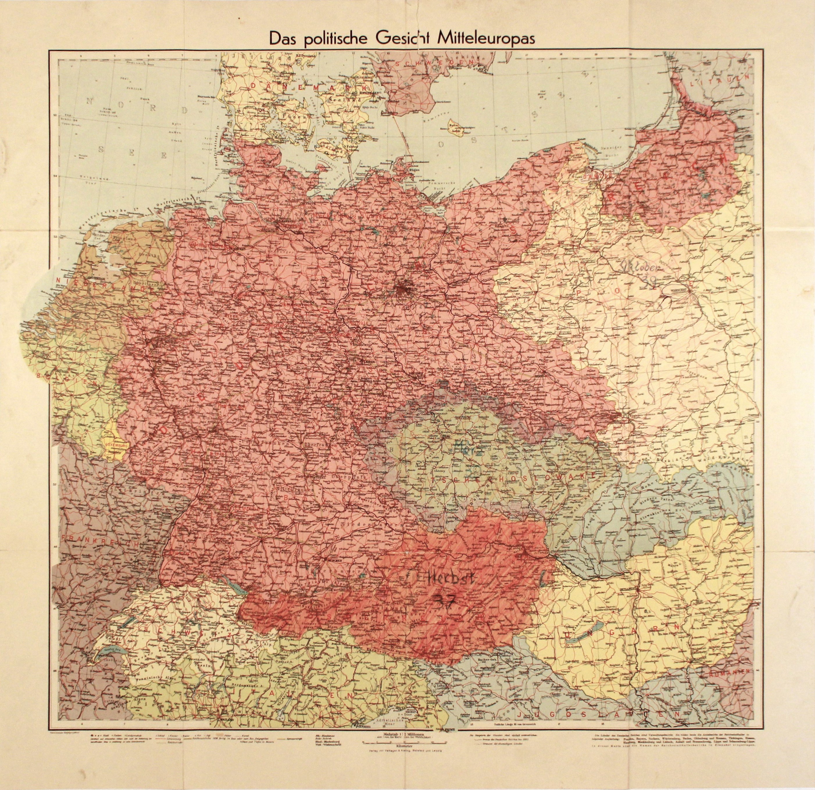
CENTRAL EUROPE. Political map of Central Europe and Polish lands before 1939; published by Velhagen & Klasing, Bielefeld-Leipzig; color print, st. db, light soiling to margins, tear at top, Polish, Czechoslovakian and Austrian lands handwritten in color, handwritten annotation: October 39 and in red circled part of Poland, which according to the original Ribbentrop-Molotov agreement was to fall to Germany; small tear on folds; dimensions: 650x620 mm; Das politische Gesicht Mitteleuropas.


![[MAP]. MAP OF POLAND 1 : 500 000. OLSZTYN. [Sheet ] 3. w-wa 1947....](https://img1.one.bid/img/6363/1859794_1x.webp?1713045600)


![Königl. Freistadt Oedenburg [Sopron szabad királyi város térképe, 1871.] Lithographiert von F. Szita. W[iene]r...](https://img1.one.bid/img/6570/1844246_1x.webp?1712700000)
![Königl. Freistadt Oedenburg [Sopron szabad királyi város térképe, 1871.] Lithographiert von F. Szita. W[iene]r...](https://img1.one.bid/img/6570/1844246_2x.webp?1712700000)


Recently viewed
Please log in to see lots list
Favourites
Please log in to see lots list