


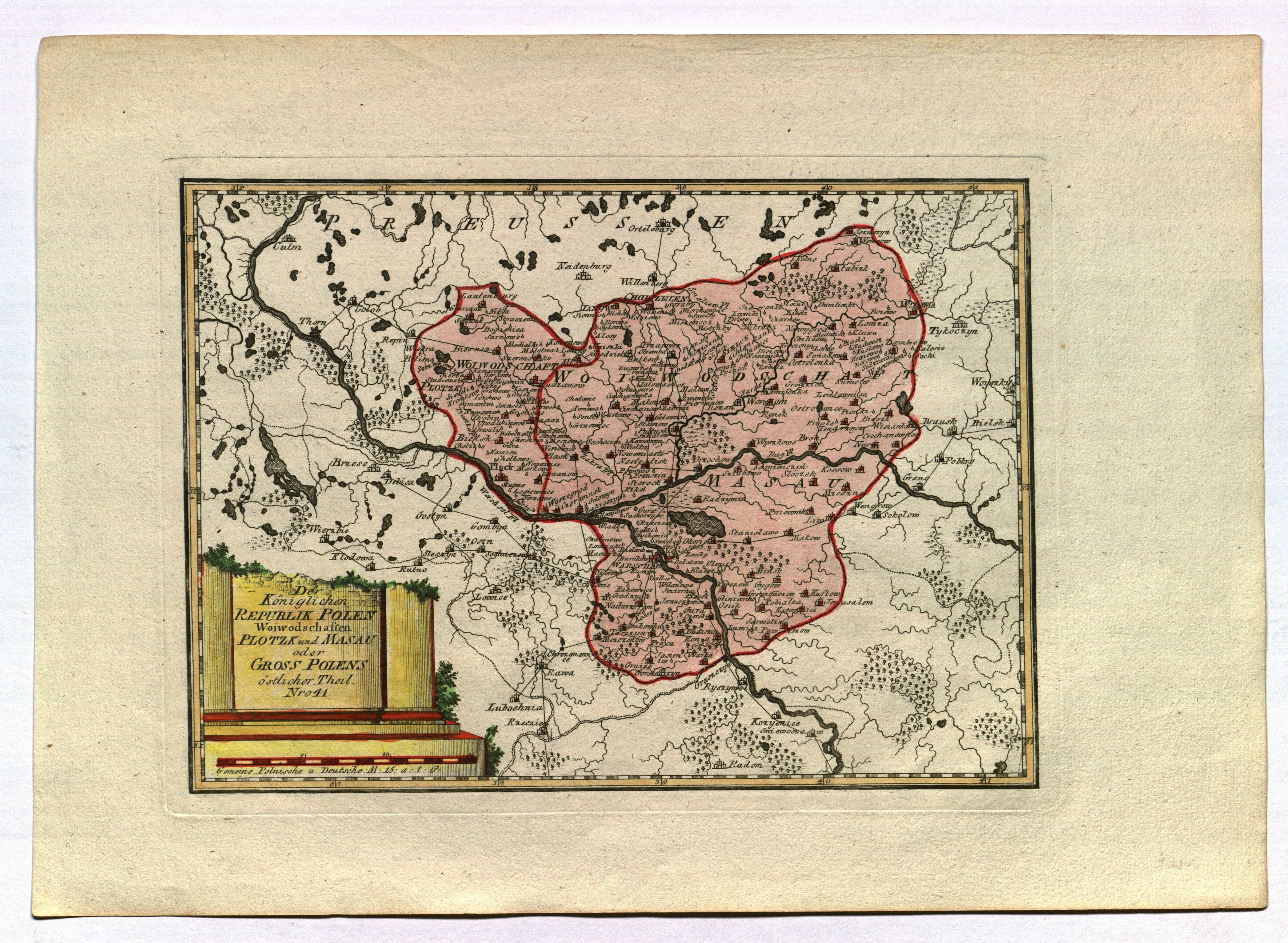
MAZOWSZE. Map of the Plock and Mazovian voivodeships; sheet no. 41, ryt. I. Albrecht, taken from the largest 18th-century atlas Schauplatz der fünf Theile der Welt [...], published by F.J.J. von Reilly, Vienna, ca. 1790; copper color, st. bdb.; plate dimensions 303x224 mm; Der Königlichen REPUBLIK POLEN Woiwodschaften PLOTZK und MASAU oder Gross Polens östlicher Theil. Nro 41.


![[MAP]. MAP OF POLAND 1 : 500 000. OLSZTYN. [Sheet ] 3. w-wa 1947....](https://img1.one.bid/img/6363/1859794_1x.webp?1713045600)


Recently viewed
Please log in to see lots list
Favourites
Please log in to see lots list