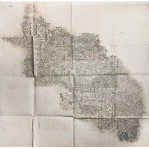
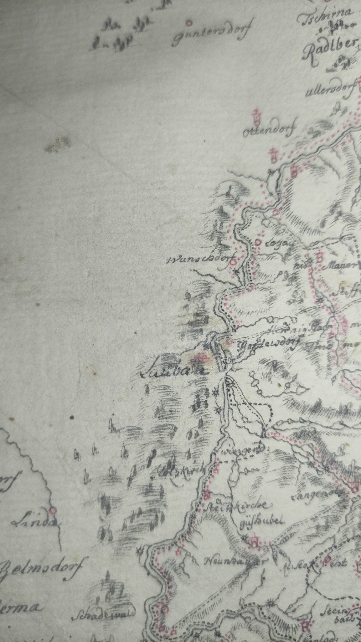
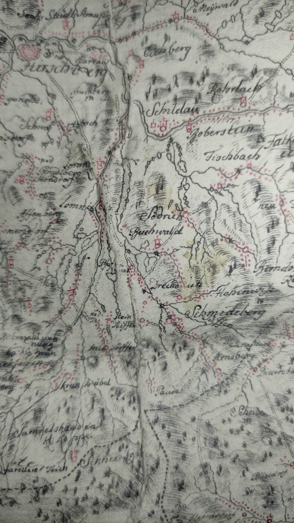
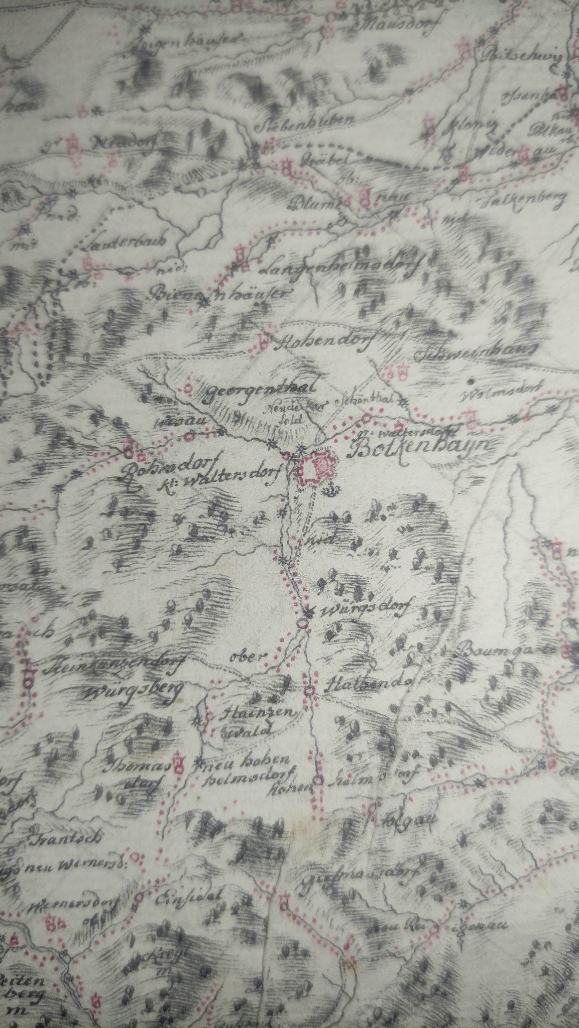
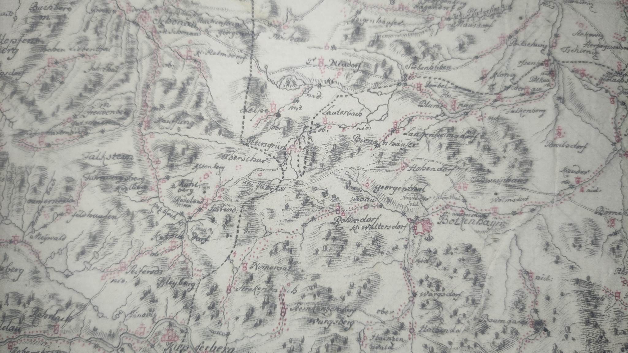
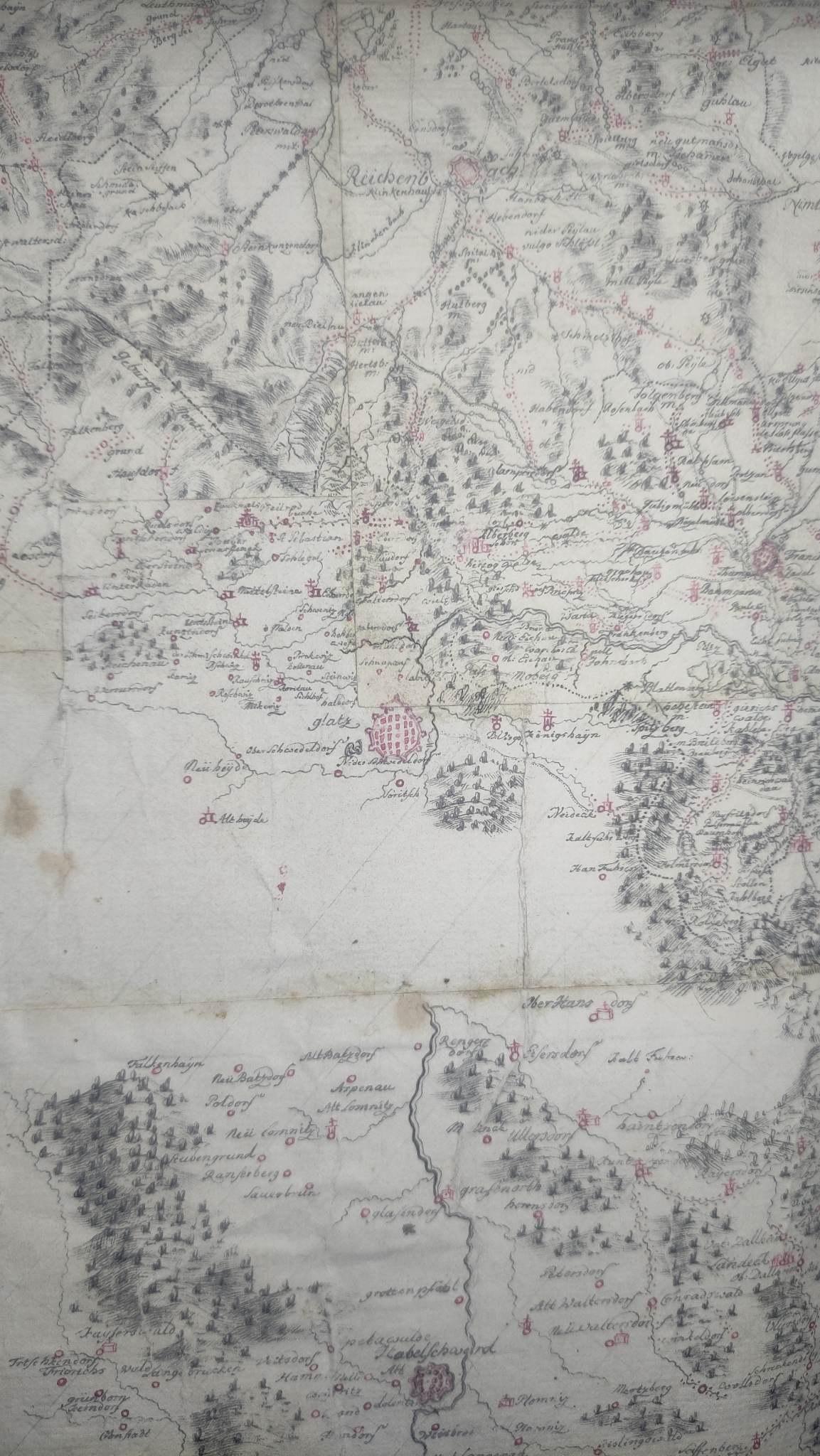
SLĄSK. Large-format manuscript map of Silesia from 1752. It covers Swiebodzin in the north, Będzin (Bendzin) in the east, Jablonkow in Cieszyn Silesia in the south, Kraustein and Waldelsdorf (Lusatia) in the west. The map is purely topographic in nature, with no indication of borders and territorial affiliations. On the verso a handwritten inscription: Dd. Schlesien, eine mit Der Feder gefertigte Zeichnung 1752. - Folding map, several sheets glued together with linen; st. bdb., in several places slight damage on folds, few spots; dimensions: 168 x 166 cm. -EXTRAORDINARY RARITY!
The map testifies to the breakthrough that took place in Silesian cartography in the mid-18th century. At the same time, it foreshadowed changes that were to take place in the next half-century in the entire European mappography of the time. It was commissioned seven years after the peace of Dresden in 1745, ending the Second Silesian War between Austria and Prussia. It was a war with classic sieges of fortresses in Glogow or Swidnica, but it was also a maneuvering war, with opposing armies constantly changing their position. Military success was determined not only by efficiency in capturing fortresses, but also by good knowledge of the terrain. "The locals", as military guides, were becoming anachronistic.
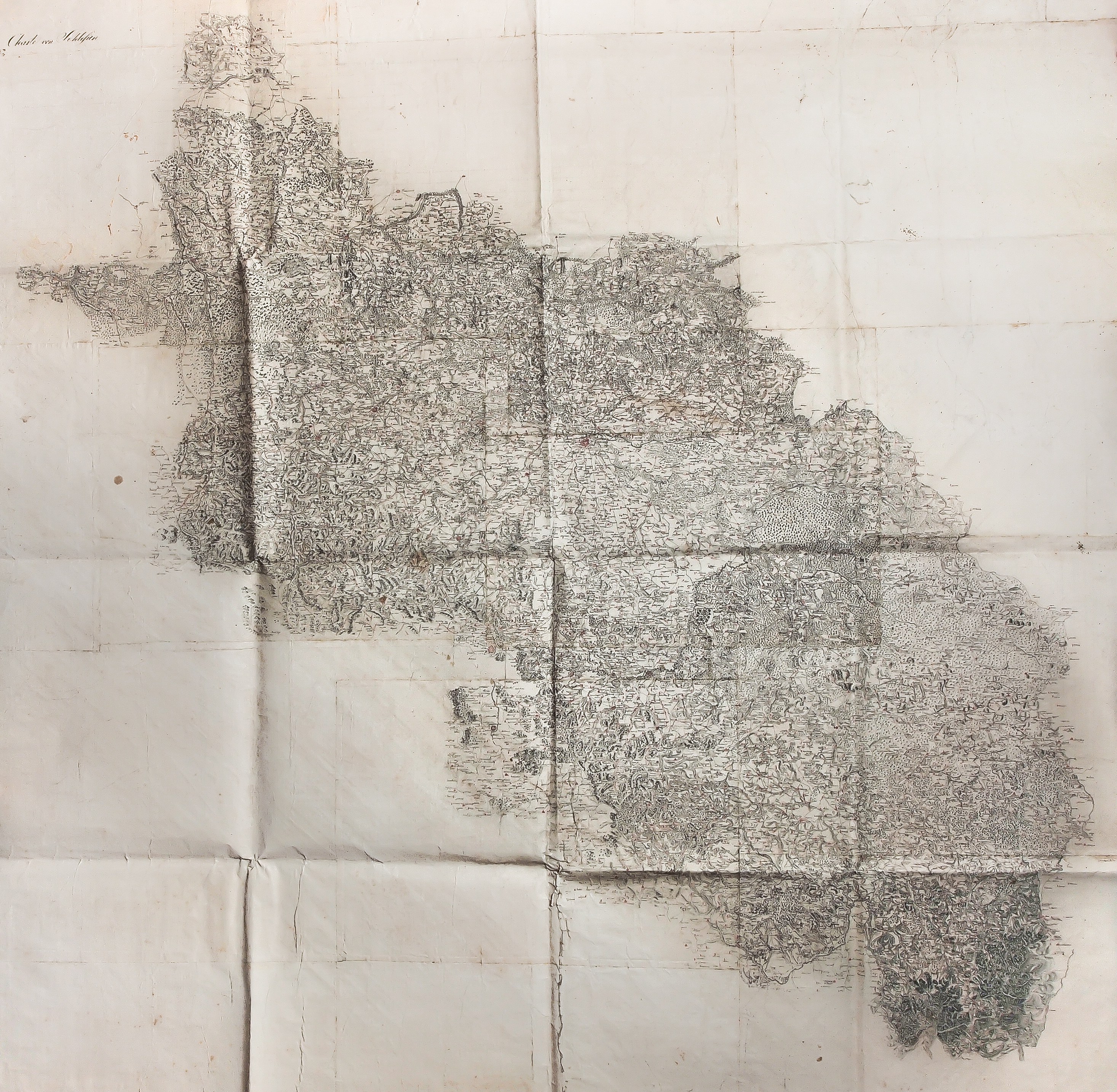
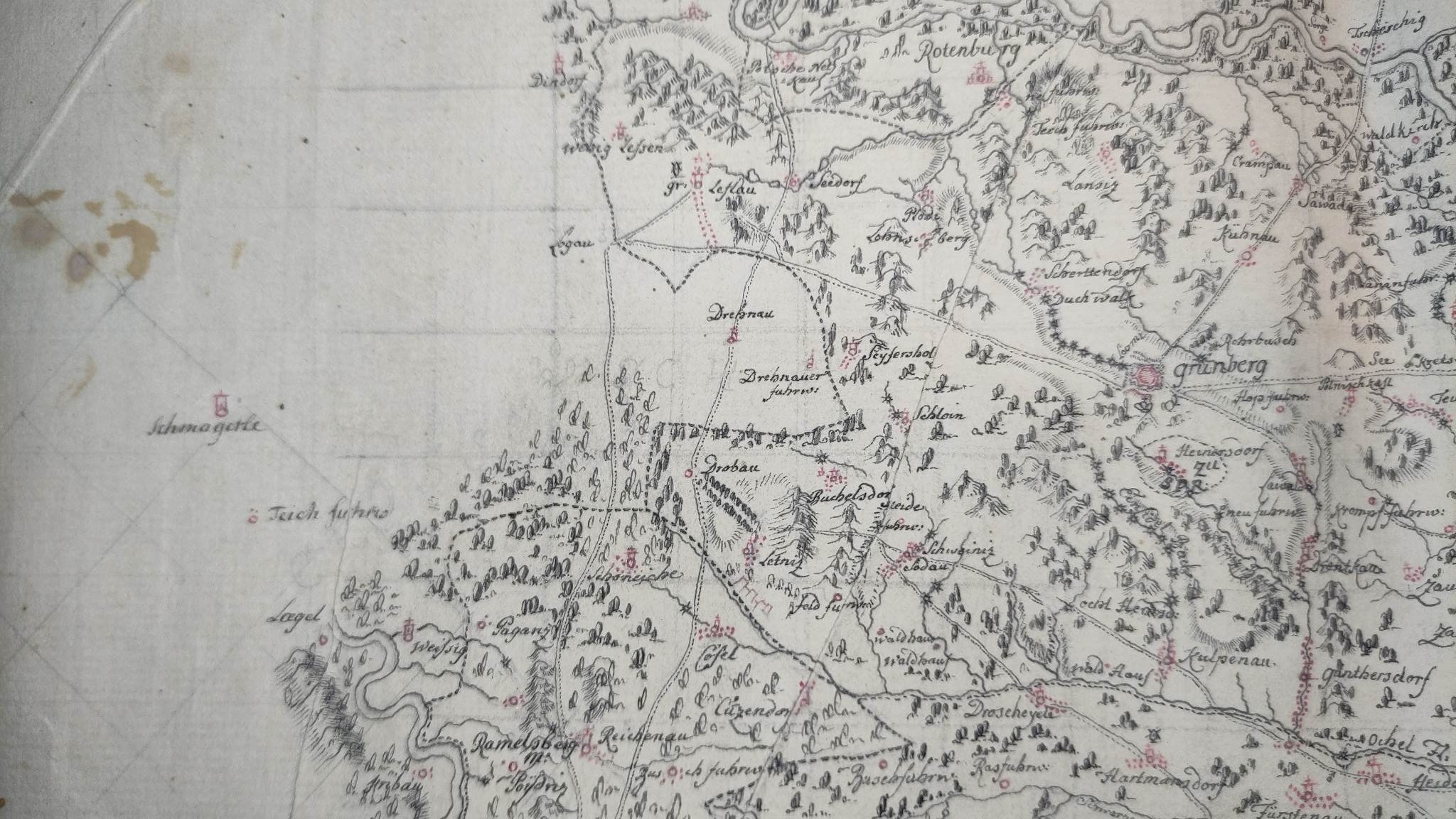
Due to the enormity of the work involving very detailed studies of the topography of Silesia, a team of at least several military cartographers undoubtedly worked on the map. It probably worked for several years. Moreover, he had to develop a system of signs to "encode" the collected information on the map. This system was later widely adopted, undergoing only minor modifications, including on the maps of the Weimar Institute, or the so-called Reymann maps (see the relevant section of the catalog). All even the smallest settlements, and sometimes single buildings, including windmills and mills, were plotted on the map. Existing religious buildings were marked. Watercourses, marshes, lakes and ponds (e.g., Milice's) were reproduced in great detail. The grid of tracts, roads and ducts was drawn. It is worth recalling that commonly available maps in the mid-18th century provided knowledge of the most important postal routes, such as those between Dresden and Warsaw. Minor ones were treated as military secrets. Knowledge of fords on rivers was also reluctantly revealed. The then state of forestation in Lower and Upper Silesia was also shown. Earlier studies of this type were done (and not often) for the use of large landowners. In fact, this is the first study of the state of forests from the mid-18th century on the territory of today's Poland.
This map was not only of military importance. It was also an inventory of Silesia made by military cartographers. This exceptionally accurate description of newly acquired lands was done on such a scale for the first time in Prussian cameralism. First, it allowed for the introduction of a tax system. Second, it allowed the seizure of domains owned by the defeated dynasty and the state in which it ruled. The plunder carried out on such estates in Silesia was repeated on a gigantic scale in the post-partition First Republic. A map of so-called New East Prussia on 135 sheets, prepared by Stein's team of cartographers in 1795-1798, served such a purpose (see Wu-el Antiquarian Auction XXXI). Undoubtedly, this manuscript map of Silesia was pioneering. It found continuators in the work of military cartographers during the Napoleonic wars. It has a unique character and as such is an impossible to overestimate monument of Silesian cartography.


![[MAP]. MAP OF POLAND 1 : 500 000. OLSZTYN. [Sheet ] 3. w-wa 1947....](https://img1.one.bid/img/6363/1859794_1x.webp?1713045600)