


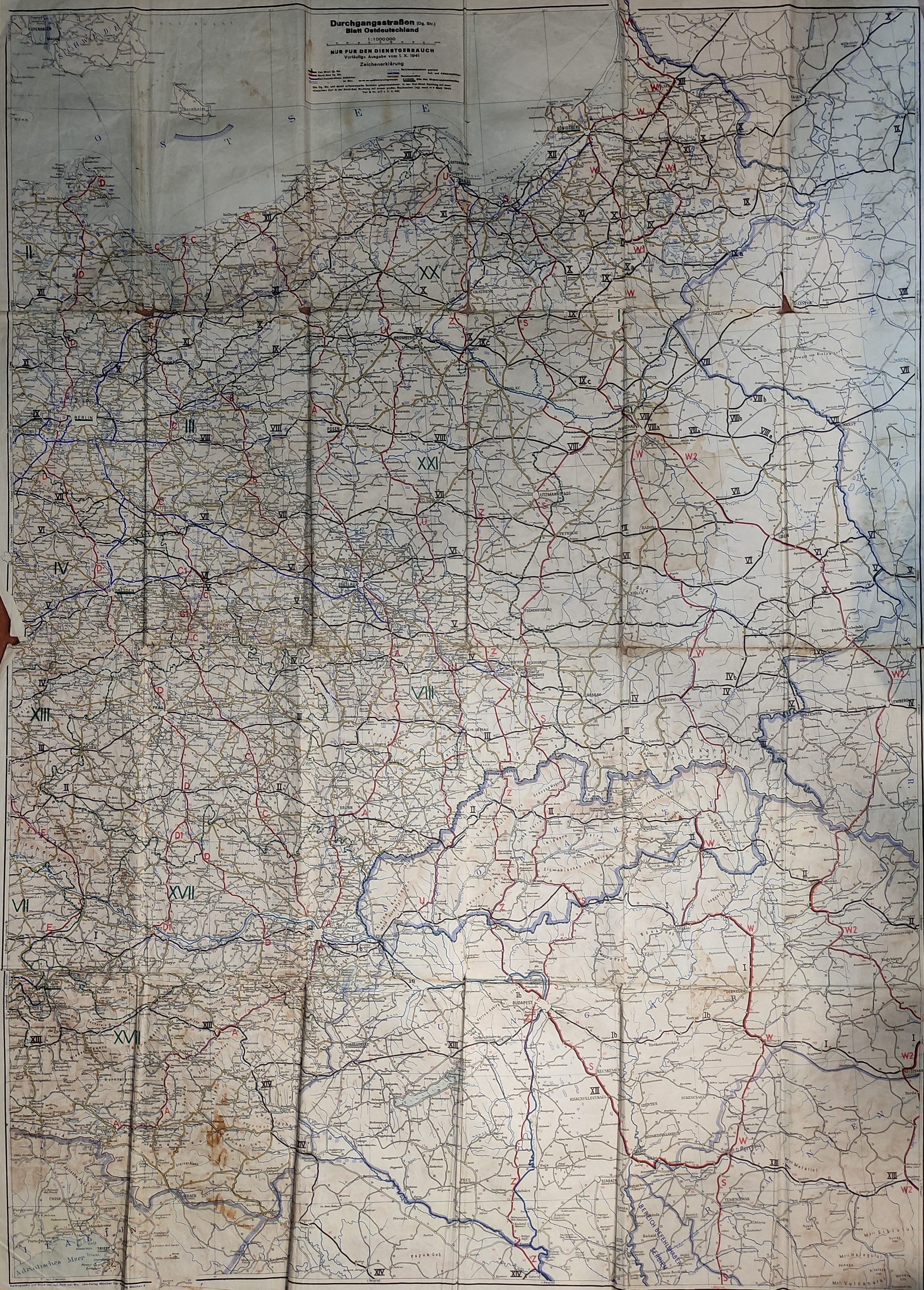
GENERAL GUBERNIA, LAND OF THE GUARD, WESTERN PRUSSIA, GDAŃSK, POMERANIA, ŚLĄSK. Map containing basic information about the German order in the East, as of late 1940. The borders of the General Gubernia are distinguished. The Polish lands incorporated into the Third Reich were given already Germanized place names, e.g. Leslau-Wloclawek, Hermannsbad-Cechocinek. The boundaries of the military districts were separated: II with its headquarters in Stettin, VIII-Wrocław district, XX-Gdańsk and XXI-Poznan. Roman numerals mark roads running from west to east; letters mark roads from north to south; Arabic numerals mark local roads. 3 projected highways are marked: Szczecin-Królewiec, Rzepin-Miroslawiec, Słubice-Poznań. Map intended for use by the German administration. Compiled and printed. J. Ruth, Munich 1941, Piece comes from the private collection of Piotr Zaremba, the first President of Polish Szczecin (1945-1950); color print; folded many times, st. fn, extensive soiling (mainly on verso), creases, rubbing and tears on folds, worn edges, rust stains; dimensions approx. 87x119 cm; Durchgangsstraßen (Dg. Str.) Blatt Ostdeutschland; VERY RARE.


![Dahlberg Erik Jonsson [Puffendorf] - Circle on the Warta River](https://img1.one.bid/img/5856/1829219_1x.webp?1712008800)


Recently viewed
Please log in to see lots list
Favourites
Please log in to see lots list