


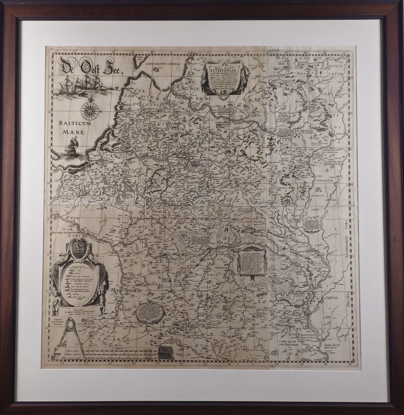
Radvila the Orphan's map of the GDL, 1643
MAGNI DVCATVS / LITHVANAE, / Caetervmque Regio / Num Ilii Adiacentivm / Exacta Descriptio / Illss.mi ac Excellss.mi Pricipis et Dni. D. Nicolai / Christophori Radziwil. D. G. Olijcae ac in Nies / wies Ducis
The initiator and patron of the map is Mikalojus Christophas Radvila "Orphan" (1549-1616)
Compiler - Tomasz Makowski (1573-1630)
Graver - Hessel Gerritsz (Gerard, Gerardus, Gherritszoon van Assum 1581-1632)
Printer - Willem Janszoon Blaeu (Guilielmus Blaeuw, 1571-1638)
Copper engraving, glued in 4 parts, 73,5 × 73,5.
Amsterdam, Blaeu family cartographic publishing house, 1643.
This map, which was noted for its accuracy and was one of the finest cartographic works of the Renaissance, was copied, reworked and printed in various atlases by European cartographers for almost a century and a half. It is one of the most significant monuments of Lithuanian history and culture, the pride of Lithuanian cartography.












Senast sedda
Vänligen logga in för att se objektlistan
Favoriter
Vänligen logga in för att se objektlistan