


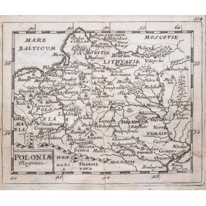
wyd. Johann Christoph Beer, Norymberga 1679
mapa pochodząca z „Geographiae Universalis” 1681
miedzioryt, wym. mapy 10,5 x 12,5 cm
stan zachowania bardzo dobry
Imago Poloniae, K31/4


Laatst bekeken
Log in om de kavellijst in te zien
Favorieten
Log in om de kavellijst in te zien