


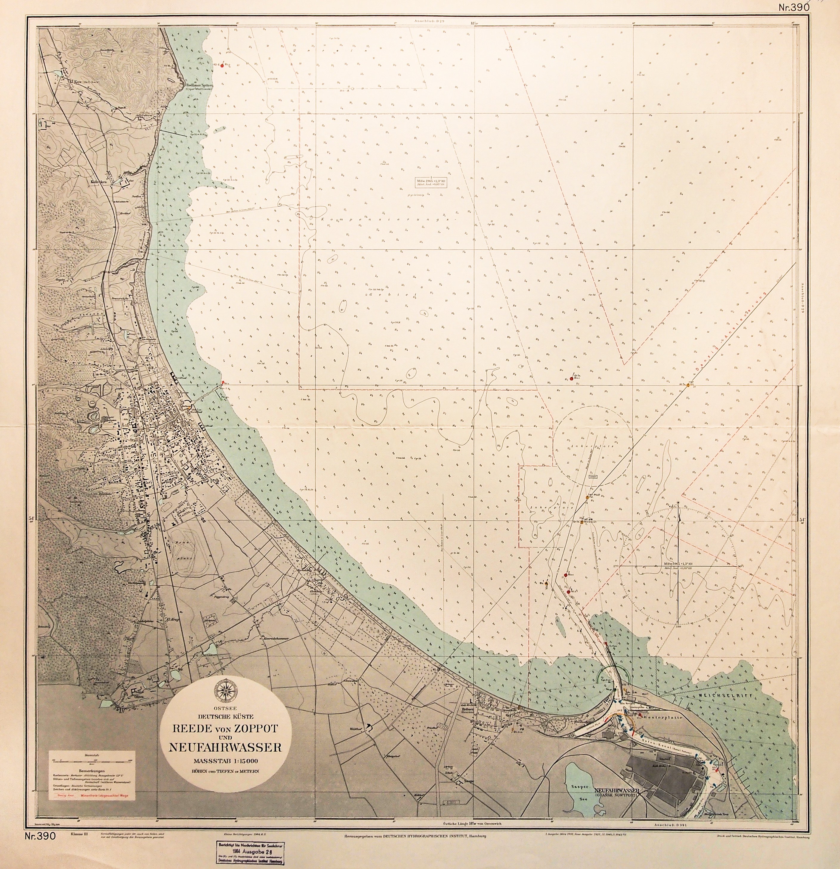
ZATOKA GDAŃSKA. Nawigacyjna mapa części
Zatoki Gdańskiej z planem Nowego Portu i Sopotu; Hamburg 1964; w górnym prawym
rogu nieaktualna pieczęć własnościowa; druk kolor., st. bdb., ślad złożenia;
wymiary mapy: 738x768 mm; Ostsee, Deutsche Küste, Reede von Zoppot und
Neufahrwasser.


![[MAP]. MAP OF POLAND 1 : 500 000. OLSZTYN. [Sheet ] 3. w-wa 1947....](https://img1.one.bid/img/6363/1859794_1x.webp?1713045600)


Laatst bekeken
Log in om de kavellijst in te zien
Favorieten
Log in om de kavellijst in te zien