


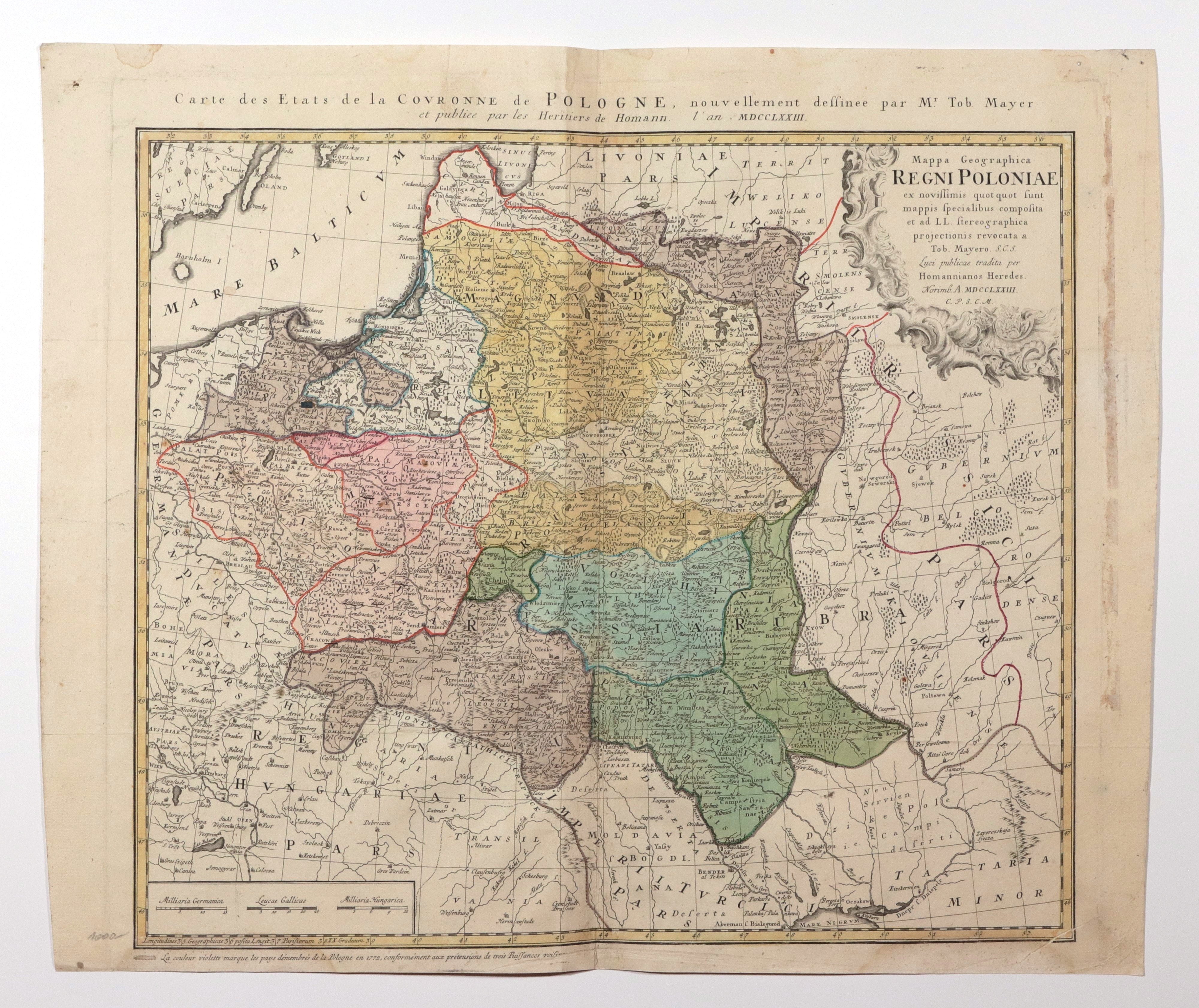
POLAND (called KORONA in the First Republic), GREAT PRINCE OF LITHUANIA. Map of Poland and Lithuania; compiled by. Tobias Mayer, published by Oficyna Spadkobierców Homanna, Nuremberg 1773; copper color, st. bdb., verso glued in place of folding, minor soiling of margins, slight trace of dampness at top, no lower plate impression; map dimensions 512x444 mm; title in Latin in cartouche: Mappa Geographica REGNI POLONIAE ex novissimis quotquot sunt mappis specialibus composita [...]; above upper frame title in French: Carte des Etats de la COVRONNE de POLOGNE [...].


![[MAP]. MAP OF POLAND 1 : 500 000. OLSZTYN. [Sheet ] 3. w-wa 1947....](https://img1.one.bid/img/6363/1859794_1x.webp?1713045600)


Recently viewed
Please log in to see lots list
Favourites
Please log in to see lots list