


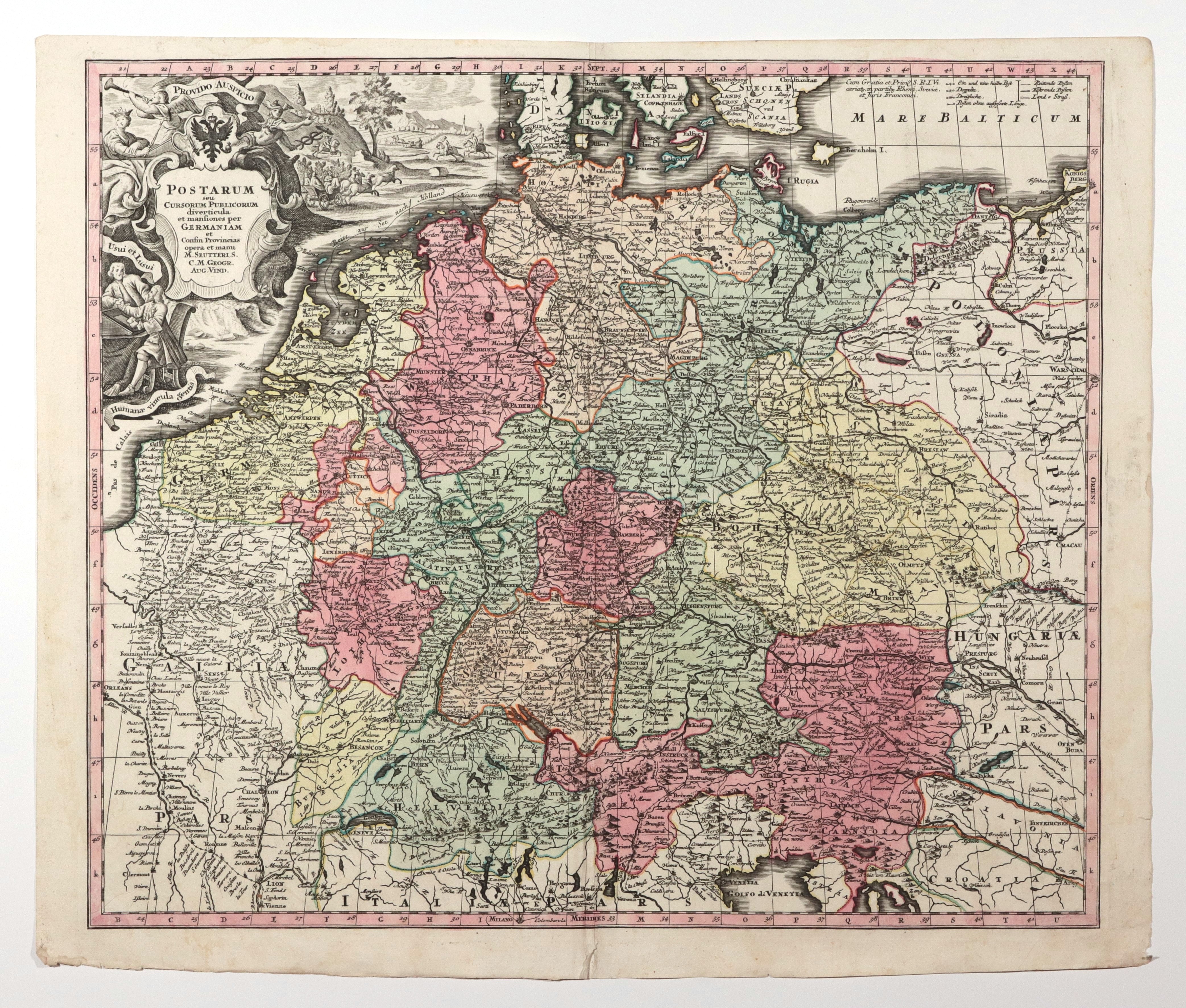
POLAND (called KORONA in the First Republic), SLASK, POMORZE, GERMANY. Map of postal routes in Saxon times; published by Matthäus Seutter, Augsburg, c. 1741; in the east it covers the areas up to Königsberg, Warsaw and Cracow, in the west - Antwerp, Brussels, Lyon, in the north - the Baltic and North Sea coasts, in the south - from Venice to Geneva; drawn, among others. a postal route from Warsaw via Łowicz, Września, Poznań and Słubice to Berlin, from Toruń via Oborniki, Szamotuły, Międzyrzecz, Krosno, Gubin to Dresden, from Cracow via Tarnowskie Góry, Opole, Brzeg to Wrocław, from Königsberg via Świecie, Tuchola, Okonek, Karsko to Kostrzyn and further to Berlin, from Gdańsk two routes: northern via Lębork and southern (more important) via Slawno, Koszalin, Nowogard to Szczecin, where it ended, or via Stargard to Berlin; also marked are the Vistula River crossings near Plock, Torun, Chelmno; copper. color, st. bdb., yellowing of margins, on verso handwritten annotation from the epoch; plate dimensions ca. 590x505 mm; POSTARUM seu CURSORUM PUBLICORUM diverticula et mansiones per GERMANIAM et Confin Provincias [...] .


![[MAP]. MAP OF POLAND 1 : 500 000. OLSZTYN. [Sheet ] 3. w-wa 1947....](https://img1.one.bid/img/6363/1859794_1x.webp?1713045600)


Recently viewed
Please log in to see lots list
Favourites
Please log in to see lots list