


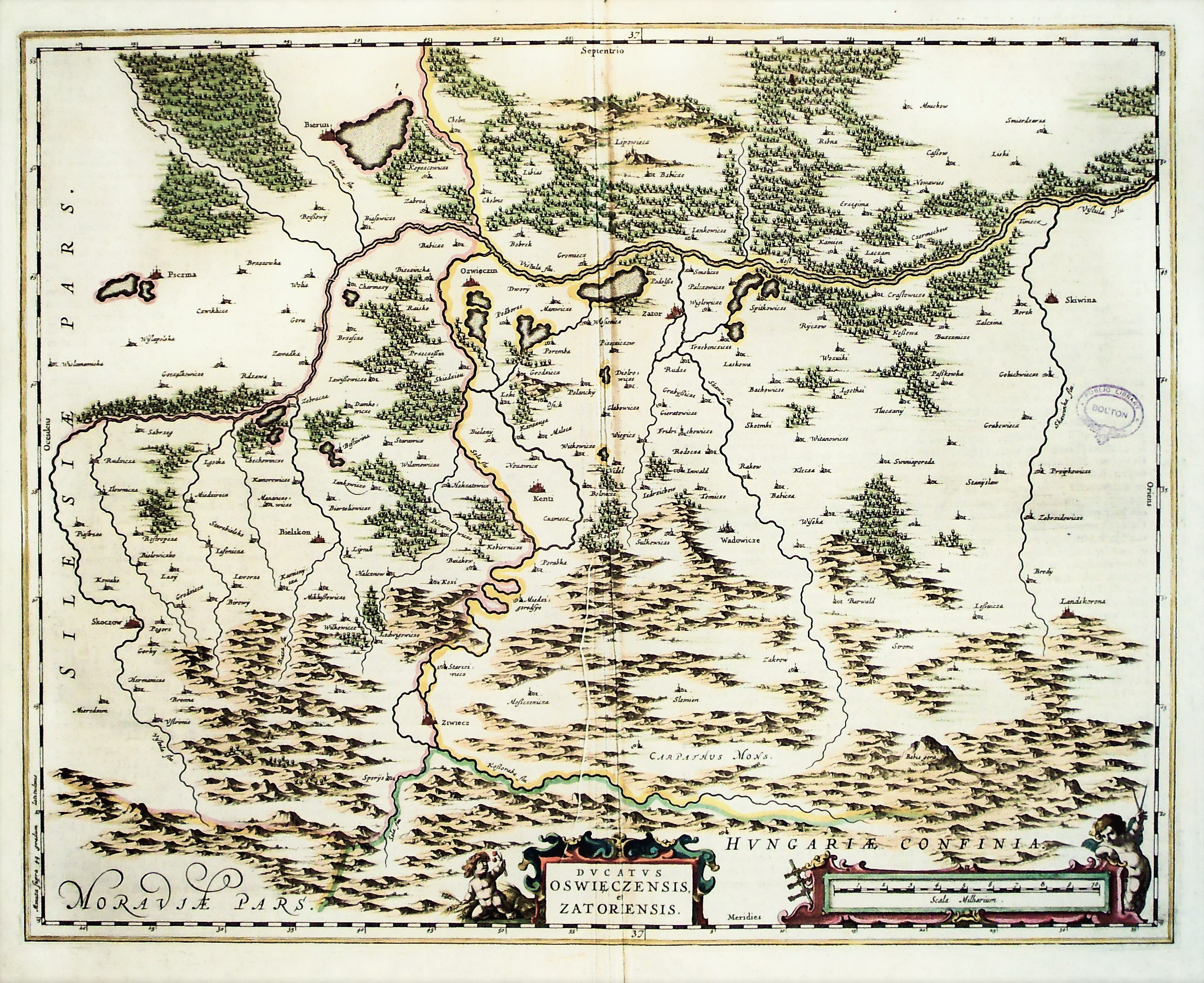
OŚWIĘCIM, ZATOR. Map of the Duchy of Oswiecim-Zator; enlarged map by Stanislaw Porębski, edited by Abraham Ortelius; taken from the largest atlas of the Blaeu publishing house: Atlas Maior sive Cosmographia Blaviana, published by Joan Blaeu, Amsterdam 1662; on verso text in Dutch: KLEYN POLEN; copper color, st. db., undated ownership stamp, edge tears, slight paper loss at edges, paper buckling in center; plate dimensions 524x417 mm; DVCATVS OSWIECZENSIS, et ZATORIENSIS; [Imago Poloniae... K87/9].


![[MAP]. MAP OF POLAND 1 : 500 000. OLSZTYN. [Sheet ] 3. w-wa 1947....](https://img1.one.bid/img/6363/1859794_1x.webp?1713045600)
![Poland car map. Cracow [1945].](https://img1.one.bid/img/6508/1873705_1x.webp?1713823200)
![Poland car map. Cracow [1945].](https://img1.one.bid/img/6508/1873705_2x.webp?1713823200)
![Map of Bydgoszcz area [ca] 61x45, [post 1922].](https://img1.one.bid/img/6474/1885259_1x.webp?1714687200)
![Map of Bydgoszcz area [ca] 61x45, [post 1922].](https://img1.one.bid/img/6474/1885259_2x.webp?1714687200)


![Dalhberg Erik Jonsson [Puffendorf] - Map of the Kingdom of Denmark and Pomerania (Szczecin)](https://img1.one.bid/img/5856/1829209_1x.webp?1712008800)


Recently viewed
Please log in to see lots list
Favourites
Please log in to see lots list