


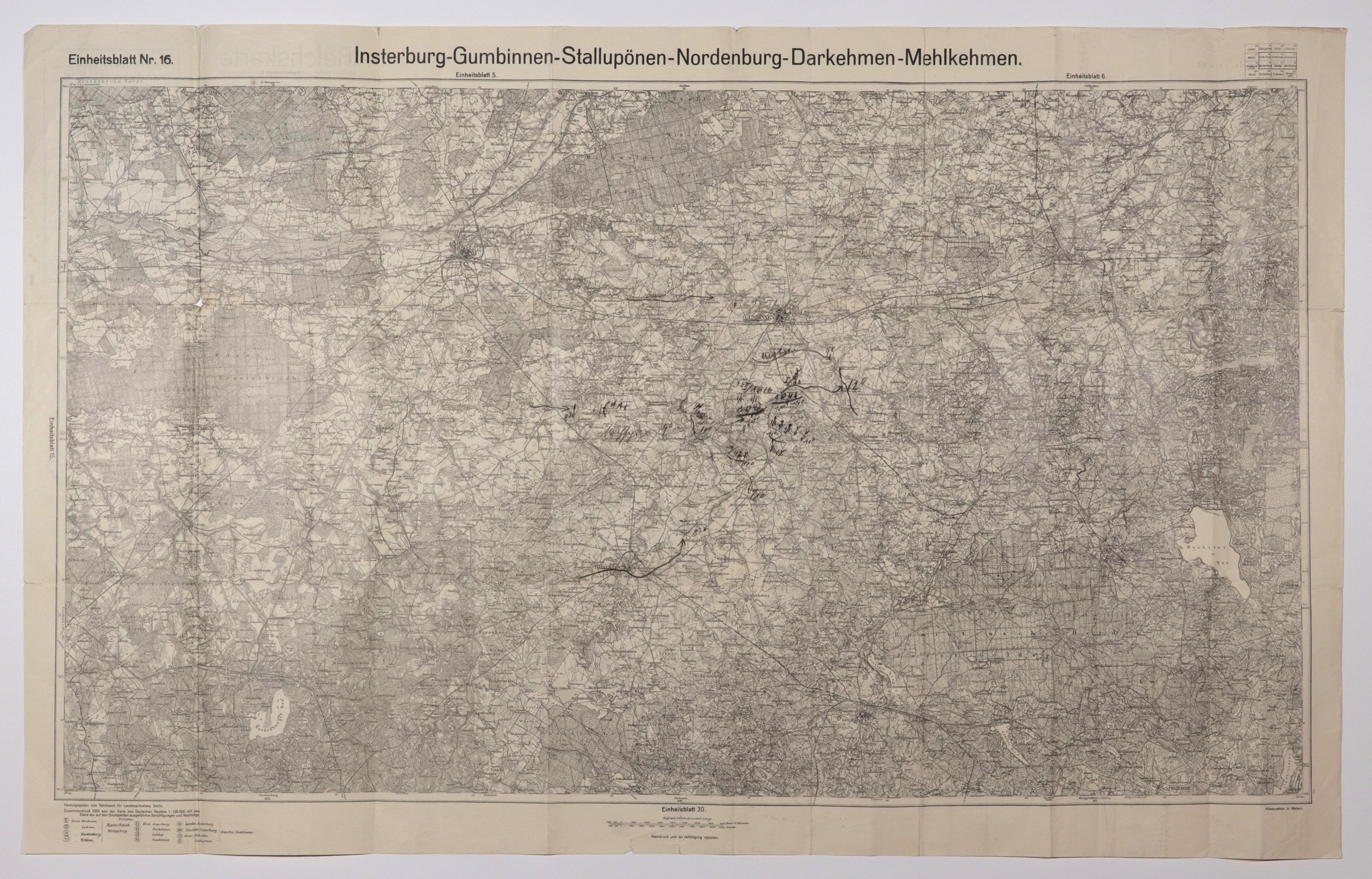
CZERNIACHOWSK (Polish: Wystruć), GUSIEW (Polish: Glabbin or Gąbin), NIESTIEROW (Polish: Stolupiany), KRYLOWO (Polish: Nordenbork), OZIORSK (Polish: Darkiejmy), KALININO. Folding map with plotted positions of military units, during maneuvers; taken from: Karte des Deutschen..., scale 1 : 100,000, published by Reichsamt..., Berlin 1924; notes in pencil, part b. print, multiple folds; st. bdb., minor tears, minimal soiling; map dimensions: 997x570 mm; Insterburg-Gumbinnen-Stallupönen-Nordenburg-Darkehmen-Mehlkehmen.


![[MAP]. MAP OF POLAND 1 : 500 000. OLSZTYN. [Sheet ] 3. w-wa 1947....](https://img1.one.bid/img/6363/1859794_1x.webp?1713045600)
![Poland car map. Cracow [1945].](https://img1.one.bid/img/6508/1873705_1x.webp?1713823200)
![Poland car map. Cracow [1945].](https://img1.one.bid/img/6508/1873705_2x.webp?1713823200)


![Dalhberg Erik Jonsson [Puffendorf] - Map of the Kingdom of Denmark and Pomerania (Szczecin)](https://img1.one.bid/img/5856/1829209_1x.webp?1712008800)


Recently viewed
Please log in to see lots list
Favourites
Please log in to see lots list