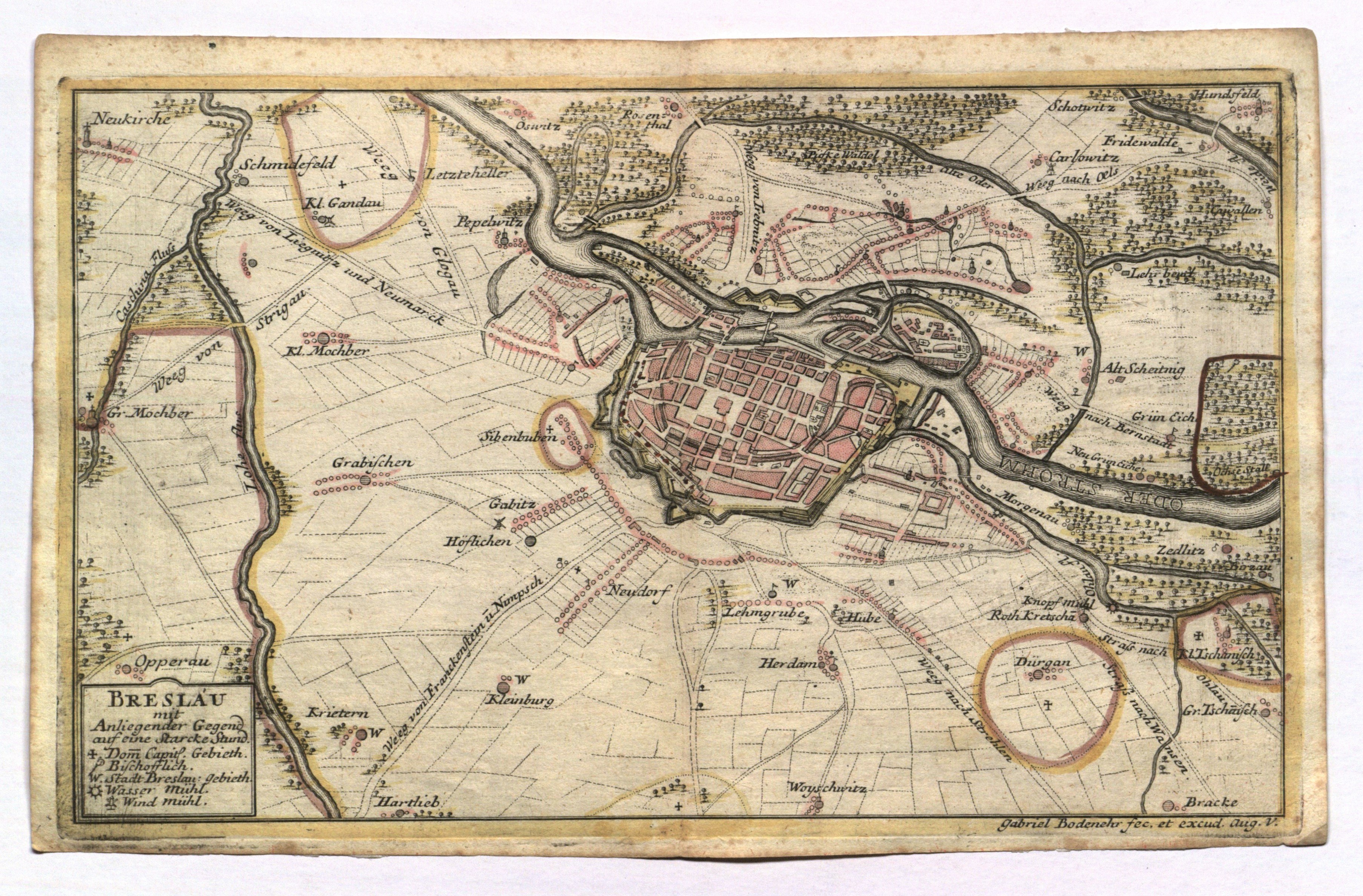
WROCŁAW. Plan of the city with map of the surrounding area; engraved and published by G. Bodenehr, c. 1740; copper color, bdb. st.; plate dimensions 294x183 mm; BRESLAU mit Anliegender Gegend auf eine Starcke Stund.
LabelsBETA
Labels are assigned by artificial intelligence based on the recognized context of the image. The algorithm is constantly learning and we make every effort to make the results more accurate over time.