


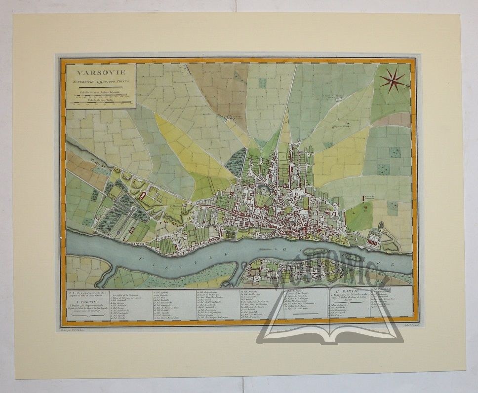
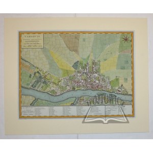
(WARSAW). "Varsovie".
Copperplate color. The authors of the plan are Pierre Francois Tardieu (1752 - 1798), Parisian engraver and cartographer, and J. B. L. Aubert. It is likely that the plan comes from an atlas: "Atlas nouveau Edme Mantelle". Paris 1782. dimensions: 33.5 x 44 (board: 43 x 55.5 cm).
Plan of Warsaw with 64 most important buildings described in the lower margin (among them numerous palaces and churches), outside the city marked, among others, the electoral field. Western orientation of the plan, in the upper left corner a title cartouche with scale. Very good condition.


Recently viewed
Please log in to see lots list
Favourites
Please log in to see lots list