SOKOLNIKI (pow. wrzesiński). Topograficzna mapa okolic miejscowości Sokolniki z zaznaczeniem granic Królestwa Kongresowego; Königlich Preuβische Landesaufnahme
addYour notecreate
Lot description
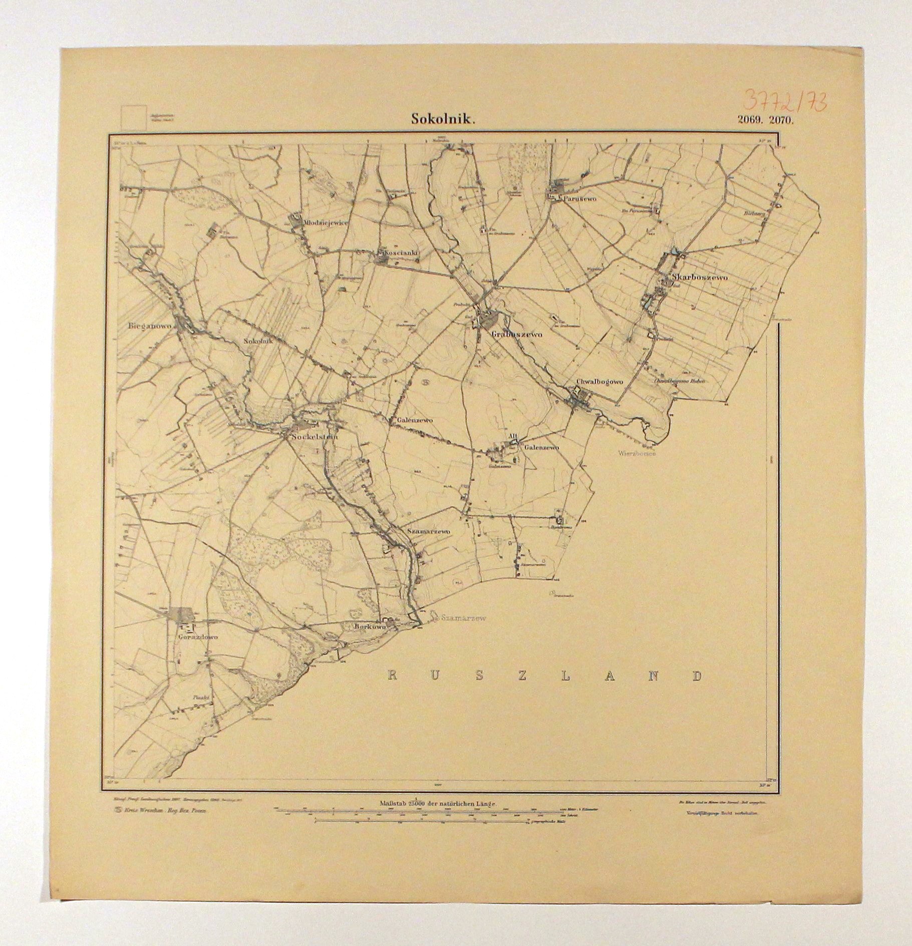
SOKOLNIKI (pow.wrzesiński). Topograficzna mapa okolic miejscowości Sokolniki z zaznaczeniem granic Królestwa Kongresowego; na północy Paruszewo, na południu Gorazdowo; Königlich Preuβische Landesaufnahme, oprac. 1887, wyd. 1911 (pierwsze wyd. 1888); skala 1: 25 000; druk dwubarwny (kolorem oznaczono zbiorniki wodne), st. bdb., odręczny dopisek, suchy tłok; wym.: 567x600 mm; Sokolnik. 2069. 2070;
LabelsBETA
Labels are assigned by artificial intelligence based on the recognized context of the image. The algorithm is constantly learning and we make every effort to make the results more accurate over time.
Point your phone towards the wall on which you want to hang the picture
Tap the button 3D View
Give the app permission to use the camera if required
Move the photo to place the picture on the wall
You can resize the photo by moving two fingers
Return Policy
Cost of delivery
Added to cartThe product is already in the cart
Name
SOKOLNIKI (pow. wrzesiński). Topograficzna mapa okolic miejscowości Sokolniki z zaznaczeniem granic Królestwa Kongresowego; Königlich Preuβische Landesaufnahme
![[MAP]. MAP OF POLAND 1 : 500 000. OLSZTYN. [Sheet ] 3. w-wa 1947....](https://img1.one.bid/img/6363/1859794_1x.webp?1713045600)