


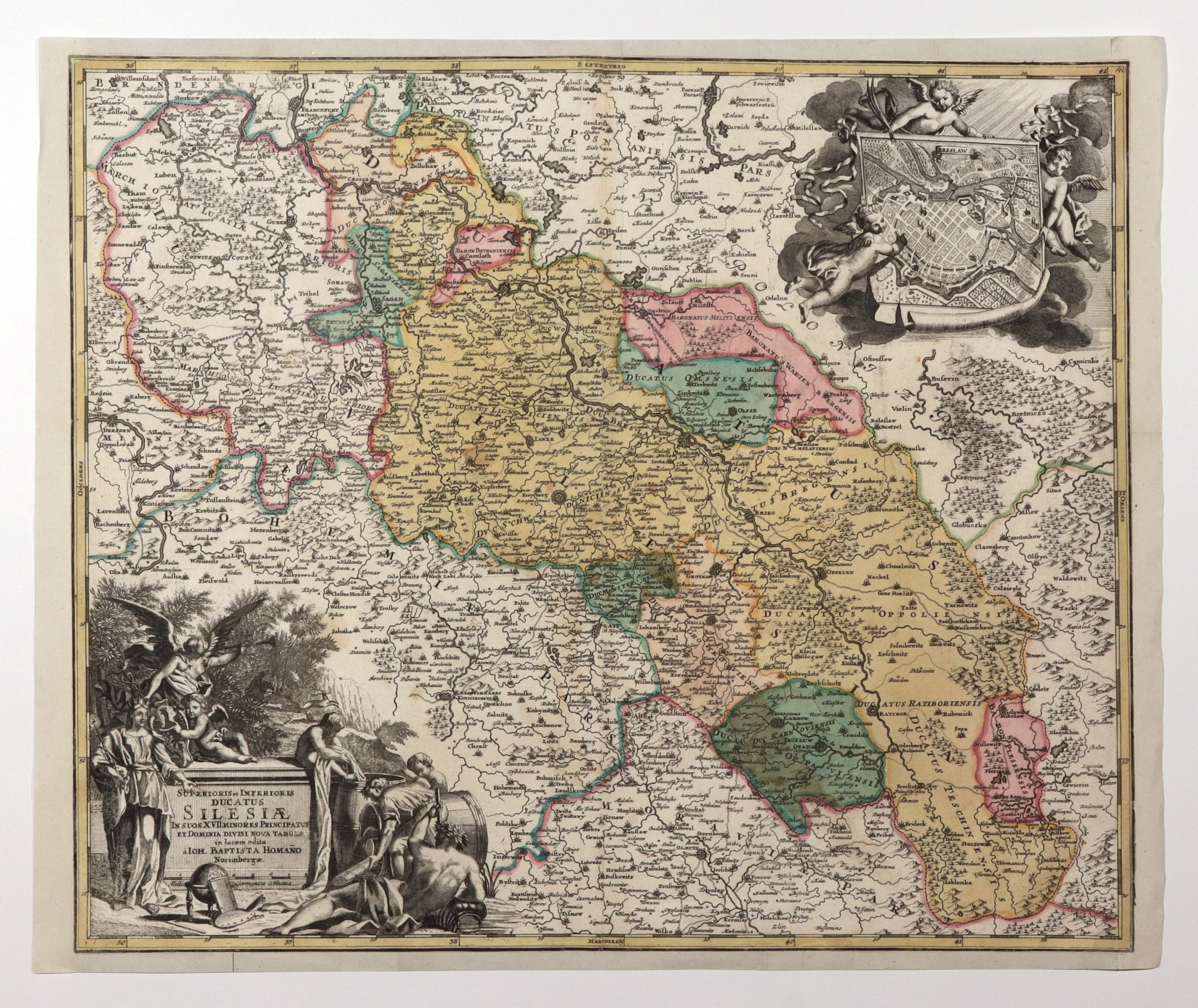
SLĄSK. Map of Upper and Lower Silesia with a plan of Breslau; issued by J.B. Homann, Nuremberg, before 1729; in the upper right corner held by three putti a scroll with a plan of Breslau- BRESLAW; cartouche of title in the form of a pedestal; copper-colored, st. bdb., minor yellowing, margins completed (plate imprint missing); map dimensions 575x485 mm; SUPERIORIS et INFERIORIS DUCATUS SILESIAE [...].


![[MAP]. MAP OF POLAND 1 : 500 000. OLSZTYN. [Sheet ] 3. w-wa 1947....](https://img1.one.bid/img/6363/1859794_1x.webp?1713045600)


Recently viewed
Please log in to see lots list
Favourites
Please log in to see lots list