


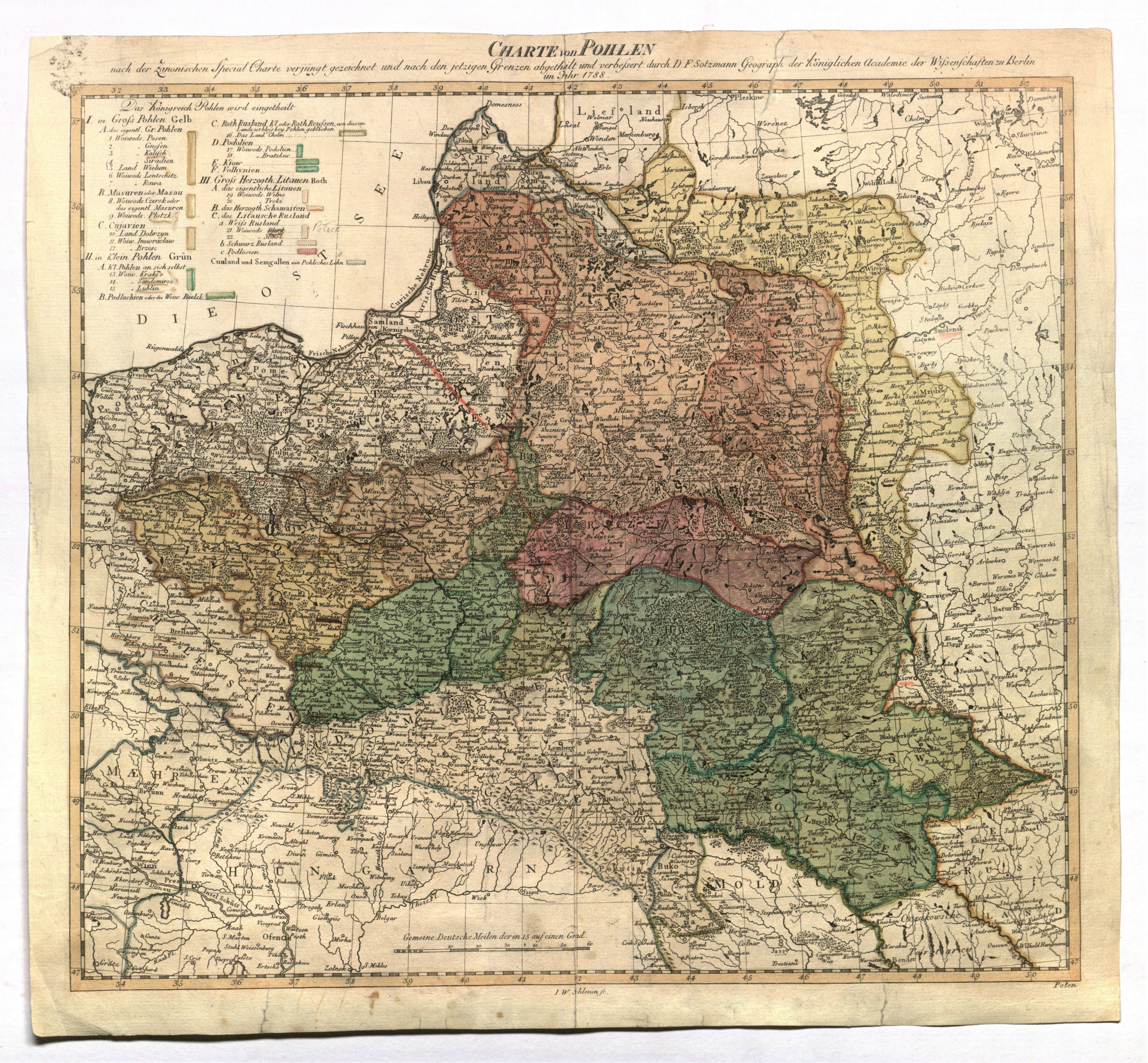
POLAND (called KORONA in the First Republic), GREAT PRINCE OF LITHUANIA. Map of the Republic in the late 18th century; compiled by. D.F. Sotzmann and G.A. Rizzi Zannoni, eng. I.W. Schleuen, published Berlin 1788; the map shows the division of Lithuania into: proper (Aukštota) with the provinces of Vilnius and Troki, the Duchy of Samogitia, and Lithuanian Ruthenia (White, Black and Polesie); copper color, st. bdb., after conservation; map dimensions 355x322 mm; CHARTE von POHLEN nach der Zanonischen[s] Special Charte verjungt gezeichnet und nach der jetzigen Grenzen abgetheilt und verbessert durch D. F. Sotzmann Geograph. der Königlichen Academie der Wissenschaften zu Berlin im Jahr 1788.RZADKIE.


![Poland car map. Cracow [1945].](https://img1.one.bid/img/6508/1873705_1x.webp?1713823200)
![Poland car map. Cracow [1945].](https://img1.one.bid/img/6508/1873705_2x.webp?1713823200)


![[MAP]. MAP OF POLAND 1 : 500 000. OLSZTYN. [Sheet ] 3. w-wa 1947....](https://img1.one.bid/img/6363/1859794_1x.webp?1713045600)


![Dalhberg Erik Jonsson [Puffendorf] - Map of the Kingdom of Denmark and Pomerania (Szczecin)](https://img1.one.bid/img/5856/1829209_1x.webp?1712008800)


Recently viewed
Please log in to see lots list
Favourites
Please log in to see lots list