


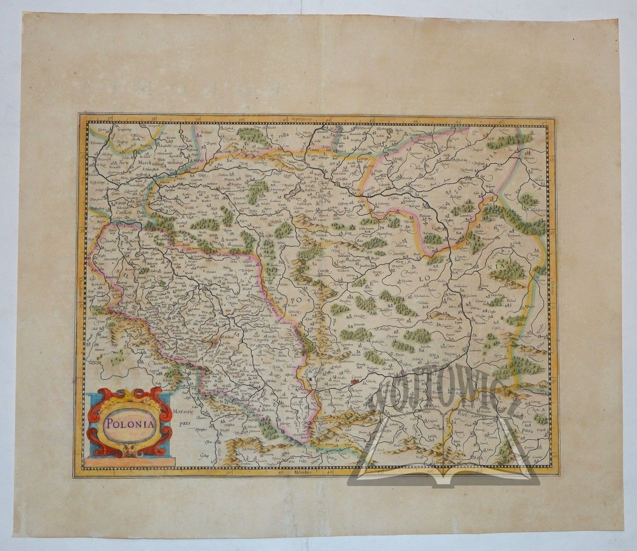
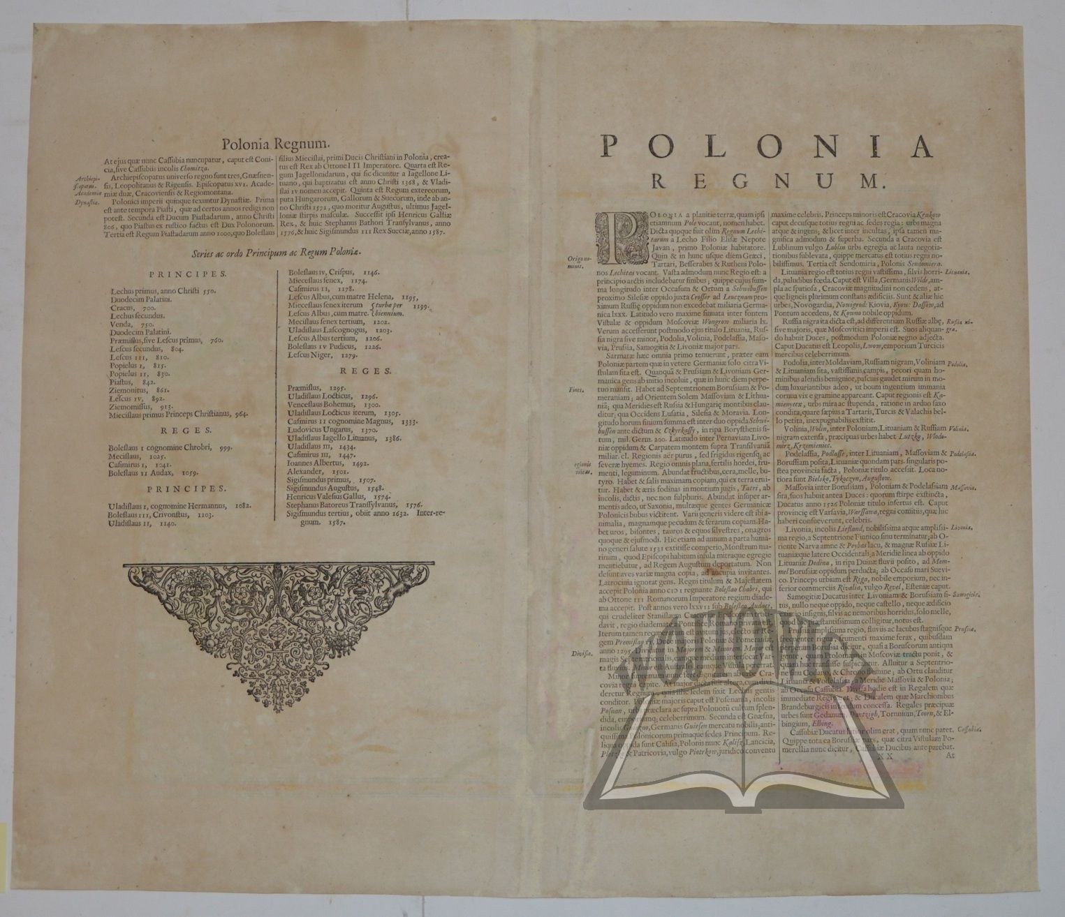
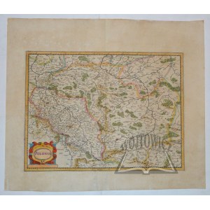
(POLAND). "Polonia.
Color copperplate. Henricus Hondius, Gerard Mercator. Second state, appeared in "Atlas or geographical description of the regions, ... of the world". Amsterdam 1636. Dimensions: 34.3 x 45.7 cm, (board: 48.5 x 57 cm).
Decorative information cartouche in the lower left corner. The second state of the offered map was also included in several other atlases published by Hondius' company in the following years. From about 1640 this state was replaced by another map. Verso text in Latin: "Polonia Regnum". Map after delicate conservation, traces of browning. Good condition. (Imago Poloniae K75/2).


![[MAP]. MAP OF POLAND 1 : 500 000. OLSZTYN. [Sheet ] 3. w-wa 1947....](https://img1.one.bid/img/6363/1859794_1x.webp?1713045600)


![Automobile MAP of Poland 1 : 2,000,000 with list of gas stations by 'Karpaty' Nakł. Karpaty Sp. z o.o., Lviv [1933].](https://img1.one.bid/img/6145/1794990_1x.webp?1709593200)
![Automobile MAP of Poland 1 : 2,000,000 with list of gas stations by 'Karpaty' Nakł. Karpaty Sp. z o.o., Lviv [1933].](https://img1.one.bid/img/6145/1794990_2x.webp?1709593200)


Recently viewed
Please log in to see lots list
Favourites
Please log in to see lots list