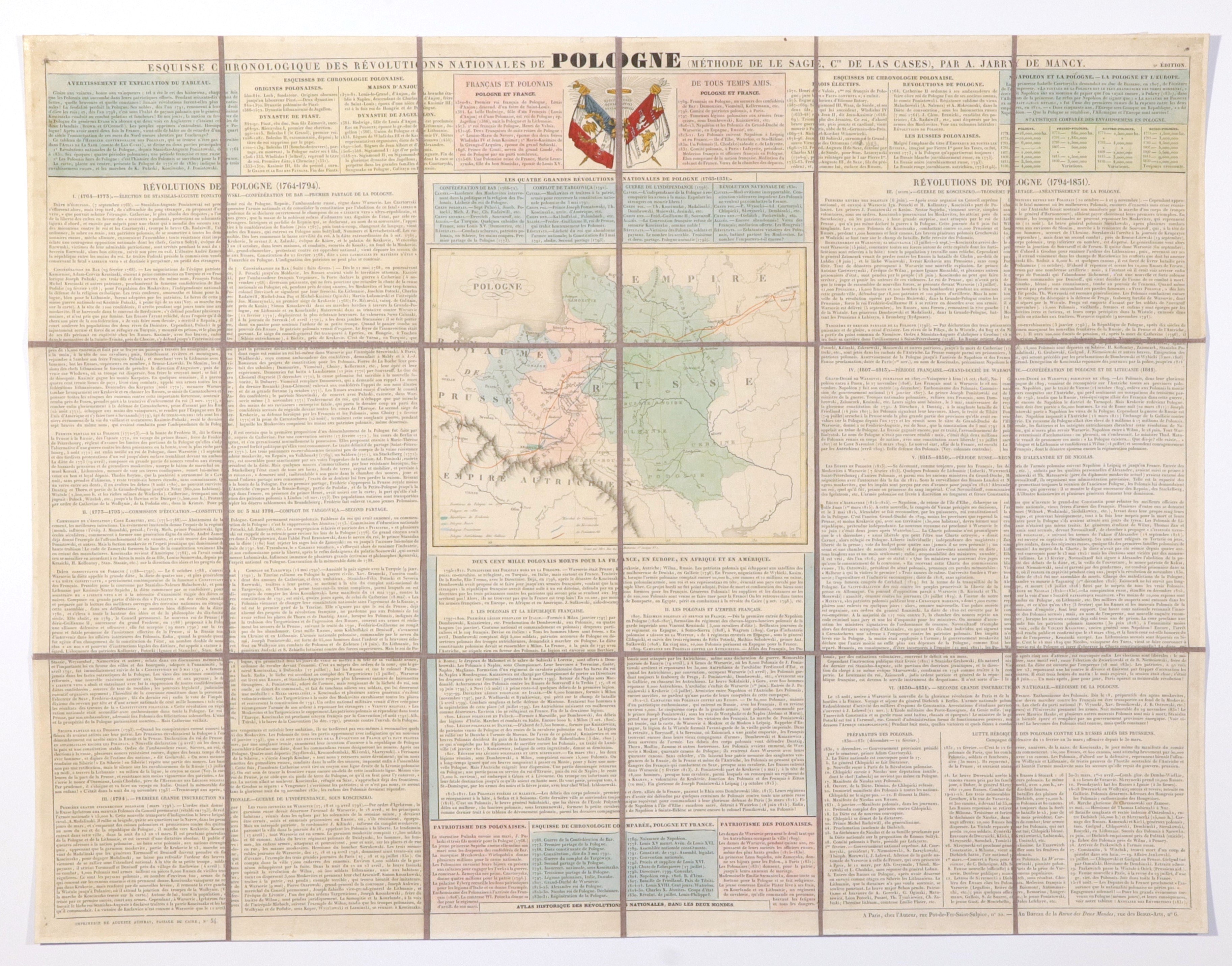
POLAND. Map of Poland - created in the wave of huge interest in Poland during the November Uprising; compiled by. A. Jarry de Mancy, taken from: Atlas historique des révolutions nationales dans les deux mondes, ca. 1831, print. A. Auffray; the map shows the division of the country after the partitions and the marching routes of Pulaski, Kosciuszko and Poniatowski; around the map very extensive text describing the national uprisings between 1764 and 1831 and the partitions, French-Polish friendship is emphasized; st. col, st. bdb., map divided into 18 parts glued together with linen, light soiling; overall dimensions 695x535 mm; ESQUISSE CHRONOLOGIQUE DES RÉVOLUTIONS NATIONALES DE POLOGNE (MÉTHODE DE LE SAGE, CTE DE LAS CASES); rare display of sympathy for Poland.
![[MAP]. MAP OF POLAND 1 : 500 000. OLSZTYN. [Sheet ] 3. w-wa 1947....](https://img1.one.bid/img/6363/1859794_1x.webp?1713045600)


![Automobile MAP of Poland 1 : 2,000,000 with list of gas stations by 'Karpaty' Nakł. Karpaty Sp. z o.o., Lviv [1933].](https://img1.one.bid/img/6145/1794990_1x.webp?1709593200)
![Automobile MAP of Poland 1 : 2,000,000 with list of gas stations by 'Karpaty' Nakł. Karpaty Sp. z o.o., Lviv [1933].](https://img1.one.bid/img/6145/1794990_2x.webp?1709593200)