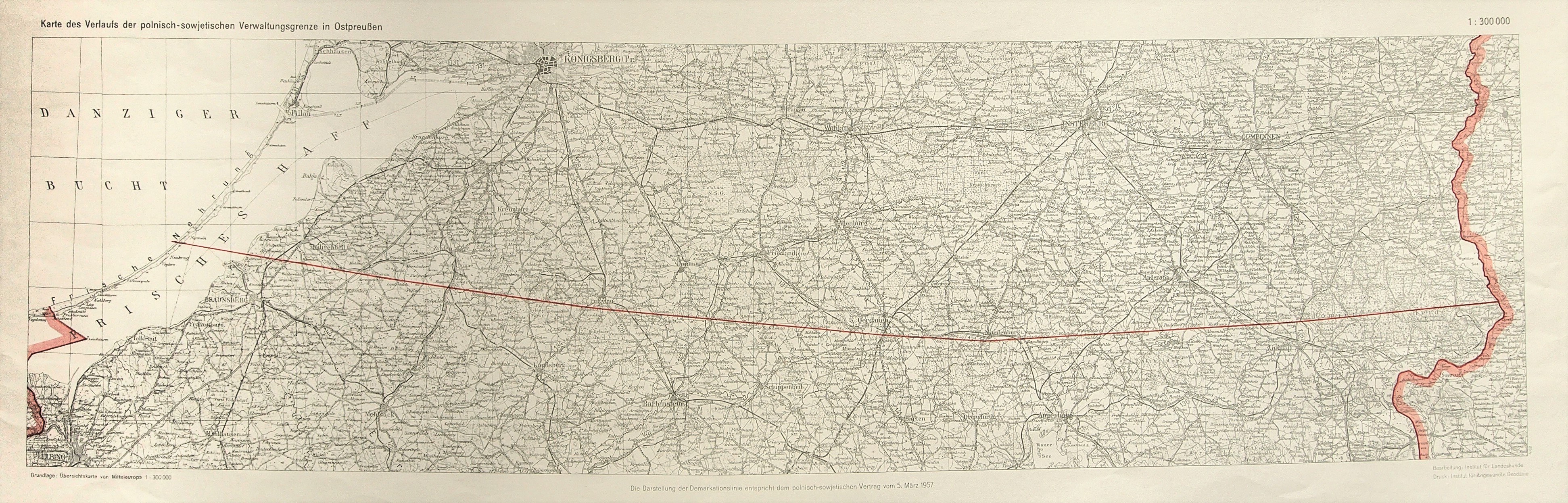
POLAND. Map of the Polish-Soviet border (today's Polish-Russian border); taken from: Übersichtskarte von Mitteleuropa, compiled by. Institut für Landeskunde, print. Institut für Angewandte Geodäsie, 1957; scale 1: 300,000; out-of-date ownership stamp in upper right corner; printed in black and white with line color (color is used to mark borders), st. bdb., slight creasing of left edge, bottom of tear; dimensions 780x220 mm; Karte des Verlaufs der polnisch-sowjetischen Verwaltungsgrenze in Ostpreußen.
![[MAP]. MAP OF POLAND 1 : 500 000. OLSZTYN. [Sheet ] 3. w-wa 1947....](https://img1.one.bid/img/6363/1859794_1x.webp?1713045600)
![Automobile MAP of Poland 1 : 2,000,000 with list of gas stations by 'Karpaty' Nakł. Karpaty Sp. z o.o., Lviv [1933].](https://img1.one.bid/img/6145/1794990_1x.webp?1709593200)
![Automobile MAP of Poland 1 : 2,000,000 with list of gas stations by 'Karpaty' Nakł. Karpaty Sp. z o.o., Lviv [1933].](https://img1.one.bid/img/6145/1794990_2x.webp?1709593200)