


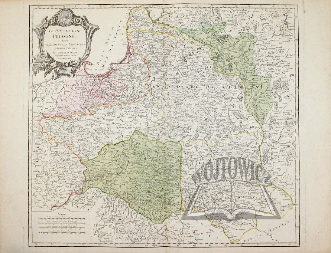
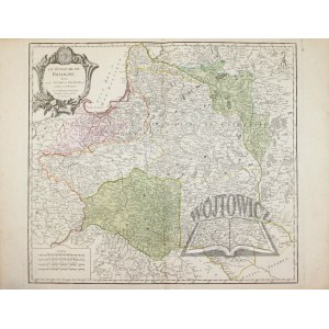
(POLAND). "Le Royaume de Pologne.
Divise en ses Duches ey Provinces e subdivise en Palatinats. Par le S. Robert de Vaugondy Geog. ord. du Roi. Avec privilege 1752. colored copperplate . Publisher: Giles and Dider de Vaugondy. The map comes from the atlas: "Atlas Universel", which was published in collaboration with the Parisian bookseller Antoine Boudet (active 1745-89). Dimensions: 48 x 53.5 cm (board: 51.5 x 67 cm).
Very good condition. Decorative information cartouche in the upper left corner, and a scale in the lower left corner. First state. (Imago Poloniae K47/2).


![[MAP]. MAP OF POLAND 1 : 500 000. OLSZTYN. [Sheet ] 3. w-wa 1947....](https://img1.one.bid/img/6363/1859794_1x.webp?1713045600)


Recently viewed
Please log in to see lots list
Favourites
Please log in to see lots list