


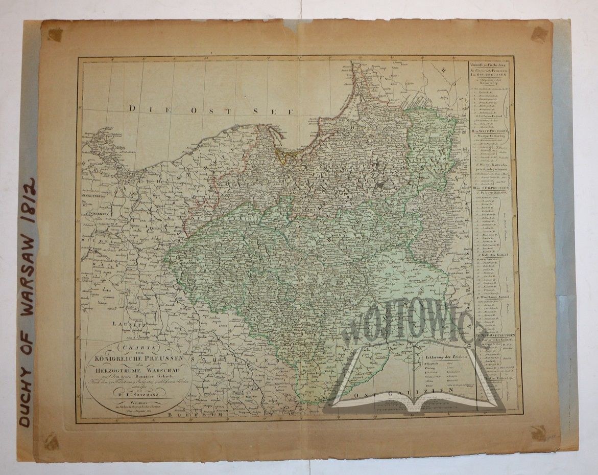
(POLAND). Charte vom Königreiche Preussen dem Herzogthume Warschau und dem neuen Danziger Gebiete. ...". .
Color steel engraving. D. F. Stozmann. Weimar 1812. format: 47.5 x 57.5 cm (board: 57.5 x 67.5 cm).
Traces of browning and dampstaining, non-tears and loss of margin. Map spot glued on cardboard backing. Information cartouche in the lower left corner, scale in the right corner. On the right side of the map information about the administrative division. The map, under the name of the Kingdom of Prussia and the Duchy of Warsaw, shows the territory of Poland from Cracow to the Baltic Sea and from Berlin to Grodno.


![[MAP]. MAP OF POLAND 1 : 500 000. OLSZTYN. [Sheet ] 3. w-wa 1947....](https://img1.one.bid/img/6363/1859794_1x.webp?1713045600)


![Automobile MAP of Poland 1 : 2,000,000 with list of gas stations by 'Karpaty' Nakł. Karpaty Sp. z o.o., Lviv [1933].](https://img1.one.bid/img/6145/1794990_1x.webp?1709593200)
![Automobile MAP of Poland 1 : 2,000,000 with list of gas stations by 'Karpaty' Nakł. Karpaty Sp. z o.o., Lviv [1933].](https://img1.one.bid/img/6145/1794990_2x.webp?1709593200)


Recently viewed
Please log in to see lots list
Favourites
Please log in to see lots list