


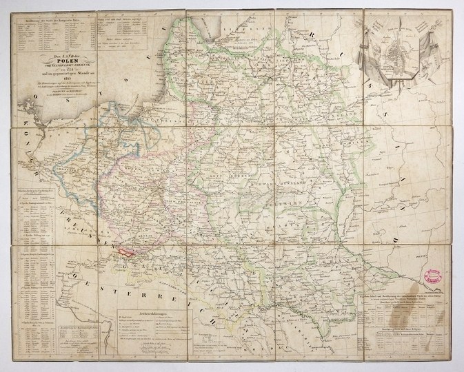
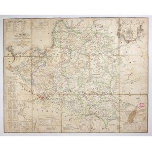
[POLAND]. Das Land der Polen vor seiner erst-n Theilung von 1772 und im gegenwärtigen Stande seit 1815. colored copperplate form. 43.8x54.9 cm.
Map of Poland within pre-partition borders published by Herdersche Kunst und Buchhandlung in Freiburg (Breisgau) ca. 1831. Title in upper left corner, above list of major cities with number of inhabitants. In upper right corner a small plan of Warsaw against a background of banners. Above the lower frame, tables containing a list of battles and skirmishes from 1768-1831, settlement of provinces, legend, national and religious structure of different parts of the country. Line color. Map cut in period into 15 parts glued together on linen, in cardboard case. Own stamp at right edge. Yellowing of paper in places, staining at lower right corner.


![[MAP]. MAP OF POLAND 1 : 500 000. OLSZTYN. [Sheet ] 3. w-wa 1947....](https://img1.one.bid/img/6363/1859794_1x.webp?1713045600)


Recently viewed
Please log in to see lots list
Favourites
Please log in to see lots list