


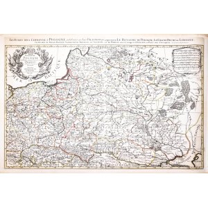
Map of the lands of the Republic from "Atlas Nouveau", fifth state, published by Pieter Mortier, Amsterdam, 1711
line-colored copperplate, 58.5 x 88 cm (plate imprint)
very good condition
Imago Poloniae, K24/4


Recently viewed
Please log in to see lots list
Favourites
Please log in to see lots list