


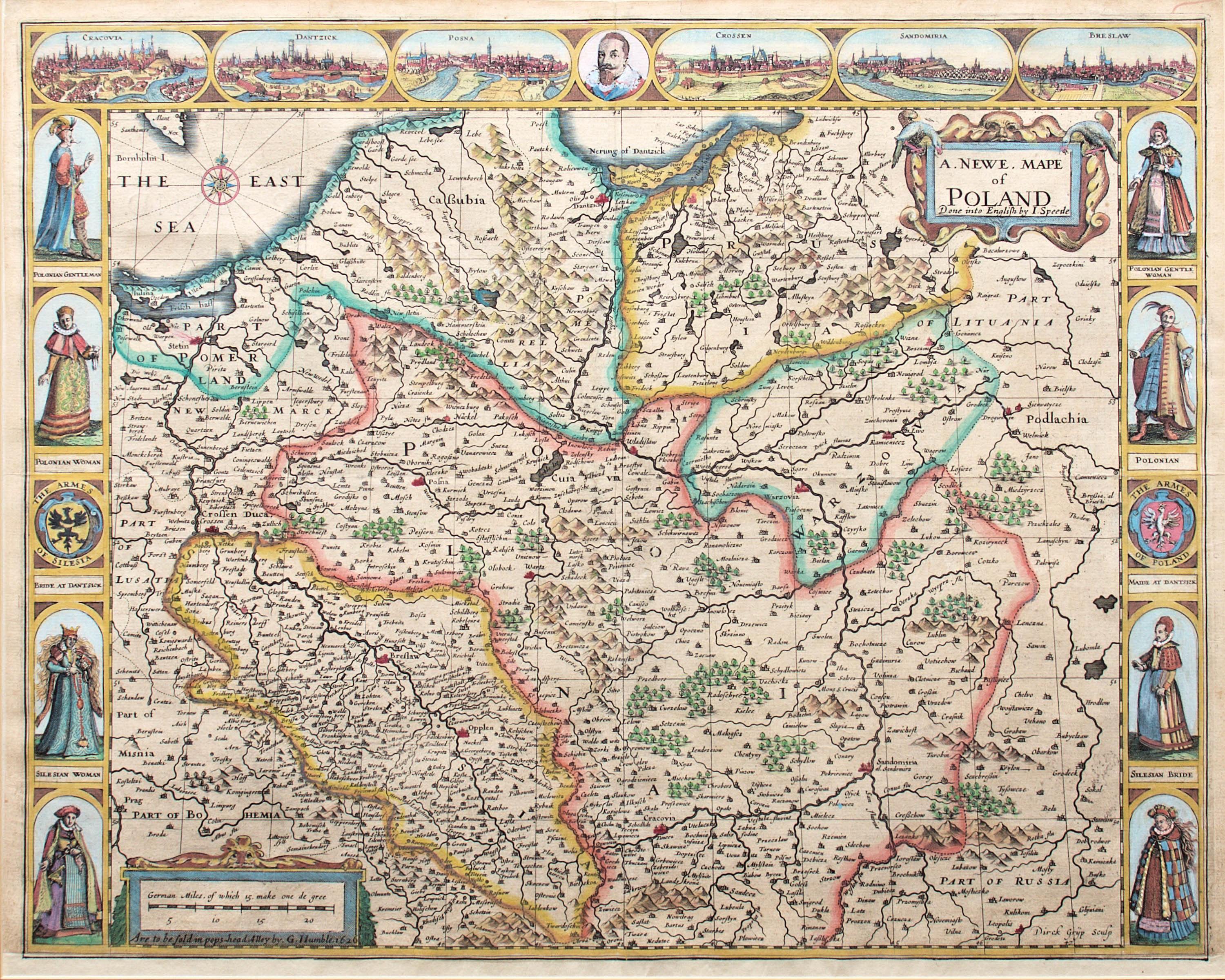
Map of Poland from 1626, first state, published by George Humble, London, 1626
colored copperplate, 41 x 53 cm in light frame
good condition +, bottom margin cut off
Imago Poloniae, K78/1


Recently viewed
Please log in to see lots list
Favourites
Please log in to see lots list