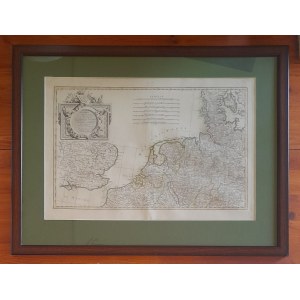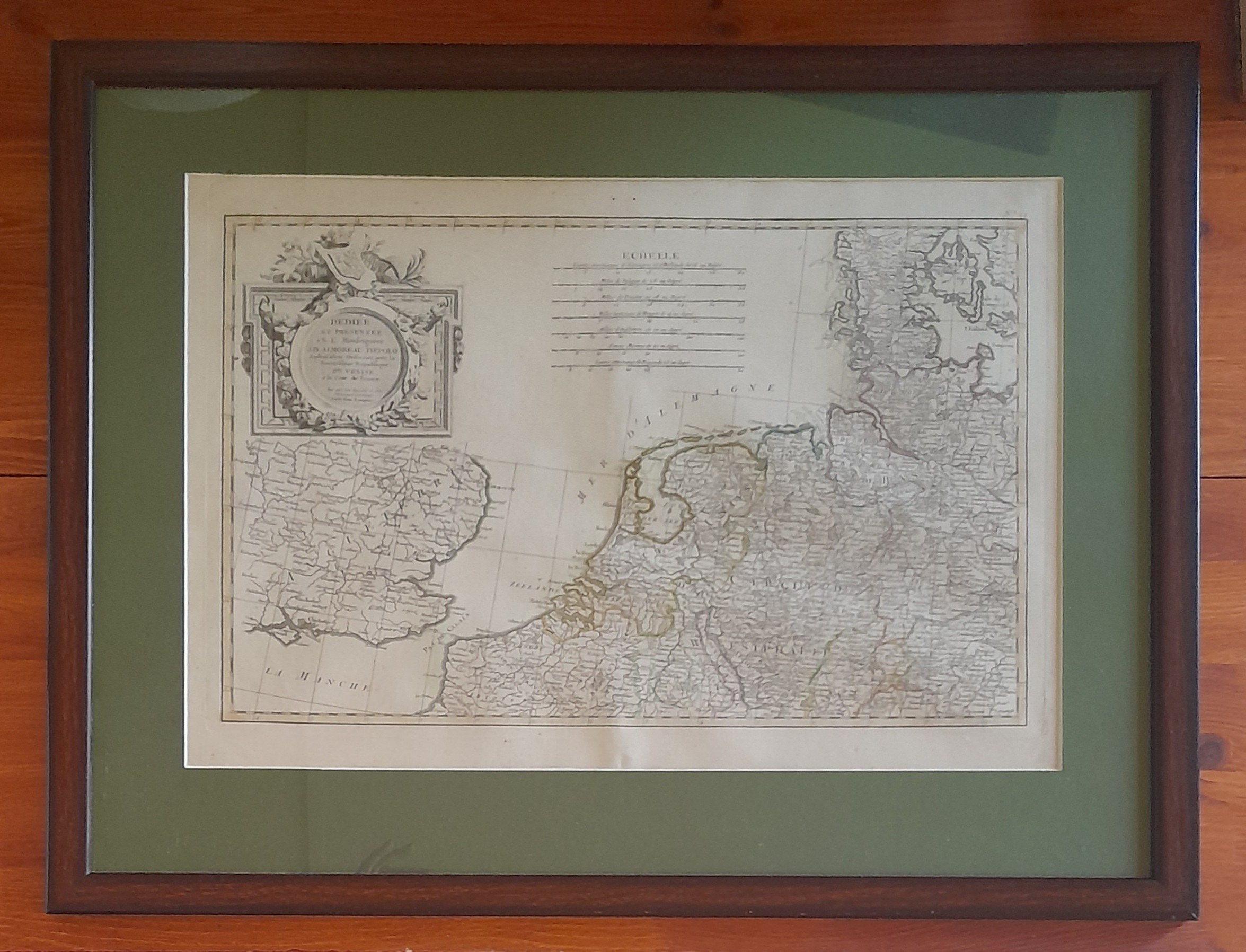
Rizzi Zannoni is a fame in his own right. A versatile artist and scientist, astronomer, mathematician and cartographer. Geographer of the Venetian Republic and hydrographer of the Paris Navy. His maps were famous for their precision and magnificent ornamentation, so they were printed in various atlases. His greatest work, is considered to be the development of the first large-scale map of Poland - the Carte de Pologne of 1772, published on 24 sheets, which was helped by Polish artillery captain Franciszek Czaki, court mathematician of Stanislaw August, Jan Frederick Endersch, and Prince Jozef Jablonowski, founder of the excellent Jablonowski Scientific Society (the whole event was held at his expense). This time, however, we are not presenting a map of Poland, but of the coast of Western Europe - from the English Channel, through the North Sea coast to Denmark. A large part of the map is occupied by an ornate cartouche with the author's signature, and an accurate 'ladder' (echelle), which is a detailed description of distances and scales.
The map is framed in a dark green passe partout frame and a wooden frame and glass pane.


![[MAP]. MAP OF POLAND 1 : 500 000. OLSZTYN. [Sheet ] 3. w-wa 1947....](https://img1.one.bid/img/6363/1859794_1x.webp?1713045600)


![Automobile MAP of Poland 1 : 2,000,000 with list of gas stations by 'Karpaty' Nakł. Karpaty Sp. z o.o., Lviv [1933].](https://img1.one.bid/img/6145/1794990_1x.webp?1709593200)
![Automobile MAP of Poland 1 : 2,000,000 with list of gas stations by 'Karpaty' Nakł. Karpaty Sp. z o.o., Lviv [1933].](https://img1.one.bid/img/6145/1794990_2x.webp?1709593200)