


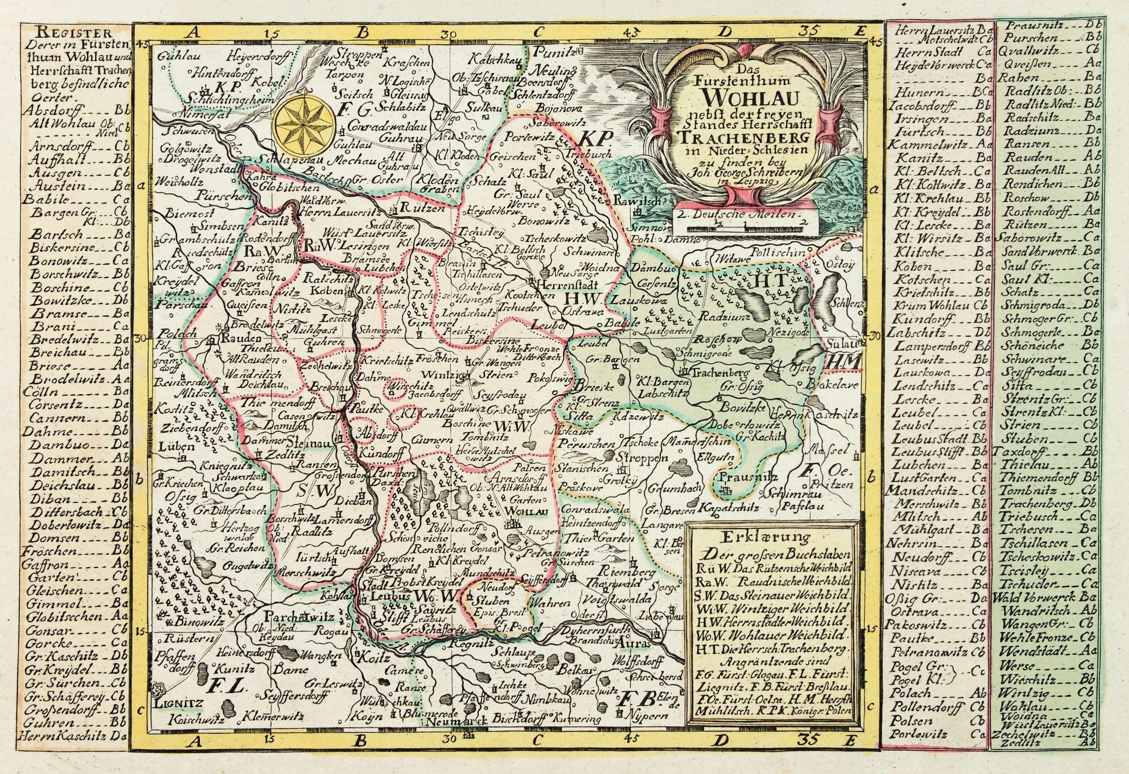
WOŁÓW, ŻMIGRÓD. Map of the Principality of Volhynia, covers borderlands of Greater Poland including Poniec; on both pages, boxes with explanatory notes; taken from: Atlas Selectus [...], ryt. and ed. by J.G. Schreiber, Leipzig, ca. 1749; copper color, st. bdb., slight yellowing of margins; plate dimensions 260x190 mm; Das Fürstenthum WOHLAU nebst der freyen Standes Herrschafft TRACHENBERG in Nieder-Schlesien [...]; [Imago Silesiae... 166 ].


![[MAP]. MAP OF POLAND 1 : 500 000. OLSZTYN. [Sheet ] 3. w-wa 1947....](https://img1.one.bid/img/6363/1859794_1x.webp?1713045600)


Recently viewed
Please log in to see lots list
Favourites
Please log in to see lots list