


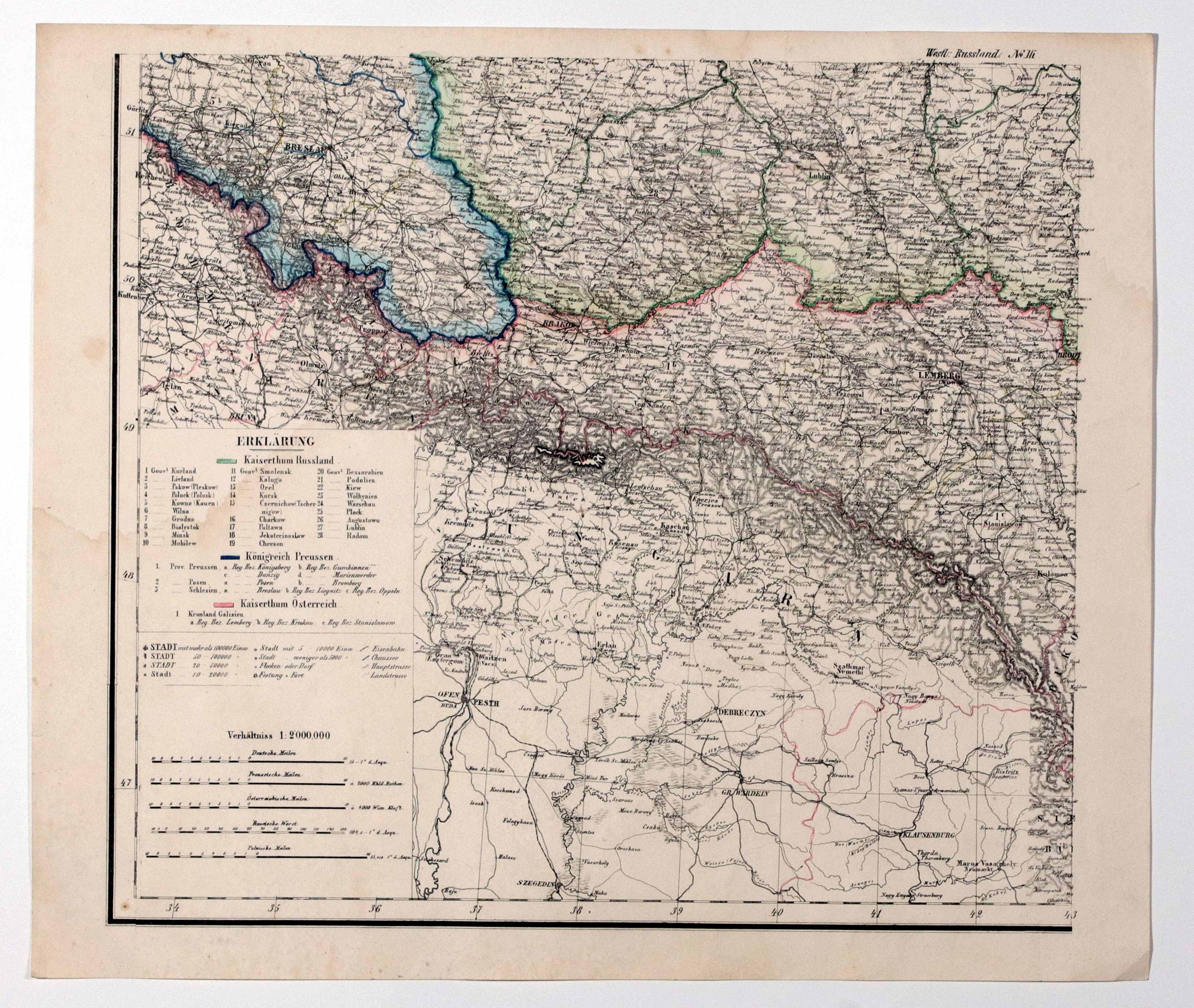

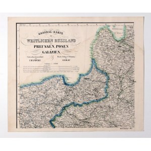
WIELKOPOLSKA, CONGRESS KINGDOM, PRUSSIA. Map of the Polish lands after the Congress of Vienna in 1815; the borders of the Russian Empire (including the lands of the Kingdom of Poland), Prussia (with Danzig), and Austria (including the Free City of Cracow) are marked; map divided into 4 sheets; in the upper right corner of the 2nd sheet, a frame with a schematic plan of Warsaw and a map of the immediate area; drawn by F. Handtke, druk. and publ. by Carl Flemming, Glogow, ca. 1870; steel. b/w with line-color, condition bdb., extensive traces of moisture, soiling, small traces of woodworm on 3 sheets; sheet dimensions 422x358 mm; GENERAL-KARTE VOM WESTLICHEN RUSSLAND nebst PREUSSEN, POSEN und GALIZIEN.


![[MAP]. MAP OF POLAND 1 : 500 000. OLSZTYN. [Sheet ] 3. w-wa 1947....](https://img1.one.bid/img/6363/1859794_1x.webp?1713045600)


![Königl. Freistadt Oedenburg [Sopron szabad királyi város térképe, 1871.] Lithographiert von F. Szita. W[iene]r...](https://img1.one.bid/img/6570/1844246_1x.webp?1712700000)
![Königl. Freistadt Oedenburg [Sopron szabad királyi város térképe, 1871.] Lithographiert von F. Szita. W[iene]r...](https://img1.one.bid/img/6570/1844246_2x.webp?1712700000)


Recently viewed
Please log in to see lots list
Favourites
Please log in to see lots list