


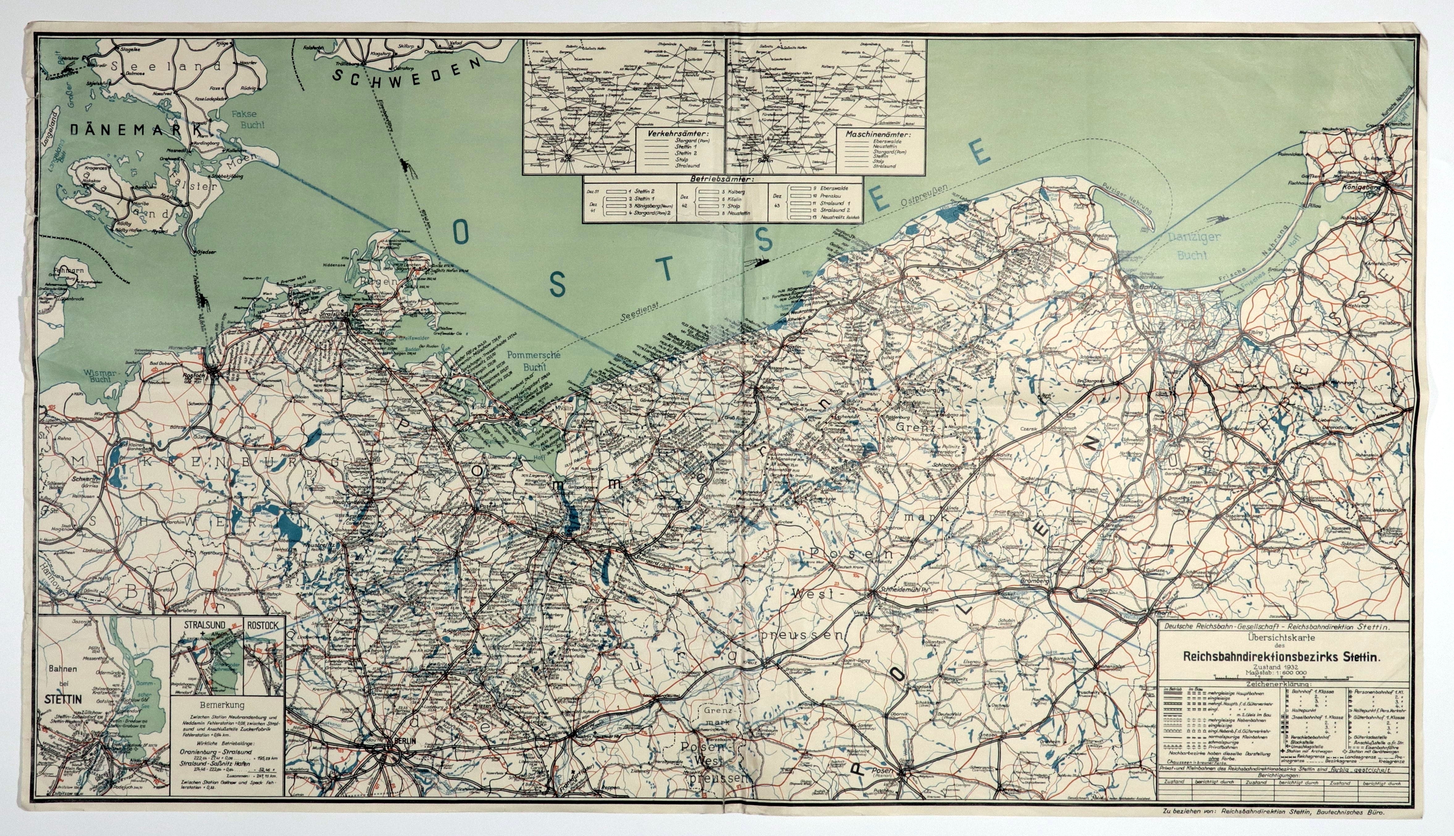
SZCZECIN. Map of the 1932 network of German railroad connections in the Szczecin district; also shows the border regions of the Second Republic - from the Baltic Sea in the north, to Poznan in the south, from Schwerin in the west to Königsberg in the east; issued before 1939; scale 1 : 600,000; legend in lower right corner, three maps of railroad connections in the vicinity of Szczecin, Stralsund and Rostock in the lower left corner, at the top two maps showing the network of traffic and machine offices; color print, st. db., multiple folds, creases at bottom, minor edge tears, underlining on verso; map dimensions 1035x578 mm; Übersichtskarte des Reichsbahdirektionsbezirks Stettin.Zustand 1932.


![[MAP]. MAP OF POLAND 1 : 500 000. OLSZTYN. [Sheet ] 3. w-wa 1947....](https://img1.one.bid/img/6363/1859794_1x.webp?1713045600)


![Automobile MAP of Poland 1 : 2,000,000 with list of gas stations by 'Karpaty' Nakł. Karpaty Sp. z o.o., Lviv [1933].](https://img1.one.bid/img/6145/1794990_1x.webp?1709593200)
![Automobile MAP of Poland 1 : 2,000,000 with list of gas stations by 'Karpaty' Nakł. Karpaty Sp. z o.o., Lviv [1933].](https://img1.one.bid/img/6145/1794990_2x.webp?1709593200)


Recently viewed
Please log in to see lots list
Favourites
Please log in to see lots list