


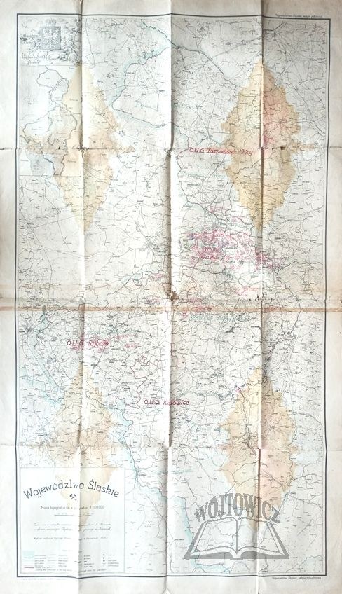
(SLĄSK) Silesian Province.
Topographic map in scale 1:100 000. compiled from official material under the direction of T. Klenczar in the surveyor's office of the Higher Mining Office in Katowice. Drawn by J. Kozik. Katowice 1928. Nakł. Higher Mining Office. Offset printing by K. Miarka Sp. Wyd. in Mikolow. Color map, folded Dimensions: 160 x 94 cm.
Traces of folding, rubbing, staining and underlining of the map at the folds, traces of soiling, non. rips and loss of edges. The map shows the southern section of the Silesian province, including Rybnik, Katowice and Tarnowskie Góry. 9136/1


Recently viewed
Please log in to see lots list
Favourites
Please log in to see lots list