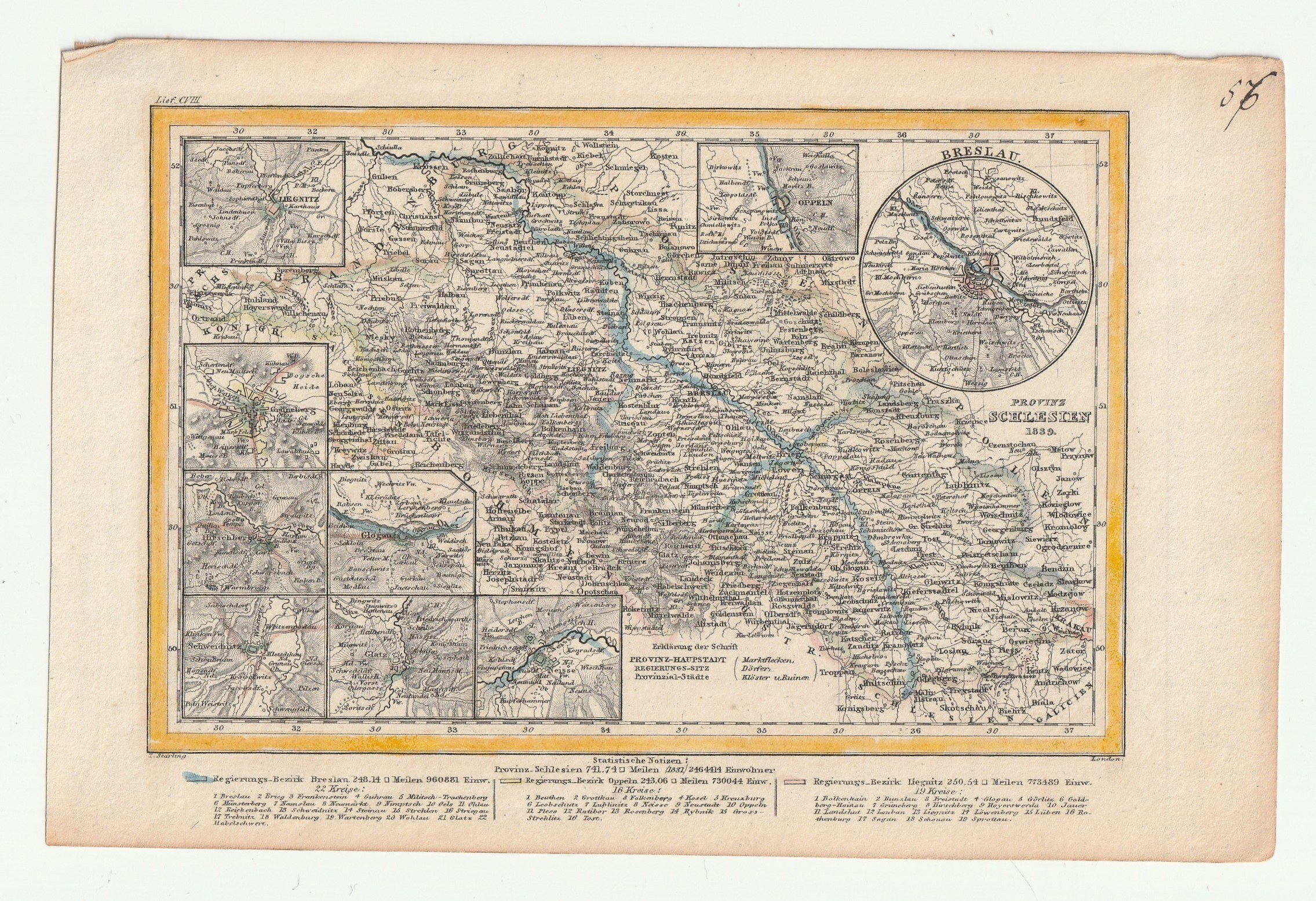
ŚLĄSK. Mapa Prowincji Śląskiej w 1839 r.; I. Starling
addYour notecreate
Lot description
ŚLĄSK. Mapa Prowincji Śląskiej w 1839 r.; niewielkie ramki z mapą okolic Legnicy, Zielonej Góry, Jeleniej Góry, Głogowa, Świdnicy, Kłodzka, Nysy, Opola i Wrocławia; ryt. I. Starling, Londyn, ok. 1840; stal. częściowo kolor., st. bdb., lekkie zażółcenia krawędzi; wym.: 143x95 mm; PROVINZ SCHLESIEN 1839;
LabelsBETA
Labels are assigned by artificial intelligence based on the recognized context of the image. The algorithm is constantly learning and we make every effort to make the results more accurate over time.
![[MAP]. MAP OF POLAND 1 : 500 000. OLSZTYN. [Sheet ] 3. w-wa 1947....](https://img1.one.bid/img/6363/1859794_1x.webp?1713045600)


![Königl. Freistadt Oedenburg [Sopron szabad királyi város térképe, 1871.] Lithographiert von F. Szita. W[iene]r...](https://img1.one.bid/img/6570/1844246_1x.webp?1712700000)
![Königl. Freistadt Oedenburg [Sopron szabad királyi város térképe, 1871.] Lithographiert von F. Szita. W[iene]r...](https://img1.one.bid/img/6570/1844246_2x.webp?1712700000)