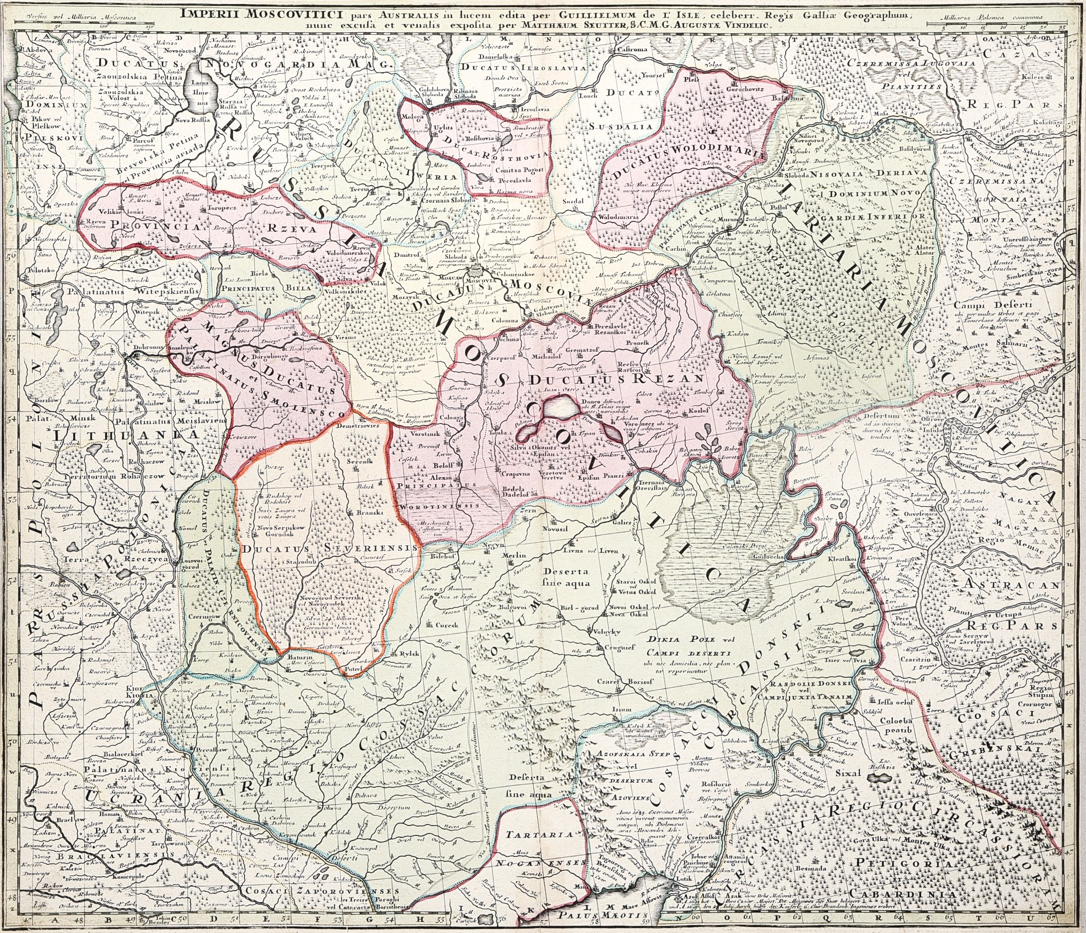
RUSSIA. Compiled by. Guillaume Delisle, published by Matthäus Seuter, Amsterdam, ca. 1740; color copperplate, map dimensions: 583x500 mm; tit. at top, within frame: IMPERII MOSCOVITICI pars AUSTRALIS in lucem edita per GUILLIELMUM de L'ISLE, celeberr, Regis Gallia Geographum; / nune excusa et venalis exposita per MATTHAEUM SEUTTER, S.C.M.G. AUGUSTAE VINDELIC.
The map shows the effects of the Zaporizhian Cossacks' settlement with the Tsar at Pereyeslav in 1654 and the creation of a Russian-subordinated Hetmanate in left-bank Ukraine. The divided Cossack territory on the map is labeled Ucranie Regio Cosacorum. The Tatars lost in 1739. Azov and the Azov Steppes.
For the First Republic, the loss of Kiev was of fundamental importance. By the end of the 17th century. Russians consistently obliterated the distinctiveness of lands that were already quite commonly called Ukrainian, referring to them as part of Greater Russia as "Malorossia," for whose capital they had just mined Kiev.


![[MAP]. MAP OF POLAND 1 : 500 000. OLSZTYN. [Sheet ] 3. w-wa 1947....](https://img1.one.bid/img/6363/1859794_1x.webp?1713045600)