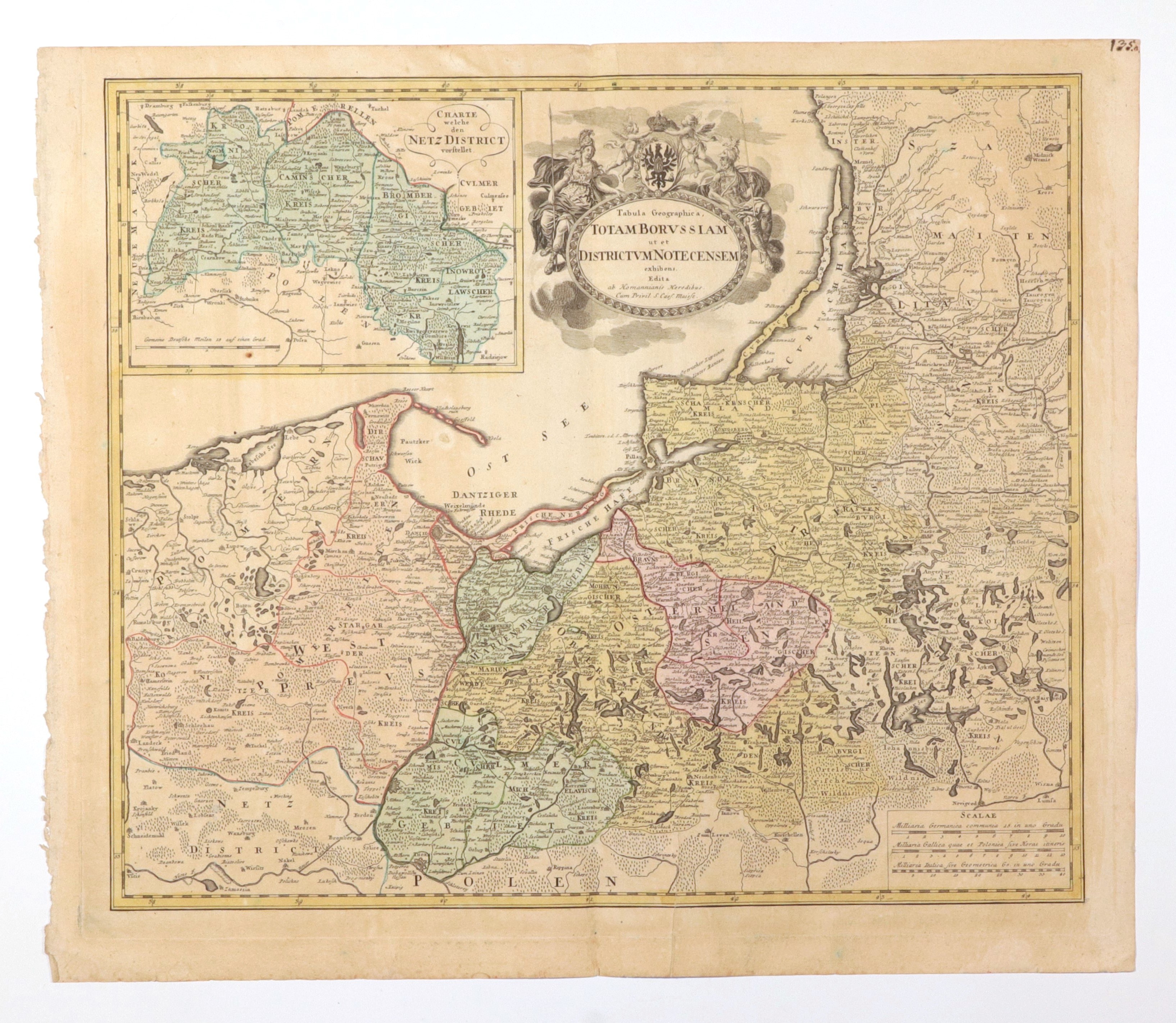
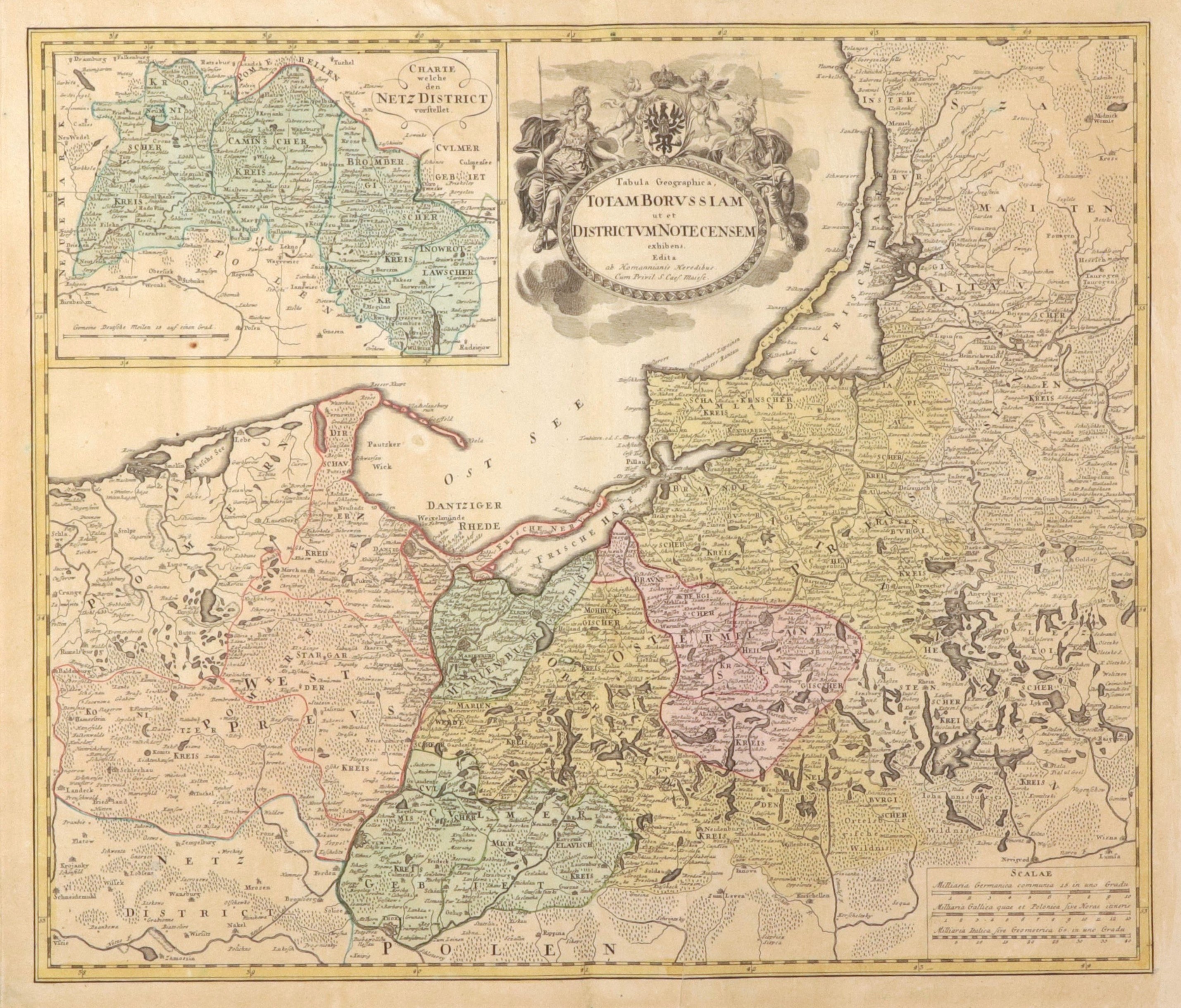
PRUSSIA, NADNOTECK DISTRICT. Map of Prussia, in the upper left corner a frame with a map of the Nadnoteck District (CHARTE welche den NETZ DISTRICT vorstellet) - marked division into districts: Walecki (Kronischer Kreis), Kamieński (Caminscher Kreis), Bydgoski (Brombergischer Kreis) and Inowrotzlawscher Kreis (Inowrotzlawscher Kreis); published by Homann's Heirs, Nuremberg 1772; copper color, f. bdb, yellowing, paper slightly pressed in two places; plate dimensions ca. 595x515 mm; Tabula Geographica, TOTAM BORVSSIAM ut et DISCRICTVM NOTECENSEM exhibens; [Prussia-Karten 193].
![[MAP]. MAP OF POLAND 1 : 500 000. OLSZTYN. [Sheet ] 3. w-wa 1947....](https://img1.one.bid/img/6363/1859794_1x.webp?1713045600)


![Automobile MAP of Poland 1 : 2,000,000 with list of gas stations by 'Karpaty' Nakł. Karpaty Sp. z o.o., Lviv [1933].](https://img1.one.bid/img/6145/1794990_1x.webp?1709593200)
![Automobile MAP of Poland 1 : 2,000,000 with list of gas stations by 'Karpaty' Nakł. Karpaty Sp. z o.o., Lviv [1933].](https://img1.one.bid/img/6145/1794990_2x.webp?1709593200)