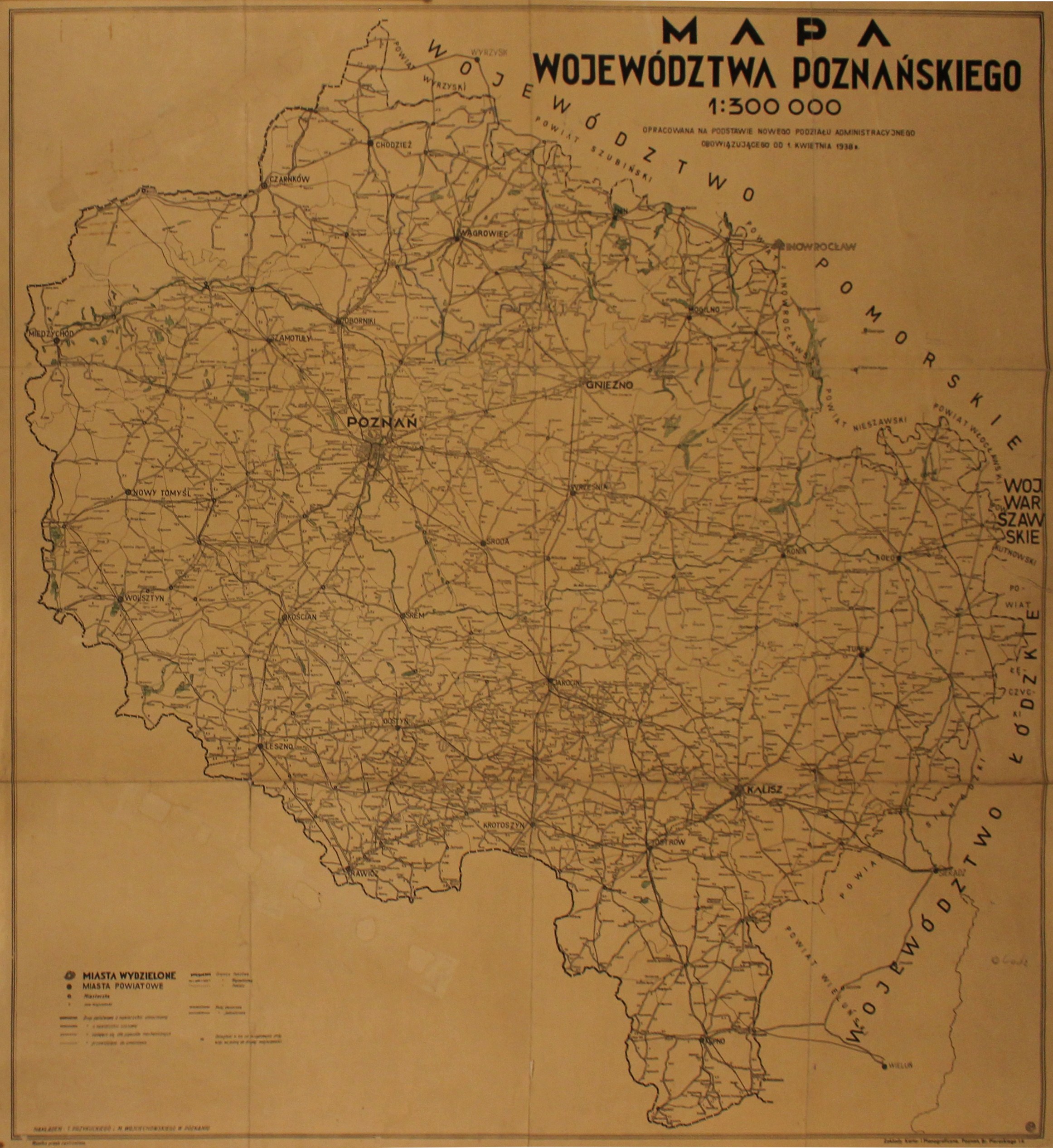
POZNAŃ. Map of the Poznań Province; compiled by. Zaklady Karto- i Planograficzane, published by T. Przykucki and M. Wojciechowski, Poznań 1938; among other things, the distance in km between road intersections is marked; printed in black and white, the area of lakes and the borders of the Wągrowiec district are marked in color; st. db, verso pastedown with linen, worn edges, traces of folding, paper losses in places; size 765x815 mm; MAP OF POZNAŃSKIE VOIVODSHIP 1:300 000 PREPARED ON THE BASIS OF THE NEW ADMINISTRATIVE DIVISION IN APRIL 1, 1938.
![[MAP]. MAP OF POLAND 1 : 500 000. OLSZTYN. [Sheet ] 3. w-wa 1947....](https://img1.one.bid/img/6363/1859794_1x.webp?1713045600)