


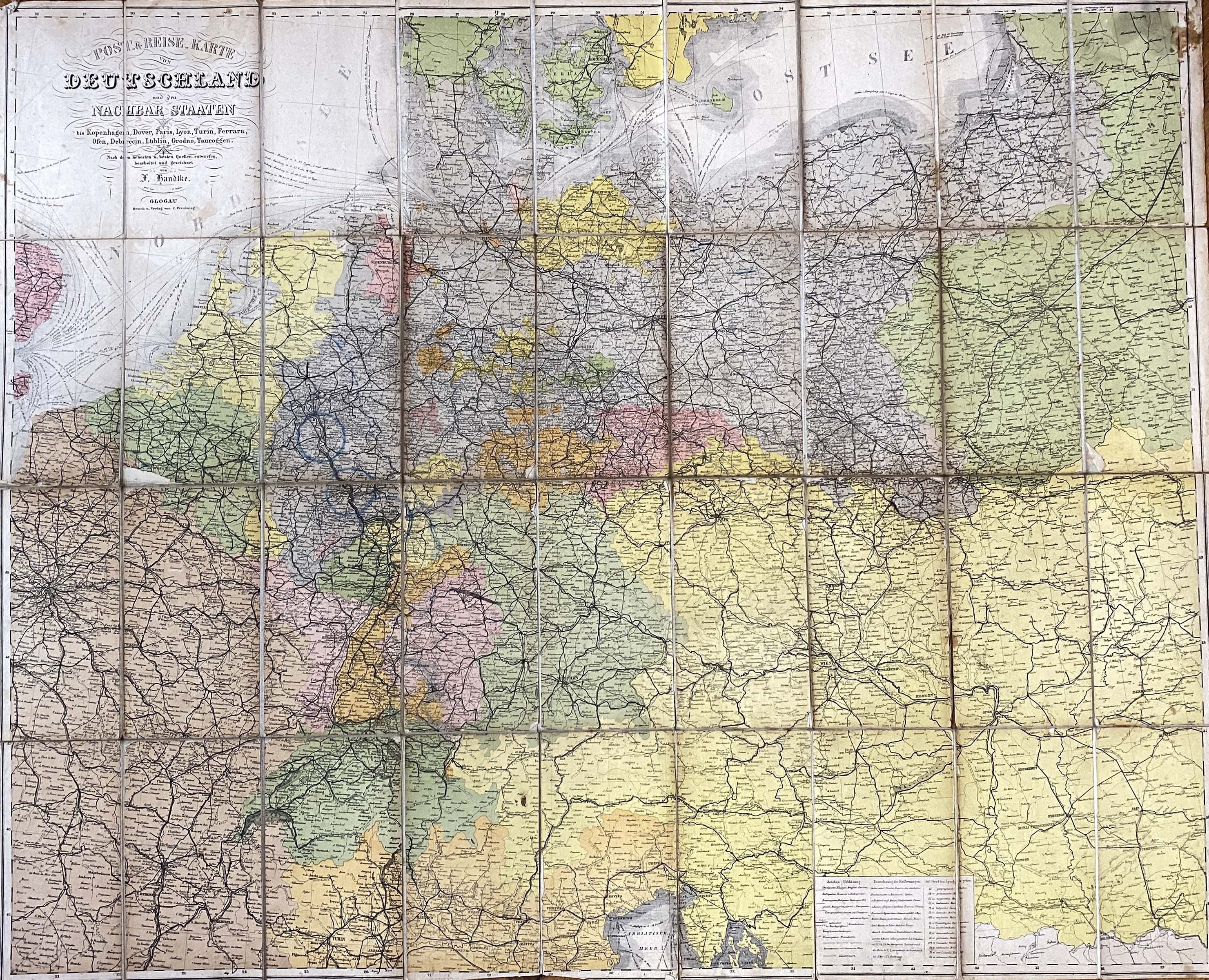
Handtke, Friedrich H. (1815-1879), Post- & Reise-Karte von Deutschland und den nachbar Staaten bis Kopenhagen, Dover, Paris, Lyon, Turin, Ferrara, Ofen, Debrecin, Lublin, Grodno, Tauroggen / Nach den neuesten u. besten Quellen entworfen, bearbeitet und gezeichnet, Verlag von C. Flemming, Glogow ca. 1866, 1 map : copperplate, color. ; dimensions ca. 85 x 105 cm. ; scale [ca 1:600,000]. ; stenciled title by H. Weber in upper left corner, publisher's data there. ; covers the area: Karlskrona-Ferrara, Orleans-Terespol (thus captures almost the entire territory of Poland within its present borders except for the Bieszczady Mountains). ; marked routes of shipping lines, railroads, roads. ; map publisher's cut into 36 parts glued together on linen, good condition.


![Königl. Freistadt Oedenburg [Sopron szabad királyi város térképe, 1871.] Lithographiert von F. Szita. W[iene]r...](https://img1.one.bid/img/6570/1844246_1x.webp?1712700000)
![Königl. Freistadt Oedenburg [Sopron szabad királyi város térképe, 1871.] Lithographiert von F. Szita. W[iene]r...](https://img1.one.bid/img/6570/1844246_2x.webp?1712700000)


Recently viewed
Please log in to see lots list
Favourites
Please log in to see lots list