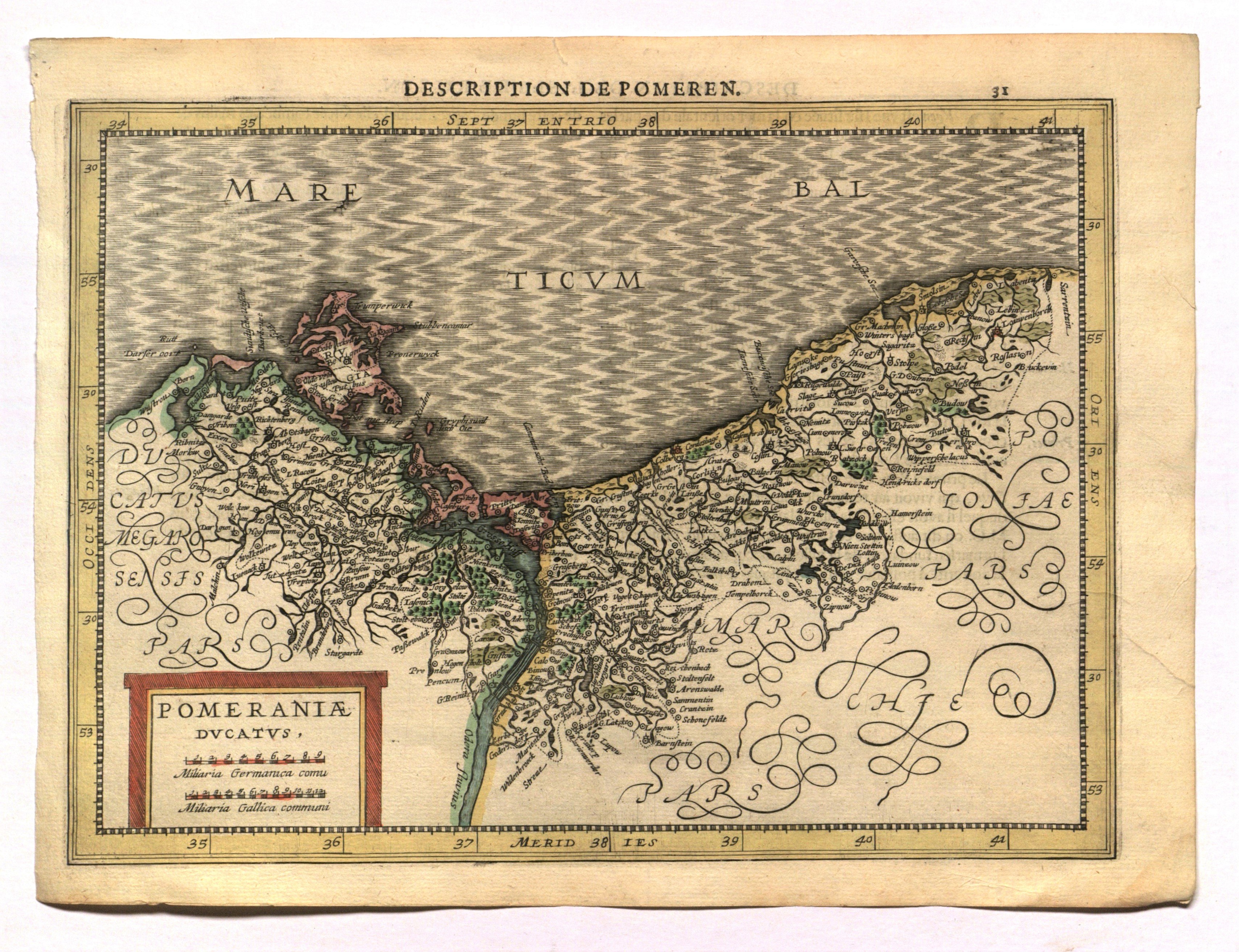
POMORSKIE. Map of Pomerania; taken from: Gerardi Mercatoris Atlas sive Cosmographicae Meditationes de Fabrica mundi et fabricati figura. De novo multis in locis emendatus novisque tabulis auctus Studio Judoci Hondii, ed. by J. Cloppenburg, Amsterdam 1630 (two editions: a French one in 1630 and a Latin one in 1632); this is a reduced copy of Jodocus Hondius II's map of Pomerania (according to Lubinus), also used in the atlases of the Blaeu outhouse; above the frame the inscription: DESCRIPTION DE POMEREN and pagination 31; on verso text: DESCRIPTION DE L'ISLE DE RUGEN; copper color, fair condition, small trace of moisture in lower right corner, slight tear in upper edge; plate dimensions 263x191 mm; plinth title: POMERANIAE DVCATVS.
![[MAP]. MAP OF POLAND 1 : 500 000. OLSZTYN. [Sheet ] 3. w-wa 1947....](https://img1.one.bid/img/6363/1859794_1x.webp?1713045600)