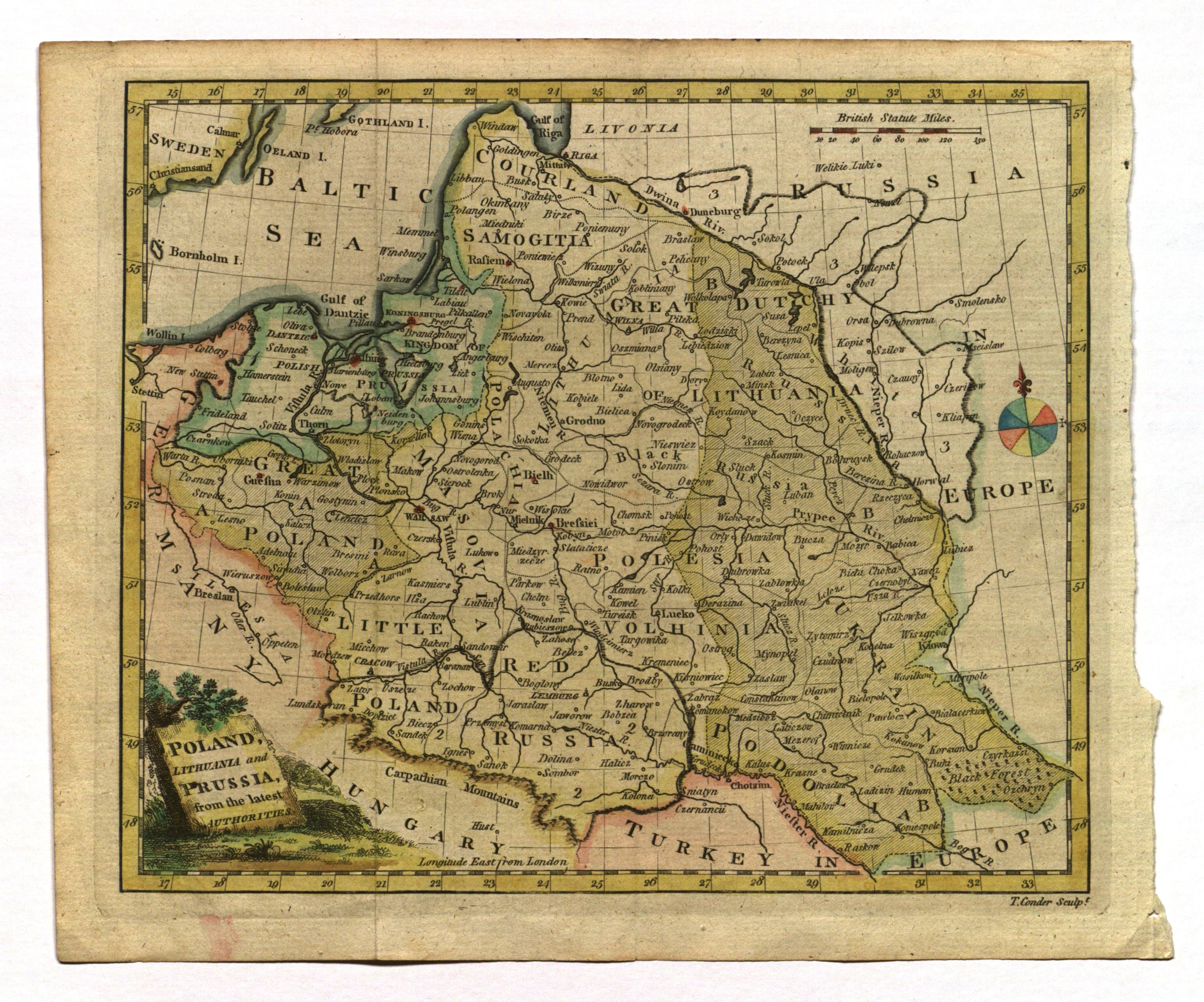
POLSKA, LITWA, PRUSY. Mapa Polski, Litwy i Prus po I rozbiorze; T. Conder
addYour notecreate
Lot description
POLSKA, LITWA, PRUSY. Mapa Polski, Litwy i Prus po I rozbiorze; ryt. T. Conder, Augsburg, po 1772; miedz. kolor., st. bdb.; wym. płyty: 230x195 mm; POLAND, LITHUANIA and PRUSSIA, from the latest AUTHORITIES;
LabelsBETA
Labels are assigned by artificial intelligence based on the recognized context of the image. The algorithm is constantly learning and we make every effort to make the results more accurate over time.


![[MAP]. MAP OF POLAND 1 : 500 000. OLSZTYN. [Sheet ] 3. w-wa 1947....](https://img1.one.bid/img/6363/1859794_1x.webp?1713045600)