


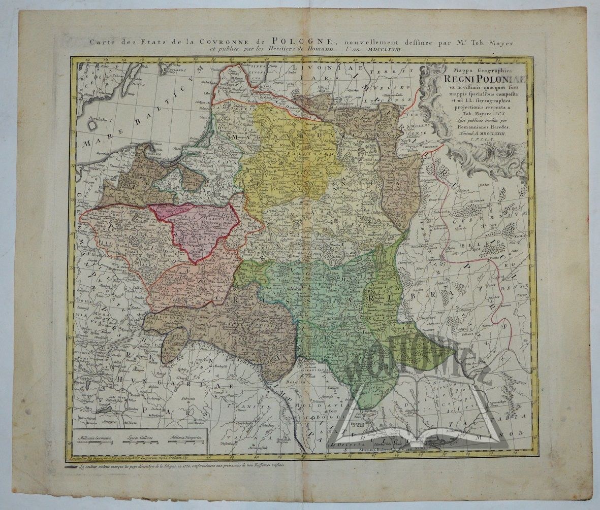
(POLAND). Mappa geographica Regni Poloniae ex novissimis quot sunt mappis specialibus composita
et ad LL. stereographica projectionis revocata a Tob. Mayero. S.C.S. Luci publicae tradita per Homannianos Heredes. Noimb(ergae) 1773. c.p.s.c.m. Color copperplate. by Tobias Mayer. format: 44 x 51 cm (board: 54 x 63 cm).
Traces of non-moisture and soiling, folding marks. Verso of the map clean. Decorative information cartouche in upper right corner. At the top above the frame a second title: "Carte des Etats de la Couronne de Pologne.... par Mr. Tob. Mayer et publiee par les Heritiers de Homann...". Map of the lands of the Republic, second state from the fourth plate. (Imago Poloniae K44/9). 9217/1


![[MAP]. MAP OF POLAND 1 : 500 000. OLSZTYN. [Sheet ] 3. w-wa 1947....](https://img1.one.bid/img/6363/1859794_1x.webp?1713045600)


![Automobile MAP of Poland 1 : 2,000,000 with list of gas stations by 'Karpaty' Nakł. Karpaty Sp. z o.o., Lviv [1933].](https://img1.one.bid/img/6145/1794990_1x.webp?1709593200)
![Automobile MAP of Poland 1 : 2,000,000 with list of gas stations by 'Karpaty' Nakł. Karpaty Sp. z o.o., Lviv [1933].](https://img1.one.bid/img/6145/1794990_2x.webp?1709593200)


Recently viewed
Please log in to see lots list
Favourites
Please log in to see lots list