


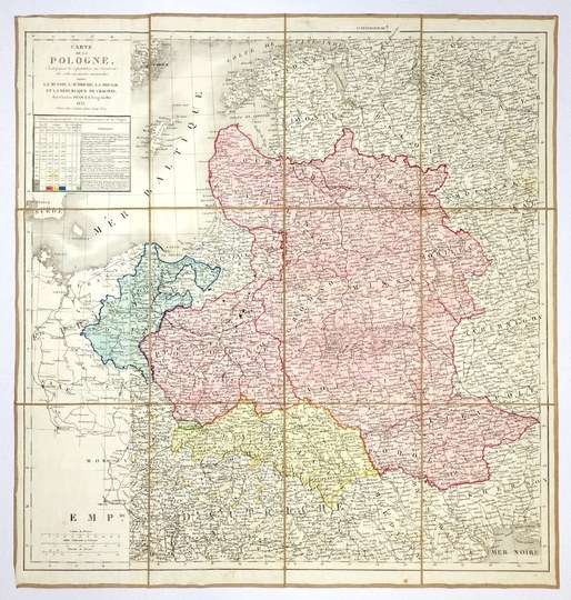
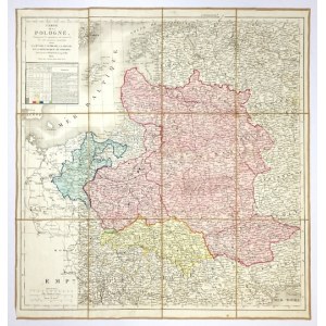
[POLAND]. Carte de la Pologne indiquant le répartition du territoire de cette ancienne monarchie entre la Russie, l'Autriche, la Prusse, et la République de Cracovie. Colorized steel engraving form. 47.2x46.2 cm.
Map of the Polish lands published by Charles Picquet in Paris in 1831. Title in a frame in the upper left corner, below a table showing territorial changes of Poland. Three linear scales in the lower left corner. Linear and area color. Map cut at age into 12 parts glued together on linen. Cardboard case. Minor staining of map surface, case damaged.


![[MAP]. MAP OF POLAND 1 : 500 000. OLSZTYN. [Sheet ] 3. w-wa 1947....](https://img1.one.bid/img/6363/1859794_1x.webp?1713045600)
![Automobile MAP of Poland 1 : 2,000,000 with list of gas stations by 'Karpaty' Nakł. Karpaty Sp. z o.o., Lviv [1933].](https://img1.one.bid/img/6145/1794990_1x.webp?1709593200)
![Automobile MAP of Poland 1 : 2,000,000 with list of gas stations by 'Karpaty' Nakł. Karpaty Sp. z o.o., Lviv [1933].](https://img1.one.bid/img/6145/1794990_2x.webp?1709593200)


Recently viewed
Please log in to see lots list
Favourites
Please log in to see lots list