No permission to use the microphone
Category
  • This auction
  • Current
  • Archive
search
Use AI suggestions to find the best results for your needs and preferences faster

Recently searched
This option is available only to logged in users
Artists
None
‹

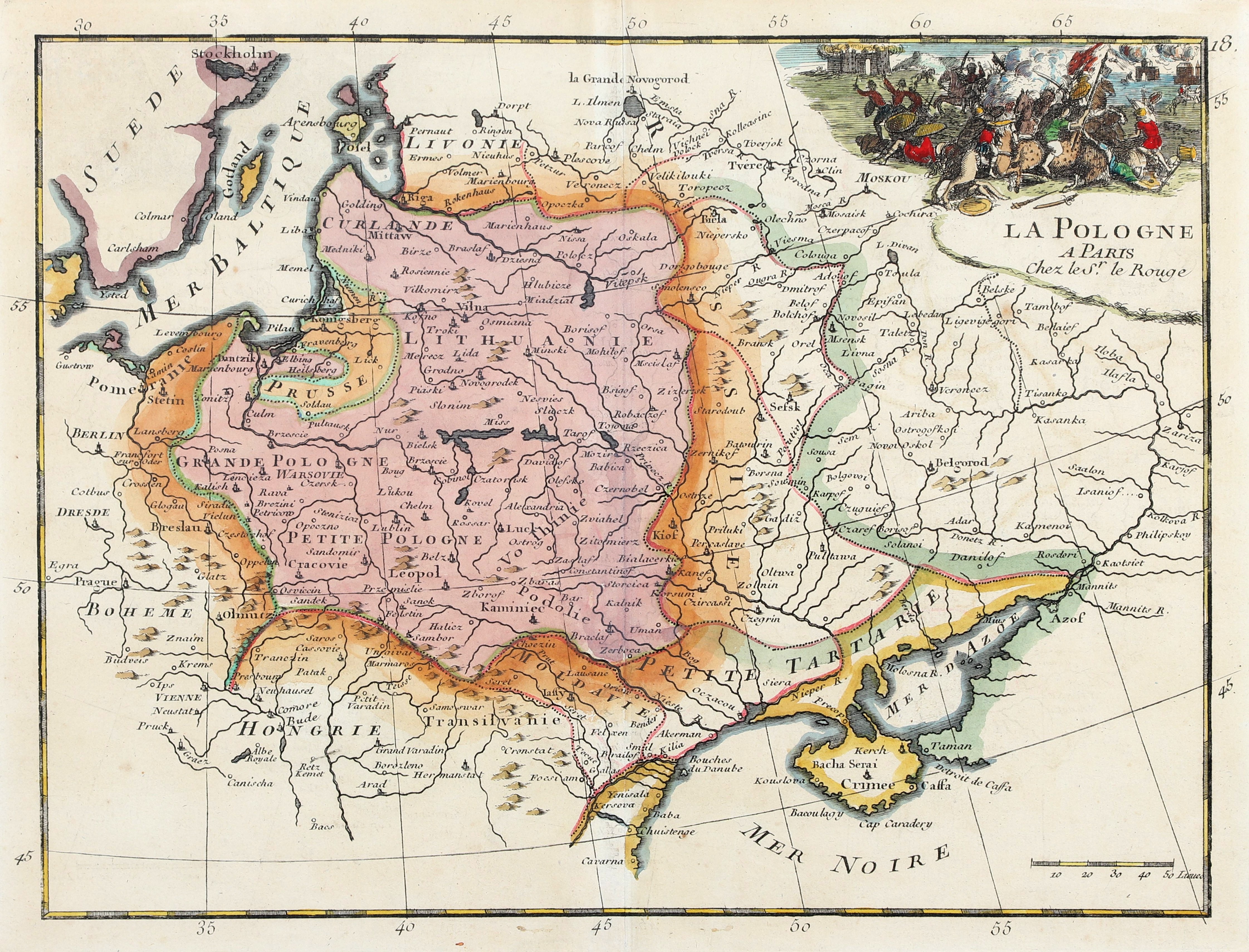
POLAND, LITHUANIA. Map of the First Commonwealth, showing the division into Greater Poland, Lesser Poland, Courland, Lithuania, Volhynia, and Podolia; battle scene; engraved and published by Le Rouge, G. Louis, 1748.

add Your note 
Lot description
POLAND (called in the First Republic KORONA), GREAT PRINCE OF LITHUANIA. Map of the First Republic with marked division into Greater Poland, Lesser Poland, Courland, Lithuania, Volhynia and Podolia; battle scene; ryt. and ed. by Le Rouge, G. Louis, 1748; copper color, st. bdb., repaired paper loss in lower margin; plate dimensions 284x218 mm; LA POLOGNE A PARIS Chez le Sr. le Rouge.
Auction
Graphics and Cartography Auction
gavel
Date
28 September 2024 CEST/Warsaw
date_range
Start price
116 EUR
Hammer price
128 EUR
Overbid
110%
Views: 287 | Favourites: 3
Auction

Antykwariat Wu-eL

Graphics and Cartography Auction
Date
28 September 2024 CEST/Warsaw
Lots bidding

All lots are listed to bid

Buyer's premium
10.00%
OneBid does not charge additional fees for the bidding.
Bid increments
  1
  > 10
  200
  > 20
  500
  > 50
  1 000
  > 100
  2 000
  > 200
  5 000
  > 500
  10 000
  > 1 000
∞
 
Terms and Conditions
About the Auction
FAQ
About the Seller
Antykwariat Wu-eL
Contact
Antykwariat Wu-eL
room
ul. św. Wojciecha 1 / U3
70-410 Szczecin
phone
+48453333540
Payment
Bank transfer: PLN, EUR, USD
See similar
keyboard_arrow_up
Help centre open_in_new