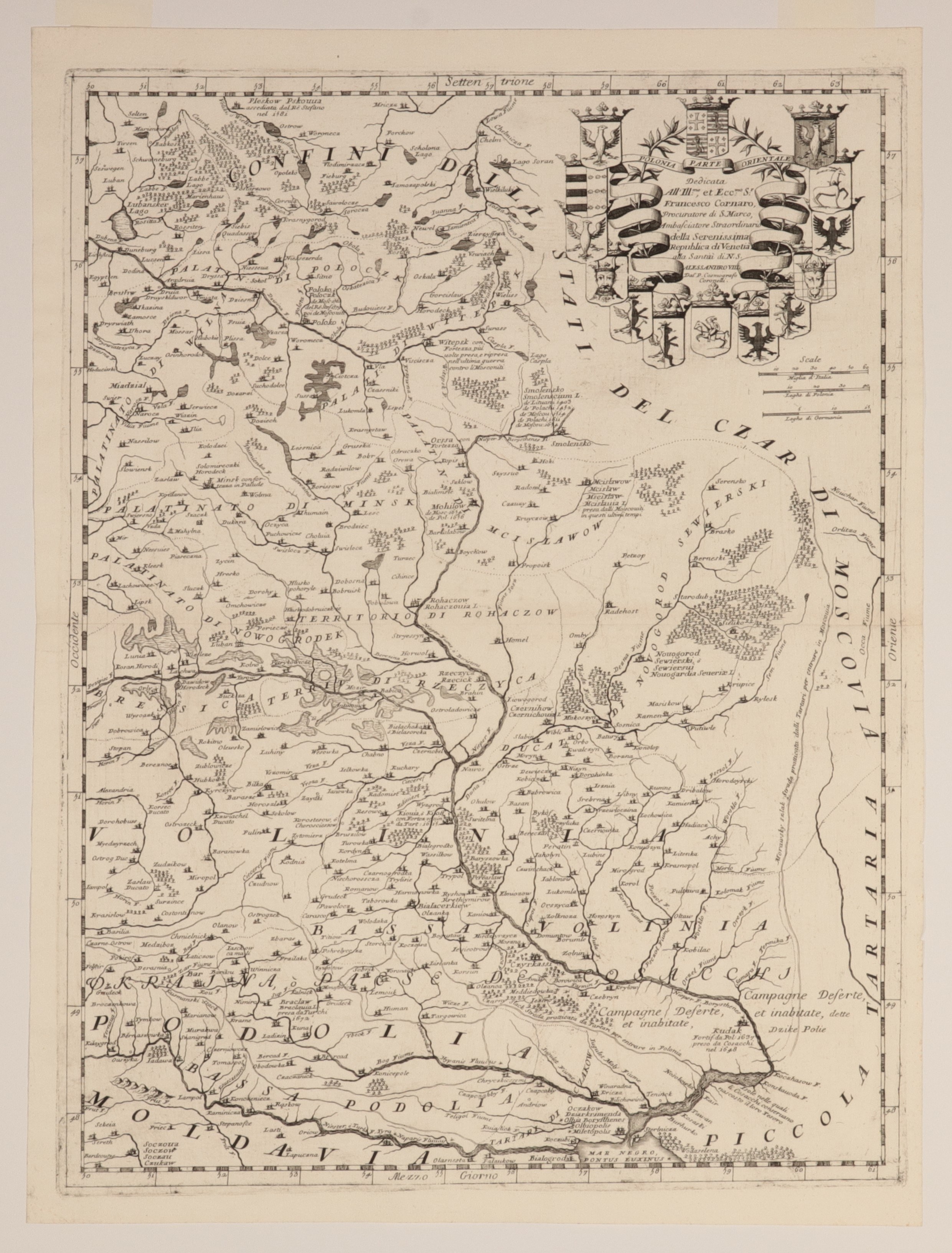
POLAND (called KORONA in the First Republic), GREAT PRINCE OF LITHUANIA, PODOLSKIE VOIVODSHIP, VOIVIA OF VILLAGE, KIJOVSKY VOIVODSHIP. Map of the eastern borderlands of the First Republic - one of the more accurate maps of the Podolia, Volhynia and Kiev provinces; issued by V.M. Coronelli, Venice, ca. 1690; title cartouche surrounded by fourteen coat of arms shields; in the cartouche a dedication to Francesco Cornato; very detailed map, contains a number of annotations, including mention of the fortification of the city of Kudak (1637.), a reference to the fortification of Kiev in the early 17th century; next to Smolensk, the countries that controlled the city between 1403 (Lithuania) and 1654 (Russia) are given; the siege of Pskov in 1581 is also noted, the conquest of Polotsk by Ivan the Terrible in 1563, and by Stefan Batory in 1579; copper b.b., st. bdb., passe-partout; plate dimensions 460x610 mm; title on wavy ribbon: POLONIA PARTE ORIENTALE. RARE!
![Poland car map. Cracow [1945].](https://img1.one.bid/img/6508/1873705_1x.webp?1713823200)
![Poland car map. Cracow [1945].](https://img1.one.bid/img/6508/1873705_2x.webp?1713823200)


![[MAP]. MAP OF POLAND 1 : 500 000. OLSZTYN. [Sheet ] 3. w-wa 1947....](https://img1.one.bid/img/6363/1859794_1x.webp?1713045600)


![Set of 16 maps of the province [before 1939].](https://img1.one.bid/img/6508/1873691_1x.webp?1713823200)
![Set of 16 maps of the province [before 1939].](https://img1.one.bid/img/6508/1873691_2x.webp?1713823200)