


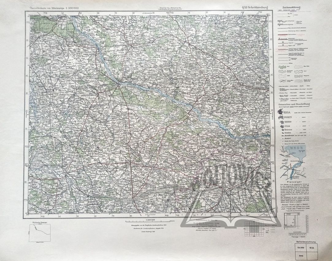
(PLOCK). Schröttersburg. Übersichtskarte von Mitteleuropa.
Color map, scale 1 : 300,000. (No place of publication.) 1943. Herausgegeben von der Preußischen Landesaufnahme 1902. Reichsamt für Landesaufnahme. Dimensions: 50 x 65 cm.
Good condition, non. scuffs and traces of creases at edges. 9114/39


![Königl. Freistadt Oedenburg [Sopron szabad királyi város térképe, 1871.] Lithographiert von F. Szita. W[iene]r...](https://img1.one.bid/img/6570/1844246_1x.webp?1712700000)
![Königl. Freistadt Oedenburg [Sopron szabad királyi város térképe, 1871.] Lithographiert von F. Szita. W[iene]r...](https://img1.one.bid/img/6570/1844246_2x.webp?1712700000)


Recently viewed
Please log in to see lots list
Favourites
Please log in to see lots list