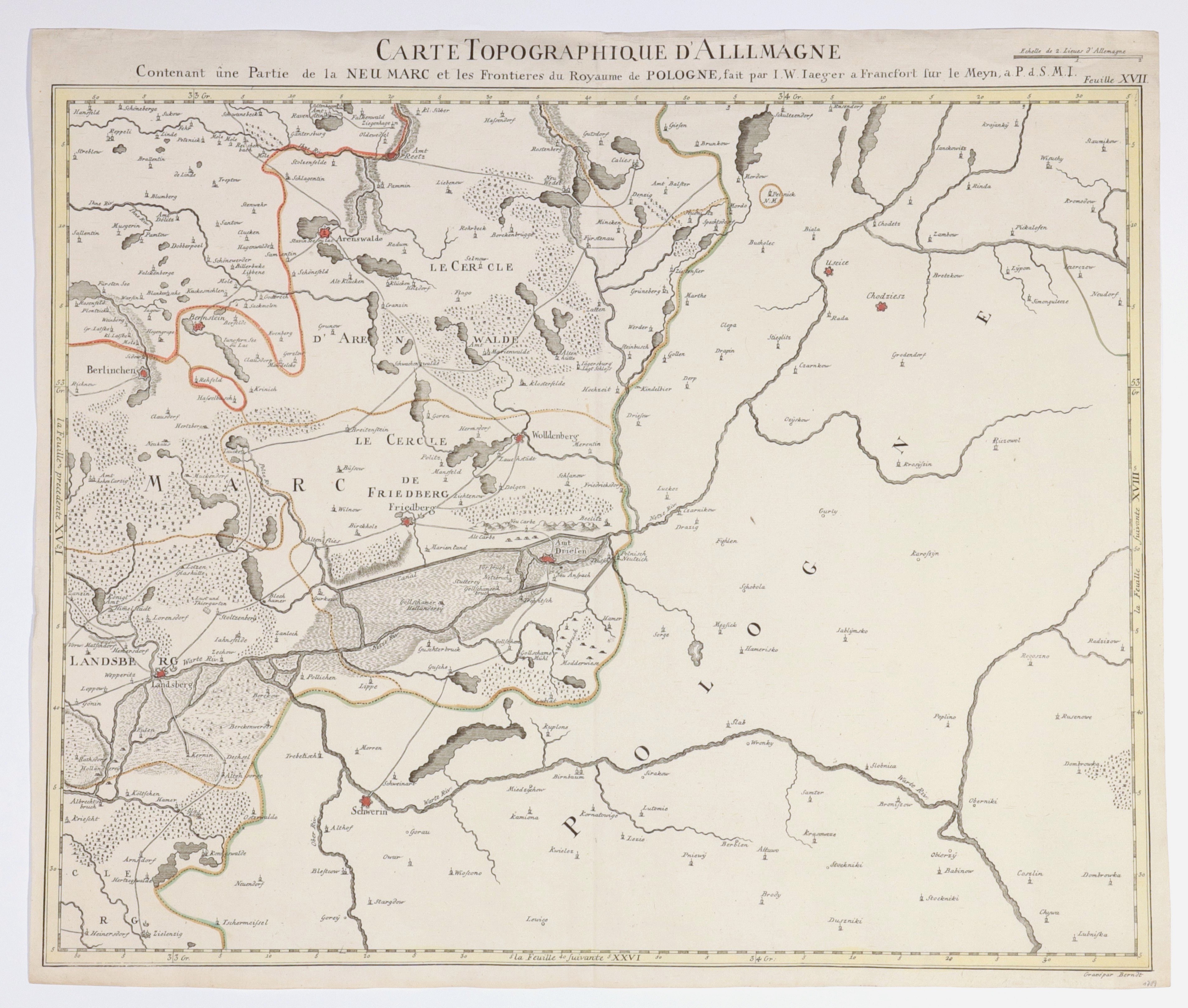
NEW MARCH. Topographical map of New March; ryt. Berndt, compiled. and published by J.W. Jaeger, taken from the compilation publication Grand Atlas d'Allemagne en LXXXI Feullies [...], sheet XVII, Frankfurt am Main 1789; showing the region of Choszczno, Gorzow Wielkopolski, Drezdenko, Skwierzyna, Chodzież, Czarnkow, Sieraków, Ujście; miedz. with line color, st. bdb., margins trimmed (plate imprint missing); map dimensions 585x467 mm; CARTE TOPOGRAPHIQUE D'ALLEMAGNE Contenant une Partie de la NEU MARC et les Frontieres du Royaume de POLOGNE [...].
![[MAP]. MAP OF POLAND 1 : 500 000. OLSZTYN. [Sheet ] 3. w-wa 1947....](https://img1.one.bid/img/6363/1859794_1x.webp?1713045600)