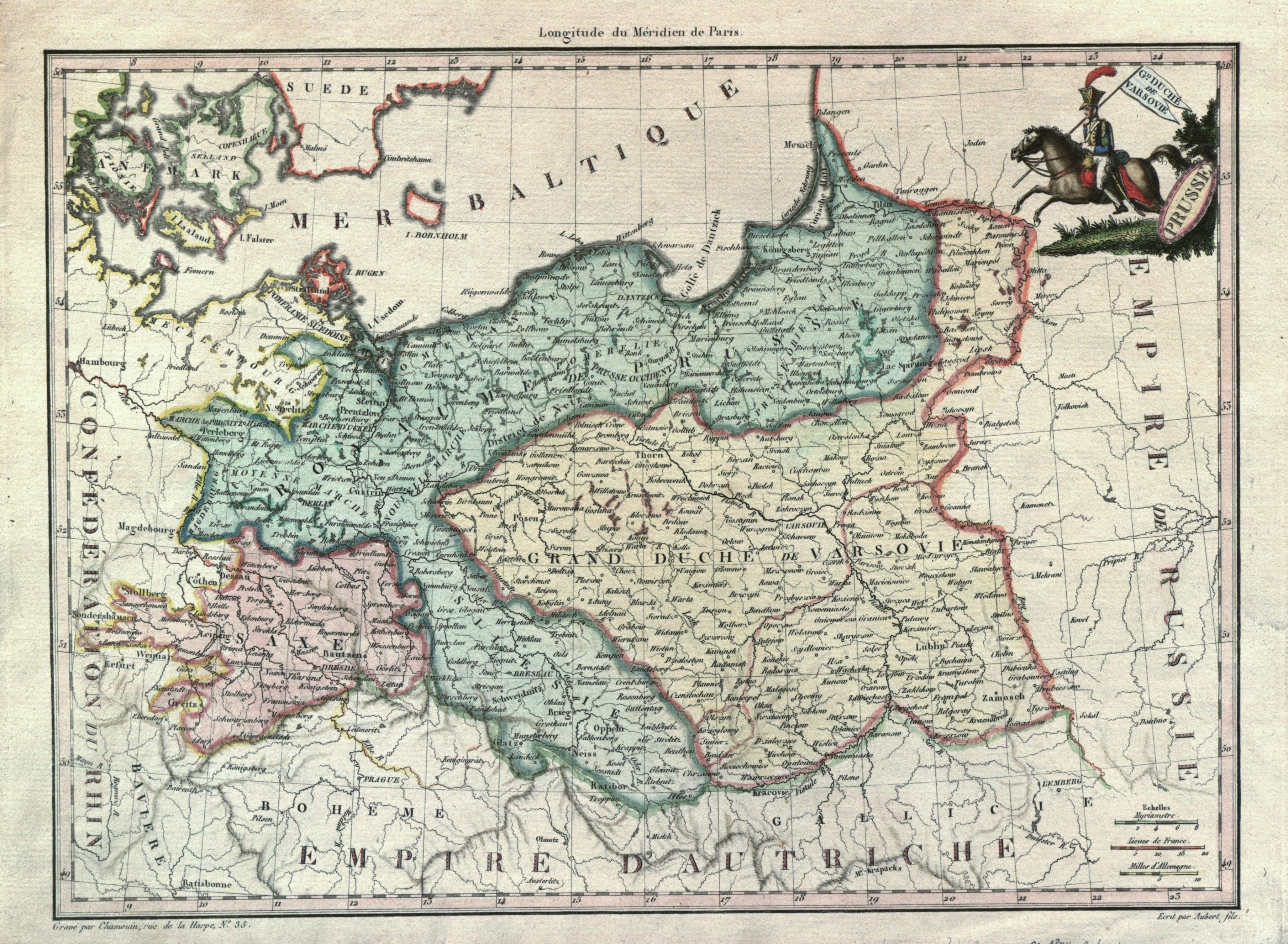
KSIĘSTWO WARSZAWSKIE. Mapa Księstwa Warszawskiego i Królestwa Prus; Pierre Lapie, Conrad Malte-Brun
addYour notecreate
Lot description
KSIĘSTWO WARSZAWSKIE. Mapa Księstwa Warszawskiego i Królestwa Prus; oprac. Pierre Lapie, pochodzi z: Atlas complet du precis de la geographie universelle, wyd. Conrad Malte-Brun, Paryż 1812, ryt. Chamouin, rys. Aubert (syn); miedz. kolor., st. bdb.; wym.: 298x218 mm; GD. DUCHÉ DE VARSOVIE; / PRUSSE;
LabelsBETA
Labels are assigned by artificial intelligence based on the recognized context of the image. The algorithm is constantly learning and we make every effort to make the results more accurate over time.