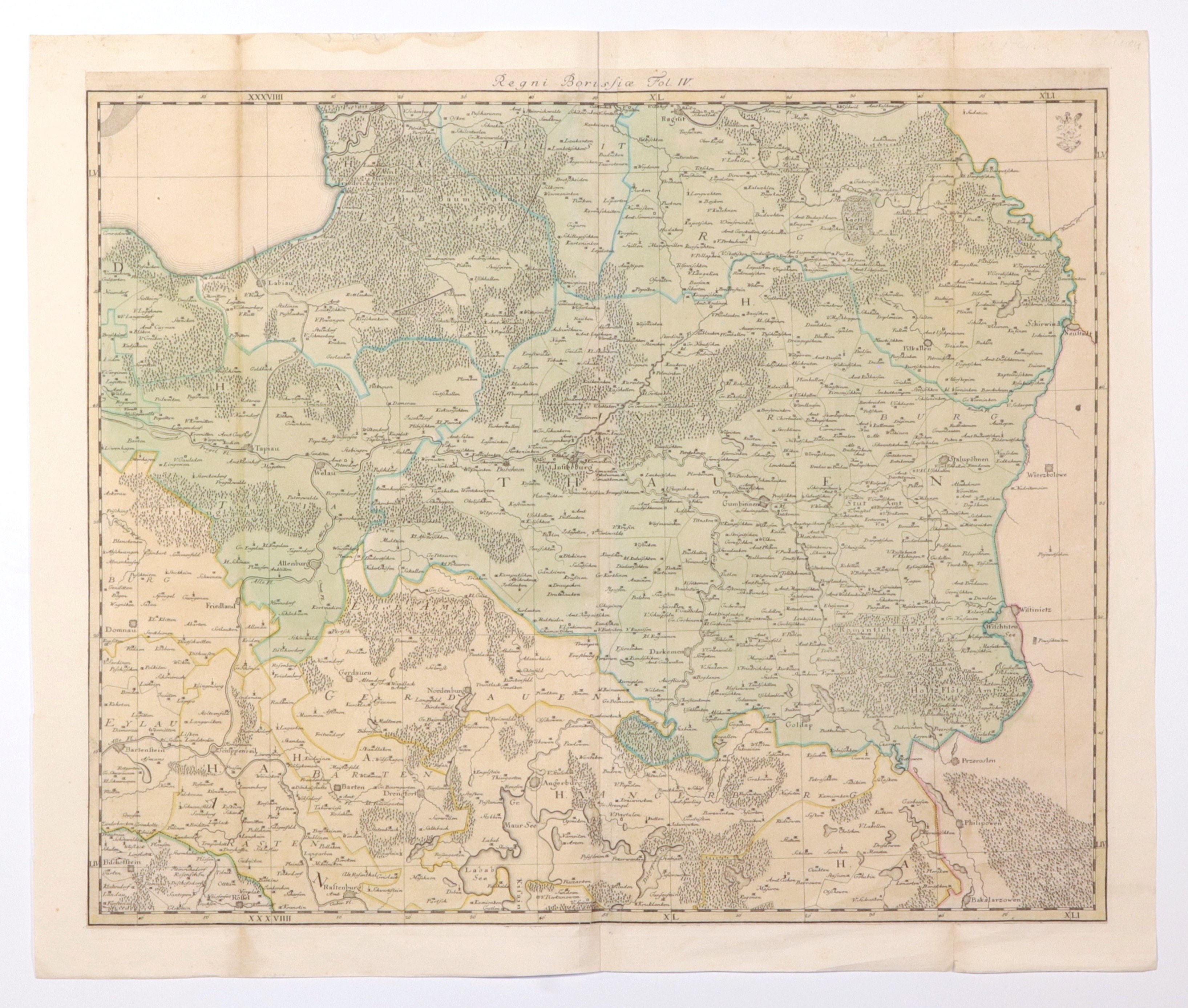
KINGDOM AND PRUSSIA PRUSSIA. Map of part of the Kingdom of Prussia; compiled by. J.W. Suchodolski (1683-1751); 4th fragment of a map consisting of six sheets, under the common title Regnum Borussiae Episcopatus Warmiensis, Palatinatus Mariaeburgensis et Culmensis cum Territorio Dantiscano et Ichnographia Urbis Regiomontis [...], ed. by A.A. Rhode, Berlin 1763; copper color, st. bdb., margins completed, minor margin tears; map dimensions 558x457 mm; tit. above upper frame: Regni Borussiae Fol. IV; VERY RARE!
![[MAP]. MAP OF POLAND 1 : 500 000. OLSZTYN. [Sheet ] 3. w-wa 1947....](https://img1.one.bid/img/6363/1859794_1x.webp?1713045600)