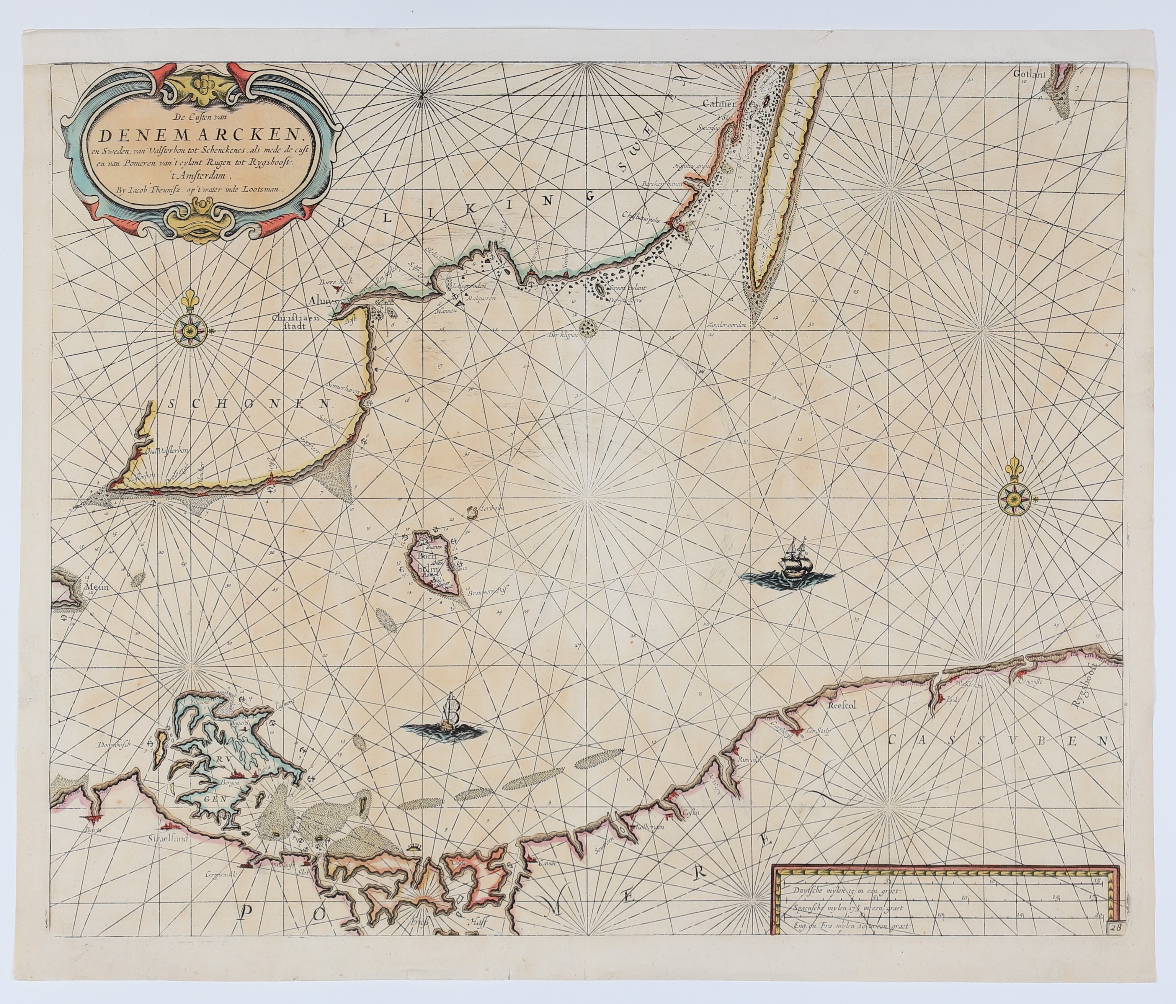
KASZUBY, POMERANIA, BALTIC SEA. Map of the Baltic coast - includes part of Denmark, Germany with Rügen and Pomerania from the islands of Usedom and Wolin in the west to Zarnowiec in the east; compiled by. J. Theuniusz and J. Lootsmann, Amsterdam, c. 1660; the map shows the following Pomeranian towns, among others: Wolin (Vollin), Kamień Pomorski (Camin), (Soutborn), Kołobrzeg (Kolbergen), Koszalin (Coslin), (De Wipper), Darłowo (Ruwolde), (Garshoost), Słupsk (Ter Stolp), (Reefcol), Łeba (Lyda), (Walsacken), Żarnowiec (Sernevisse), (Rygshooft); one of the few maps on which Kaszuby is marked; copper. color, st. bdb., filled upper margin, slight edge tears; map dimensions 530x428 mm; De Custen van DENEMARCKEN, en Sweden, van Valsterbon tot Schenckenes, als mede de custen van Pommern van't eylant Rugen tot Rygshoost [...].