


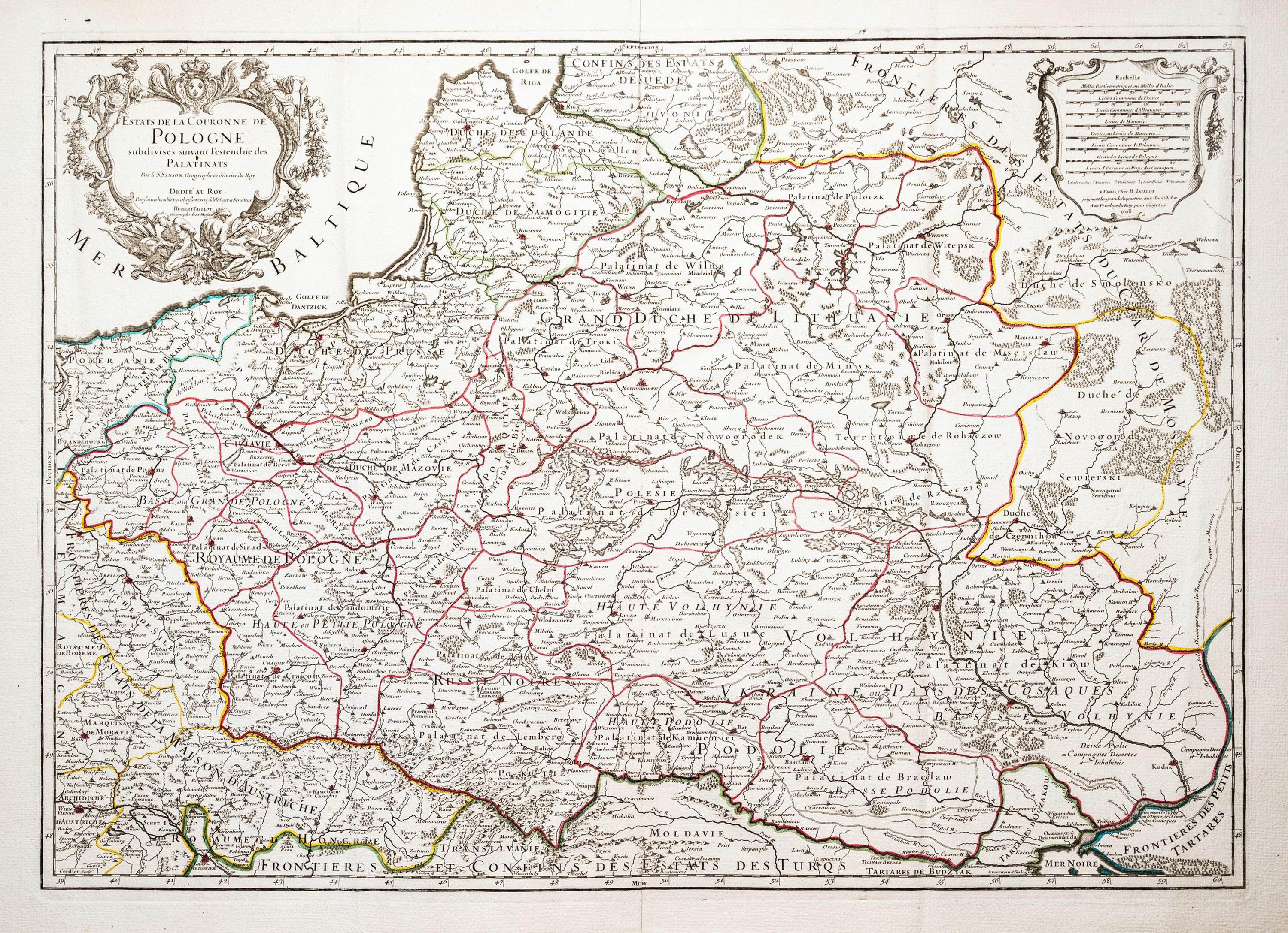
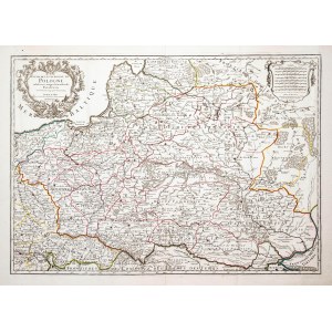
Map of the lands of the Republic from "Atlas Francois", fifth state, Paris, 1708
line-colored copperplate, 47 x 65.5 cm (plate imprint)
very good condition
Imago Poloniae, K35/2


![[DE FER Nicholas] STETIN ville Forte d'Allemagne [SZCZECIN - Fortified City of Germany, Capital of Royal Pomerania] Paris. 1691.](https://img1.one.bid/img/6508/1873735_1x.webp?1713823200)
![[DE FER Nicholas] STETIN ville Forte d'Allemagne [SZCZECIN - Fortified City of Germany, Capital of Royal Pomerania] Paris. 1691.](https://img1.one.bid/img/6508/1873735_2x.webp?1713823200)


Recently viewed
Please log in to see lots list
Favourites
Please log in to see lots list